Nano P60
Our most compact and lightweight LiDAR system.
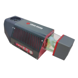
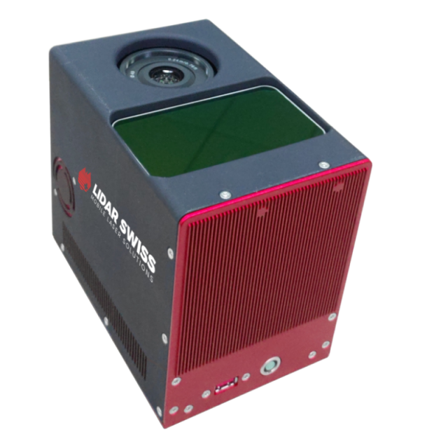
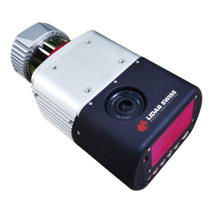
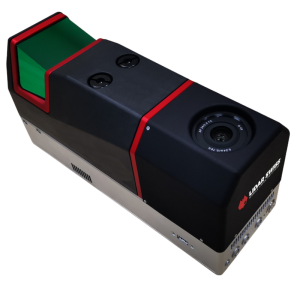
Our brand new 2.1kg, solid-state LiDAR that fits on small drones. The Nano P60 consists of a Cepton® Sora P60 solid-state scanner, Applanix® IMU/ GNSS, 42mp camera and LidarSwiss proprietary intelligent system controller.
LidarSwiss Solutions
Buchs, CH
Description
Nano P60 is the brand-new solid-state LiDAR system by LidarSwiss in 2022. Featuring its automatic RGB point cloud generating function, it consists of a Cepton® Sora P60 solid-state scanner, a 42mp camera, an Applanix® IMU/GNSS, and a LidarSwiss controller. With a total weight of 2.1kg, this compact LiDAR system is suitable for many industries when mounted on small drones.
The prominent features of the Nano P60 are its high stability, point density, and intelligence. The Nano P60's MTBF is 67,000 hours and its scanning speed is 19 times that of a mechanical scanner with multiple laser heads. With its LidarSwiss controller, the Nano P60 automatically generates laser point clouds with RGB values at landing, which improves working efficiently dramatically.
Nano P60's colorized laser point clouds are in standard format. They can be used directly to produce mapping products such as DOM/DEM and 3D models, or to generate industrial analysis reports.
Key Features:
- Solid-state scanner MTBF67000h
- Effective flying height of 180m
- Applanix® IMU/GNSS
- 42mp calibrated camera
- Rigid control unit
- Automatic RGB attribution to laser points 30% overlap only for flightline design
- Fits in small Pelican® case
- High accuracy
- High point density
- High stability
Specifications
-
Application
-
Main applications
Forestry resources monitoring, Quick response landslide analysis, Disaster management, Power line inspection/danger tree analysis, Riverbank and coastal line mapping, High accuracy small area mapping, Terrain modeling for heavy vegetation areas, Historical site mapping, Rapid and accurate distance measuring, Volumetric calculations for mining, Other 3D data applications, Other corridor mapping
Training, maintanence and support
Training included in purchase
Distinguishable features
Solid-state scanner MTBF67000h, Effective flying height of 180m, Rigid control unit Automatic RGB attribution to laser points 30% overlap only for flightline design, Fits in small Pelican® case
-
Measurement Characteristics
-
Scanning method
MMT (mirrorless, non-rotational)
Max. pulse frequency [Hz]
315000
Max. field of view [degrees]
60
-
Physical Properties
-
Height [cm]
14.5
Length [cm]
16.8
Width [cm]
10.9
Weight [kg]
2.1
-
Laser Pulse Characteristics
-
Laser Class
Class 1, eye safe
Beam divergence [mrad]
0.6
Max. range of laser pulse [m]
200
-
Power Supply
-
Power consumption
20-28V DC
-
Positioning System
-
Heading, Pitch and Role internally captured
Y
Type of INS or IMU
Applanix
-
Operation Characteristics
-
Camera included
Yes
Camera specifications
42mp calibrated camera


