


AlphaUni 20
Multi-Platform High-End LiDAR Solutions
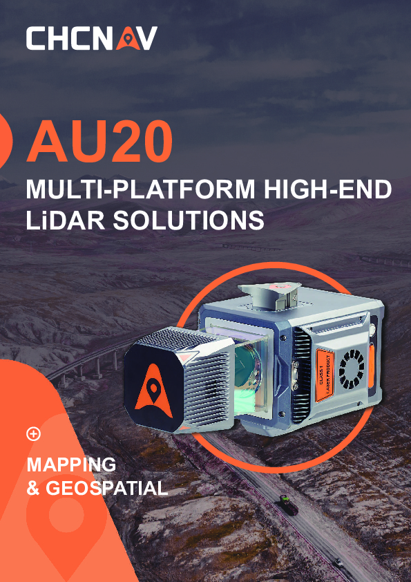
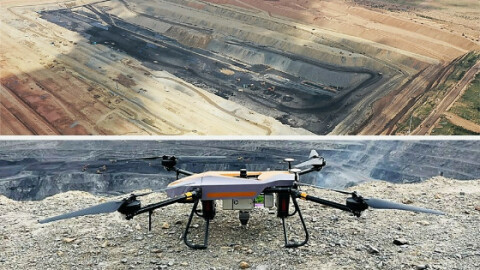
The AlphaUni 20 represents the next generation of cost-effective, multi-platform mobile mapping systems. It is the result of six years of innovation and product development powered by CHCNAV's state-of-the-art Lidar technology. The AU20 excels in airborne scenarios, delivering superior data and increasing survey efficiency through its exceptional vegetation penetration capability, extended measurement range, high accuracy, and data density.

CHC Navigation | CHCNAV
Shanghai, CN
Description
-
OUTSTANDING ACCURACY
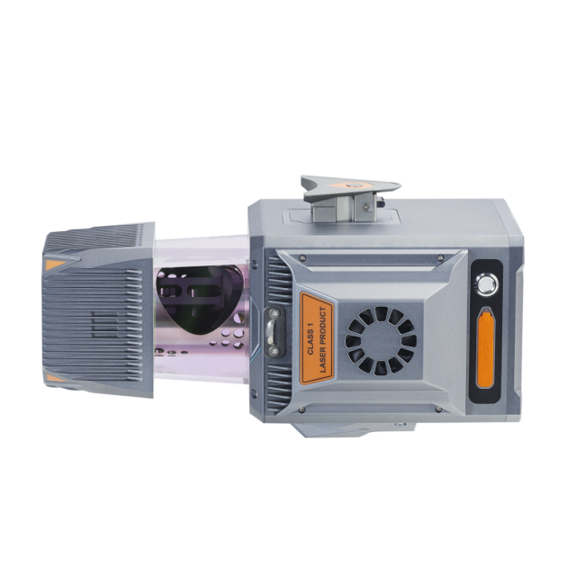
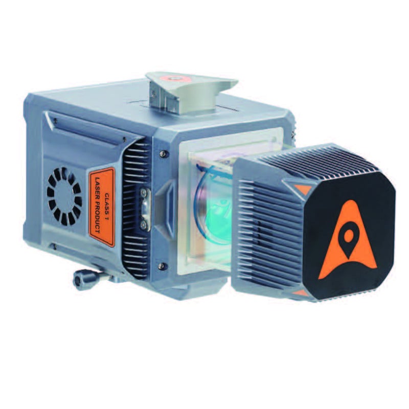
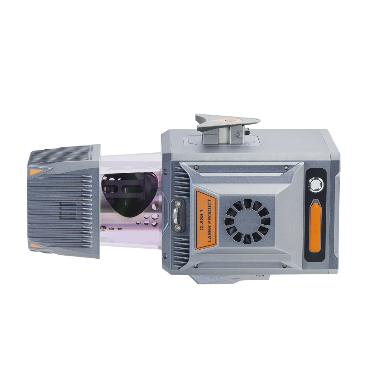
The AlphaUni 20 (or AU20) delivers precise accuracy through CHCNAV's high-precision navigation algorithm and a scanner with 5 mm repeated range accuracy, resulting in exceptional absolute accuracy of 2 to 5 cm, even in challenging environments. Its long-range scanning capabilities reach up to 1450 m, while high-speed measuring at 2M points per second is enabled by a 200 Hz continuously rotating mirror. The AU20 provides enhanced detail for all critical surveying tasks. In addition, the newly developed SLAM algorithm will improve trajectory accuracy in a challenging environment.
-
STRONG VEGETATION PENETRATION
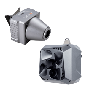
The AU20's advanced multi-target capability supports up to 16 target returns, enhancing its ability to penetrate vegetation. Capturing ground surfaces and generating accurate Digital Elevation Models (DEMs) and Digital Surface Models (DSMs) is effortless, even in challenging environments with dense vegetation. Installing the AU20 on aerial survey drones is fast and easy, thanks to Alpha port’s one-click connection to the power source and camera.
-
RELIABILITY AND SIMPLIFIED WORKFLOW
The AU20 offers unparalleled levels of protection and operational performance in any field environment. Surveying missions can encounter unexpected weather or site conditions, but the AU20 is designed to outperform in all circumstances, ensuring consistent and reliable performance. The SmartGo software provides fully automated reality capture and real-time mission monitoring, and CoPre desktop software performs intelligent point cloud processing and data fusion.
-
LIGHTWEIGHT MULTI-PLATFORM DESIGN
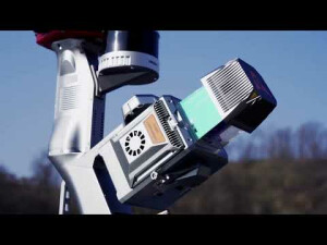
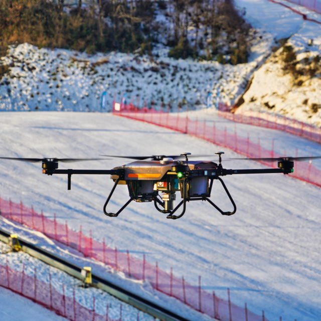
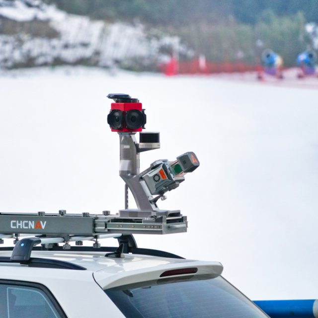
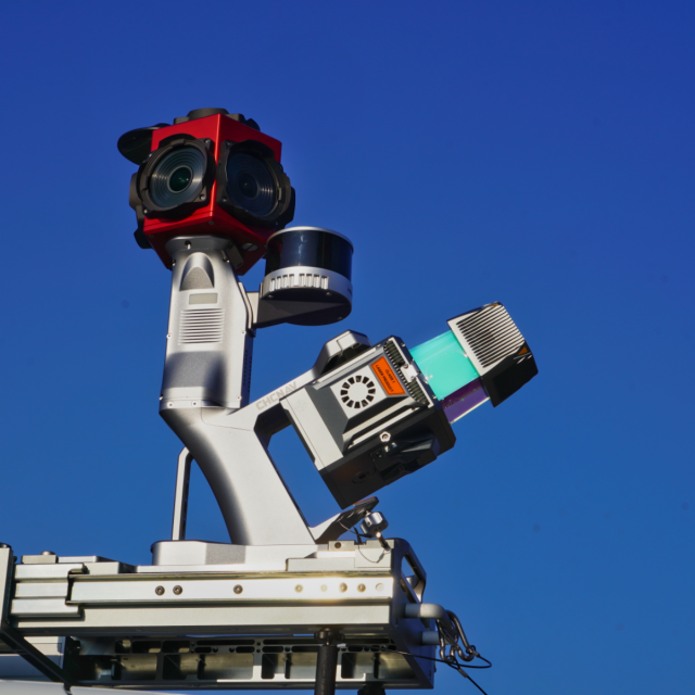
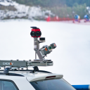
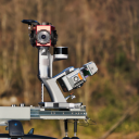
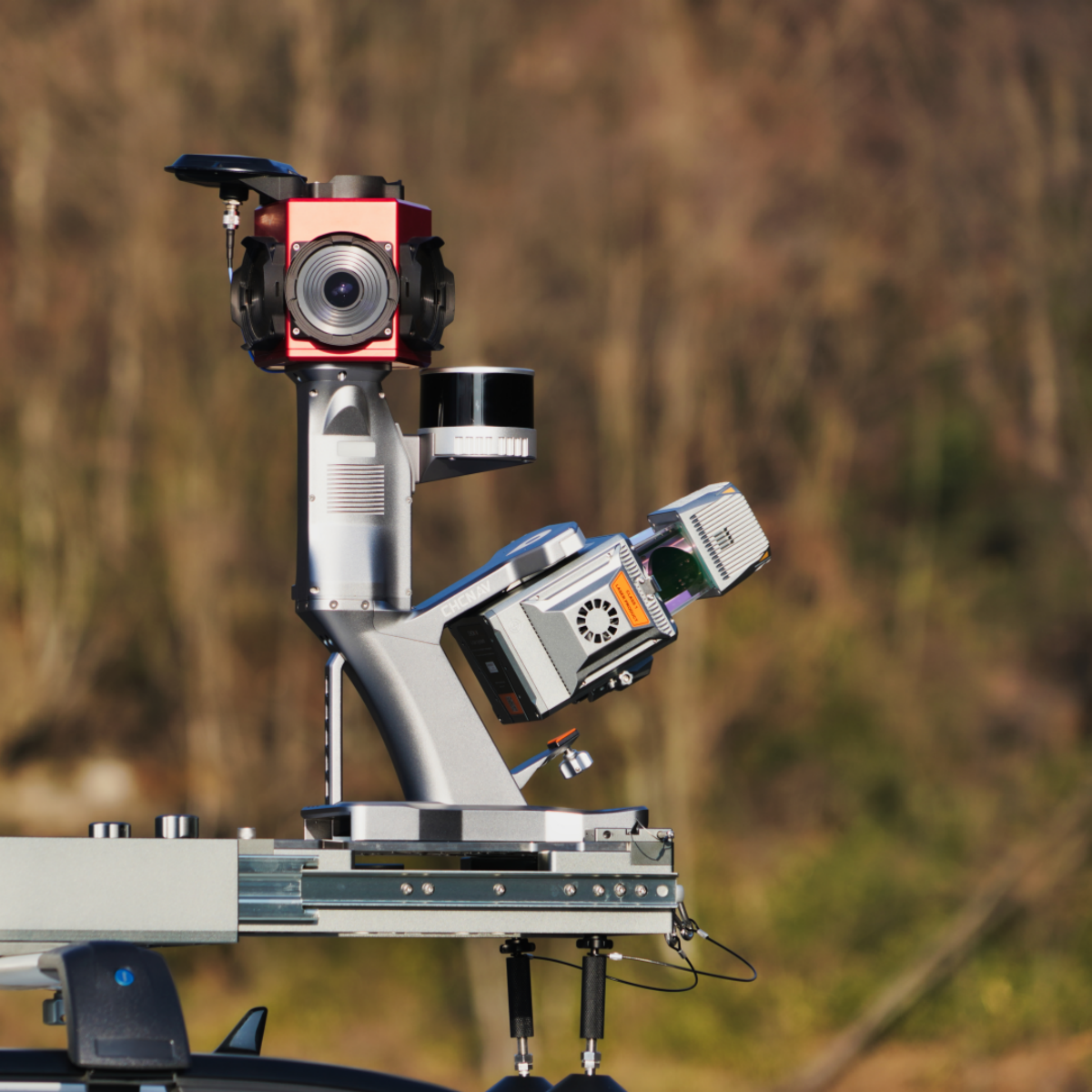
The AU20 Lidar is light and compact, weighing just 2.82 kg. Combined with its car mount kit, including a Ladybug5+ and SLAM technology, the total weight is only 10.7kg. With its flexible multi-platform design, the AU20 can be easily mounted on manned and unmanned aircraft for airborne scanning. In addition, it can be seamlessly integrated into a variety of land vehicles, such as cars, boats, and trains, for mobile mapping applications. The AU20 can also be mounted on a backpack for narrow-area mapping providing unparalleled versatility.
In airborne scenarios, the AU20 delivers superior data and improves survey efficiency thanks to its exceptional vegetation penetration capability, extended measurement range, high accuracy, and data density. The AU20's unique, flexible installation design, coupled with CHCNAV's Lidar technology, ensures the best combination of point cloud density, accuracy, and quality. The system provides accurate point cloud and immersive panoramic imagery optimized for a variety of applications, including road surfaces, highway maintenance, and asset management through vehicle-based surveying. Mobile mapping has never been more flexible with the AU20, democratizing the reality capture industry and making it accessible to all.
Do you have questions about this product?
- Questions about price, availability, and/or retailers
- Questions about technical specifications and usage
- Questions about suitability for your project or application
Specifications
-
Operation Characteristics
-
Camera included
-
General
-
Year of last update
2023
Year of introduction
2022
Documents
Brochure
au20-ds-en.pdf
2.22 MB
Videos


