


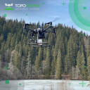

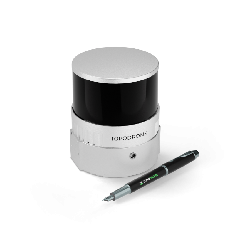
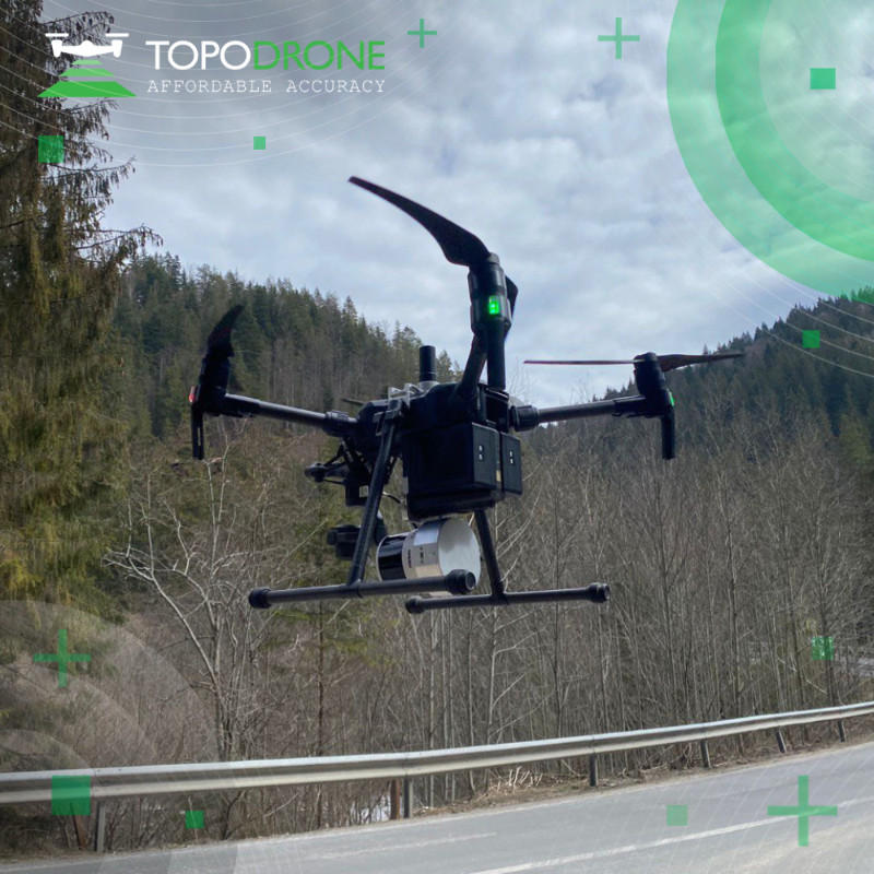

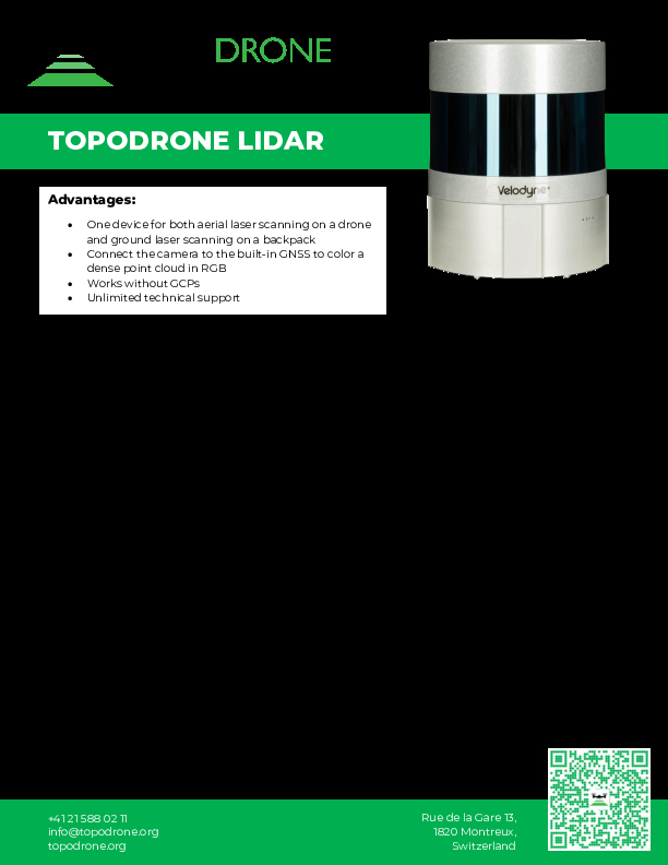
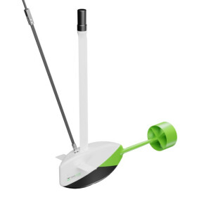
TOPODRONE LiDAR 200+
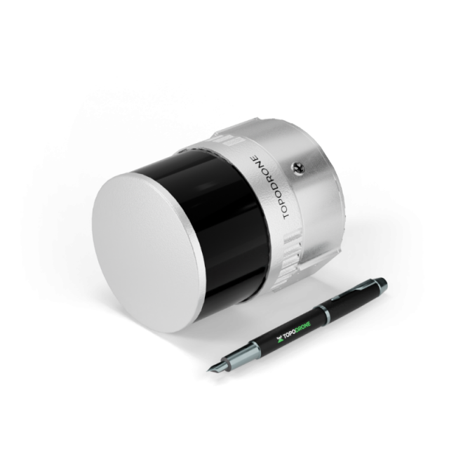
Laser scanner based on Hesai XT32M2X, 300 m working range, 200 m working flight altitude, triple return mode up to 1,920,000 points per second, 3-5 cm XYZ accuracy, 360° FOV, built-in 200 Hz IMU with 0.07/0.01 accuracy, built-in GNSS receiver, weight 0.8 kg.
Laser scanner based on Hesai XT32M2X, 300 m working range, 200 m working flight altitude, triple return mode up to 1,920,000 points per second, 3-5 cm XYZ accuracy, 360° FOV, built-in 200 Hz IMU with 0.07/0.01 accuracy, built-in GNSS receiver, weight 0.8 kg.

TOPODRONE
Montreux, CH
Description
Description
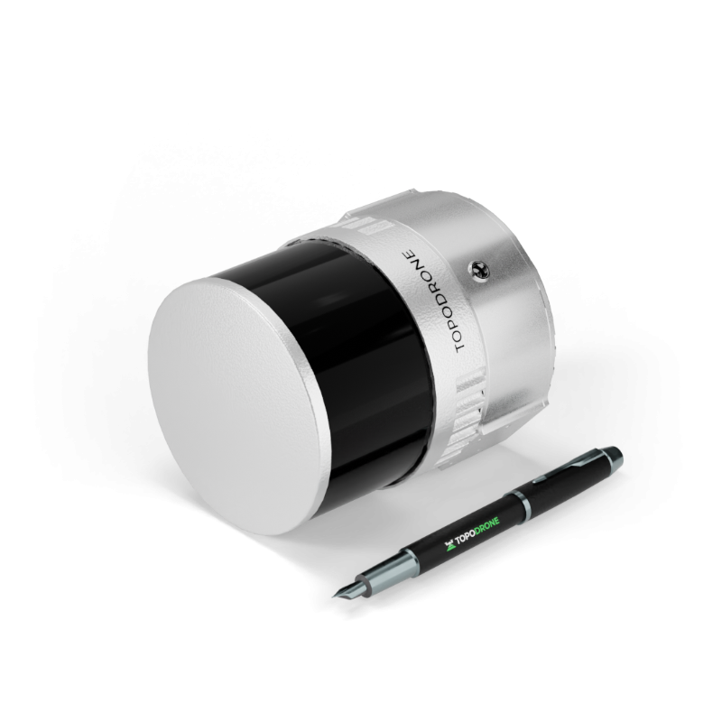
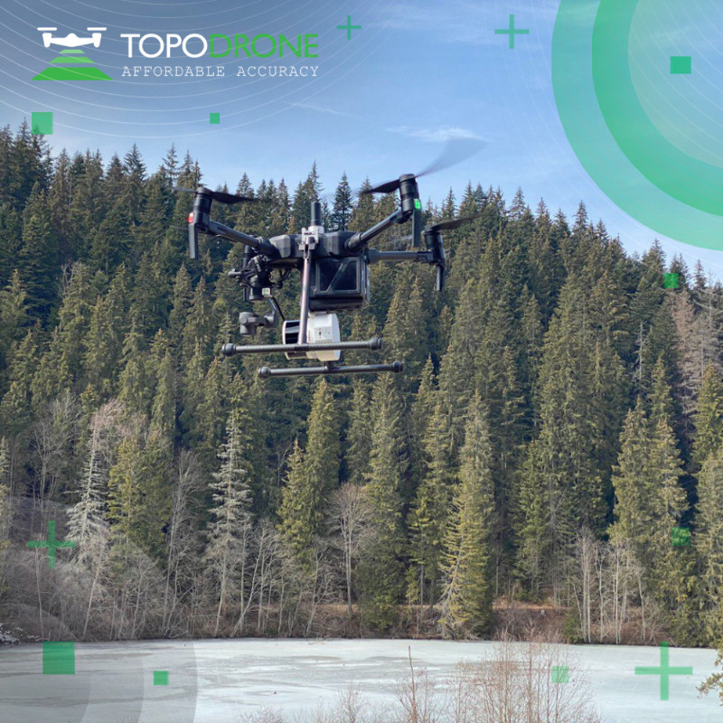
Laser scanner based on Hesai XT32M2X, 300 m working range, 200 m working flight altitude, triple return mode up to 1,920,000 points per second, 3-5 cm XYZ accuracy, 360° FOV, built-in 200 Hz IMU with 0.07/0.01 accuracy, built-in GNSS receiver, weight 0.8 kg.
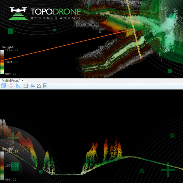
- The most compact 360° LiDAR on the market.
- The lightest LiDAR of the product line - 800 g.
- The highest working flight altitude - 200 m.
- Triple return mode, the others have dual return.
- Highest scanning frequency - 1 920 000 PPS.
Features
- Affordability. We work hard to provide the lowest prices for LiDARs in its class.
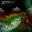
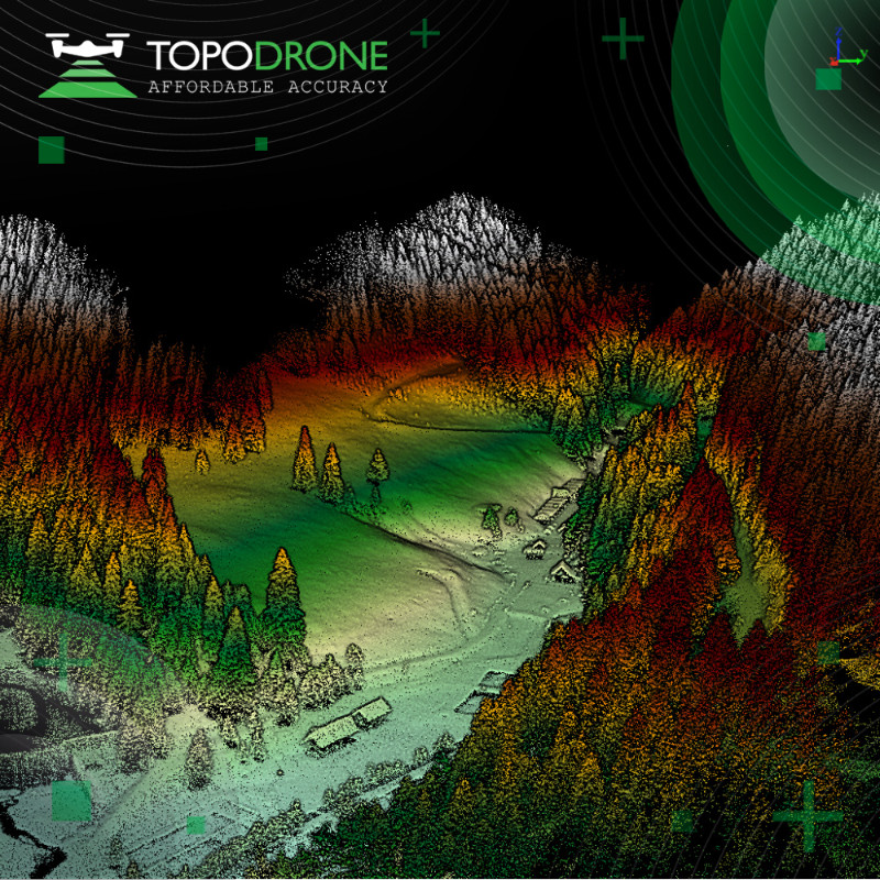
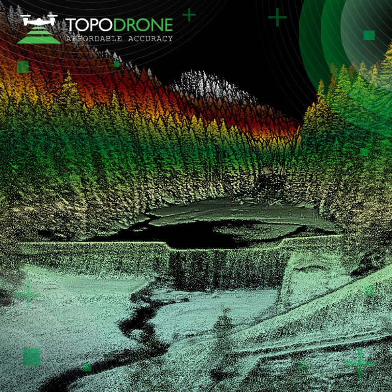
- Performance. Covers over 2 sq. km. of territory in one flight from a 200 m altitude.
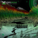
- Accuracy. Very precise and thin point cloud due to modern laser sensor, built-in high precision IMU and integrated GNSS receiver.
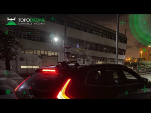
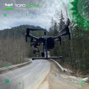
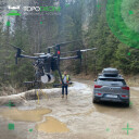
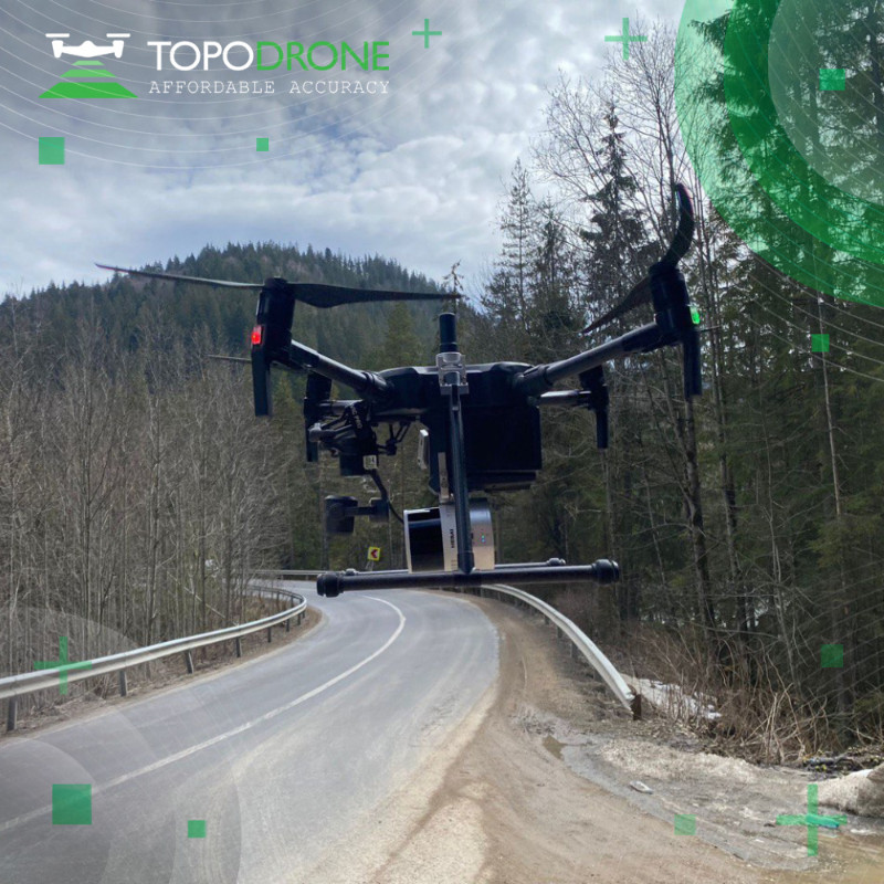
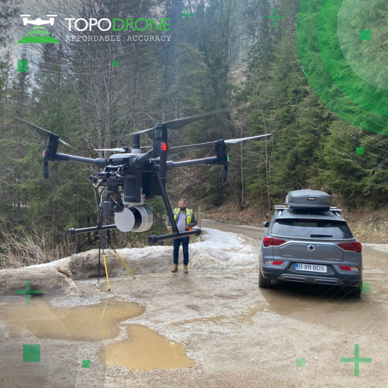
- Mobility. LiDAR 3 in 1: can be mounted not only on the drone, but also on a car and a surveying backpack.
- Autonomy. Completely autonomous LiDAR missions when mounted on the DJI Matrice 300 RTK.
- Software. Provides full processing cycle from trajectory calculation to point cloud generation with the required coordinate system, strip adjustment and SLAM algorithms for data processing in conditions of insufficient GNSS signal are supported.
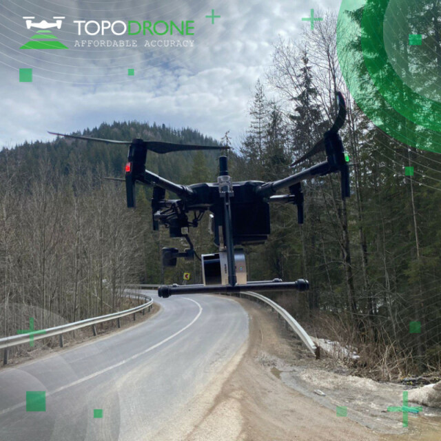
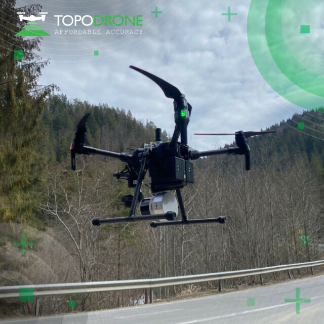
- Integration. The laser scanner can work on any drone, is fully compatible with TOPODRONE P24 and P61 photogrammetric cameras, the camera can be connected to the laser scanner, a fixed installation on LiDAR, as well as an option with installation of the camera on a 3-axis gimbal.
In the box
1 * TOPODRONE LiDAR 200+
1 * Drone mount
1 * Antenna cable
1 * GNSS antenna
1 * Flash card
1 * Cable kit
1 * Carrying case
Comparison
| Specifications | TOPODRONE 200+ | TOPODRONE 100+ | TOPODRONE 100 |
| Weight | 800 g | 1000 g | 1000 g |
| Working Range | 300 m | 120 m | 120 m |
| Working Flight Altitude | 200 m | 100 m | 100 m |
| Number of Lines | 32 | 32 | 16 |
| PPS - Single Return | 640 000 | 640 000 | 320 000 |
| PPS - Dual Return | 1 280 000 | 1 280 000 | 640 000 |
| PPS - Triple Return | 1 920 000 |
Specifications
| General | |
| Manufacturer | TOPODRONE |
| Country of origin | Switzerland |
| Year of release | 2023 |
| Warranty | 12 month |
| Weight | 800 g |
| Dimensions | |
| Operating Temp | -20℃ to 60℃ |
| Storage Temp | -40℃ to 85℃ |
| LiDAR System | |
| Sensor type | XT32M2X |
| Sensor weight | 490 g |
| Recording data to internal memory | Yes |
| Recording data to a flash card | Yes |
| Camera connection | Yes |
| Built-in IMU | Yes |
| Built-in GNSS module | Yes |
| Laser Sensor | |
| Working Range | 300 m |
| Working Flight Altitude | 200 m |
| Sensor Accuracy | 3-5 cm |
| Number of Lines | 32 |
| Horizontal FoV | 360° |
| Vertical FoV | 40.3° |
| Horizontal Resolution | 0.09° |
| Vertical Resolution | 1.3° |
| Points Per Second (Single Return mode) | 640000 |
| Points Per Second (Dual Return mode) | 1280000 |
| Points Per Second (Triple Return mode) | 1920000 |
| Refresh Rate | 5-20 Hz |
| Laser Wavelength | 905nm Class 1 eye safe |
| Operating Voltage | 9 V – 36 V |
| Power Consumption | 10 W |
| Output | UDP/IP Ethernet, 100BASE-TX |
| Ethernet Connection | 100 Mbps |
| Data synchronization | GPS/PTP |
| Water Resistance | IP6K7 |
| IMU | |
| IMU Weight | 35 g |
| Operating frequency | 200 Hz |
| Heading accuracy (°, 1σ) | 0,07 |
| Pitch accuracy (°, 1σ) | 0,01 |
| Roll accuracy (°, 1σ) | 0,01 |
| GNSS Receiver | |
| PPK mode | Yes |
| Number of channels | 184 |
| Frequency | 10 Hz |
| Data Accuracy | 3-5 cm |
| GPS | L1C/A, L2C |
| GLONASS | L1OF, L2OF |
| BeiDou | B1I, B2I |
| Galileo | E1B/C, E5b |
| SBAS | L1C/A |
| QZSS | L1C/A, L1S, L2C |
| Working without GCPs | Yes |
Do you have questions about this product?
- Questions about price, availability, and/or retailers
- Questions about technical specifications and usage
- Questions about suitability for your project or application
Specifications
-
Application
-
Training, maintanence and support
Available
-
Measurement Characteristics
-
Range accuracy [mm]
50
Scanning Speed [measurements p second]
1920000
Max. field of view [degrees]
360
-
Physical Properties
-
Weight [kg]
0.8
-
Laser Pulse Characteristics
-
Laser Class
1
Wavelength [nm]
905
-
Operation Characteristics
-
Camera included
Optional
-
General
-
Year of last update
2023
Year of introduction
2023
Documents
Brochure
topodrone-lidar-2021-eng.pdf
182.53 KB