
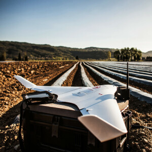
UAS for Mapping and 3D Modelling
An Unmanned Aerial System for Mapping and 3D Modelling is available as one of two platforms; aircraft and copter. Both of which have advantages and disadvantages. An Aircraft will have a longer flight time and larger coverage area, but it requires more space to take-off and land. This makes Aircrafts ideal for larger scale Mapping and 3D Modelling projects. Aircraft will conventionally be able to carry a larger payload than Copters. A Copter is able to lift off and land horizontally and is often used for small-scale Mapping of 3D Modelling projects.
Showing 1-15 of 19 results

E300 Unmanned Aerial Mapping Solution

Astero

BB4 UAV
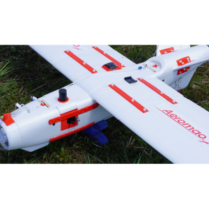
Aeromapper 300
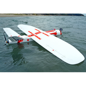
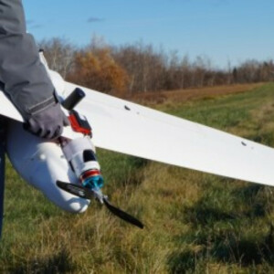
Aeromapper Talon Amphibious
Aeromapper Talon sUAS
Atlas ppX
IT180-120

Hovermap Core

Matrice 30

Matrice 300 RTK

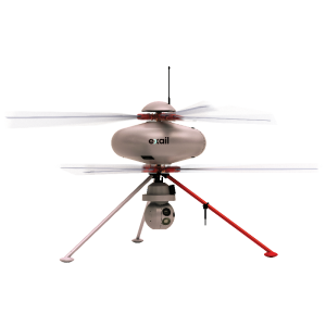
SLL3 Versatile Multi-rotor UAS
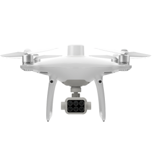
P4 Multispectral
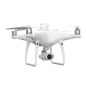
PHANTOM 4 RTK
Need some help? Ask a Geo-matching expert!
Our team and network of 1000+ manufacturers and developers is here to assist you.

Critical Factors When Selecting Unmanned Aerial Systems
An in-depth look at the buyers’ selection process for unmanned aerial systems (UAS)
Choosing the right Unmanned Aerial System (UAS) or drone for surveying, mapping and 3D modeling is not an easy task, because of the wide range of available options, different payloads, proprietary software and different platforms; hence this buyers’ guide
In the hydrography and geomatics industry, established manufacturers and suppliers have dominated the market for many years. This is not the case for Unmanned Aerial Systems (UASs), there is still plenty of movement and innovation in the market for drones for mapping and surveying. Many startups and established manufacturers, like Topcon, Riegl and DJI see great opportunities in many different applications, not making it easier to choose the right Unmanned Aerial System.
When buying a Unmanned Aerial System platform, all considerations should be based on the applications we aim to use it for. Close-up inspections or 3D modeling of buildings in the built environment require different equipment than generating large scale 3D models for mining, forestry or agriculture. Therefore, choosing the right platform is the first task. Generally speaking, we can choose from three different options: a copter, a fixed wing or a hybrid form; a fixed wing which can vertically take-off and land (VTOL). A fixed wing drone for land surveying is best used to cover large areas, while the multirotor is more applicable for close-up inspections, generating 3D data, BIM and volumetric measurements on smaller construction and excavation sites.
Next, there are two main categories of propulsion to choose from: electric or with a combustion engine. Combustion engines are generally used for their longer operation time, bigger flight range, and ability to lift heavier payloads, while electric systems are generally cheaper and require less maintenance. Also the desired payload is a determining factor in choosing the right propulsion, a heavier payload will significantly decrease the operating time, therefore a heavy payload could require a more powerful platform.
There is a wide range of different payloads available, and the number of available technologies that can be mounted under a UAV have increased fastly over the past decade. The most common payload is a camera, which is, depending on their use case, equipped with a gimbal or can be mounted under the UAV. For an overview of cameras for UAVs, click here. Also, LiDAR sensors for hydrographic surveying, forestry and mining that can be mounted under an unmanned system have become more widely available, and can be found here.
Ground penetrating radar to detect pipes and cables can be found here. Use gamma spectrometers to use a UAS for nuclear and chemical research
The use of intelligent flight planning software can significantly ease the use of a UAS in surveying. The levels of automation vary from automated mission planning and automatic geotagging aerial imagery, to importing height models of your surroundings to customize your map and flight plan. Flight planning software can be found here.


