Small and Compact MS400U Multibeam Echosounder Used in Reservoir Dredging Survey
The analysis of the survey results of the underwater topography in this reservoir area shows that the MS400U multi-beam echosounder performs well and is stable in deep-water environments. At the same time, with the post-processing function of Hypack, it can generate good results and diverse display forms. Compared with singlebeam, multibeam improves the scanning density of sounding points and increases efficiency. It took two days from installation and test to the end of the survey to complete the full coverage survey of the whole area.
Reservoir sedimentation is mainly the accumulation of sediment carried by the river between the terminal of the backwater and the river barrage structure. More sedimentation will reduce adequate storage capacity and affect the barrage structure's regular operation.
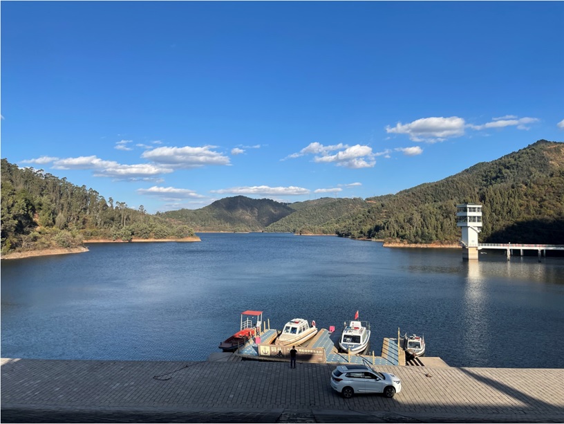
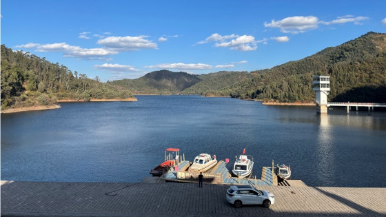
Image 1: Reservor in China
In the upper reaches of the reservoir, sedimentation raises the river bed, which can raise the river water level, reduce the slope and flow rate, reduce the river discharge capacity and aggravate flood control difficulties. The rise of the river water level may also result in the increase of groundwater level on both banks and lead to soil salinization.
In the lower reaches of the channel, during the period when the reservoir silts and intercepts sediment, the reservoir discharges clear water, the downstream river bed generally cuts down due to scouring, and the water level drops consequently. This will have both positive and negative impacts. On the one hand, it is not conducive to the foundation of dams and buildings along the river, making it challenging to operate water diversion projects along the river and reduce the embedded depth of the bridge foundation downstream. On the other hand, it can reduce the tail water level of the hydropower station and increase its power output, increase the downstream water depth and decrease the flow rate, which is good for the stability and navigation of the river bed.
The project is a reservoir in south China, where a dredging operation and multibeam survey were carried out in 2018. Now the surveying team needed to obtain the underwater topographic condition by multibeam survey, understand the sedimentation change situation by comparing it to the survey results of 2018 and further provide reference consideration for the subsequent dredging work.
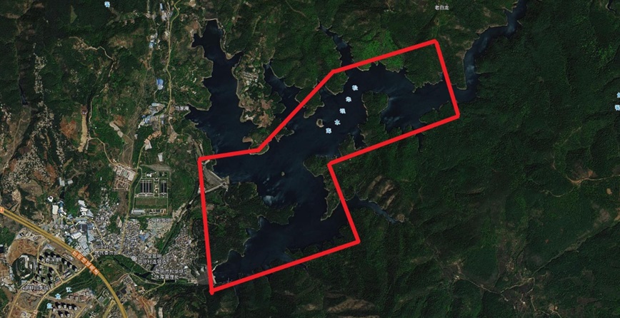
Image 2: Aerial image of the reservoir
The Underwater 3D Terrain Survey Using a Multibeam Echosounder
Based on the situation mentioned above, the Scenic Spot Management Office entrusted a water conservancy survey office cooperating with Hydro-Tech Marine Technology to survey the water depth of the reservoir and collect the related data. We carried out the underwater 3D terrain survey with the solution, which combined a small vessel and MS400P, which was used to carry out a full coverage survey of the proposed survey area.
Due to the deep water depth and low liquidity, the sound velocity changes considerably under different water depths, so it is necessary to use the sound velocity profiler to measure the sound velocity at different depths underwater to facilitate correction during later data processing. And MS400U had a built-in motion sensor like Applanix SurfMaster to enhance sounding accuracy.
Surveying the Reservoir in Four Parts
Due to the irregular plane shape of the reservoir area, we divided the lake area into four main parts. We measured them respectively to ensure the stability of the navigation state during the survey and ensure the vessel kept uniform rectilinear motion while sailing, improving the survey efficiency and accuracy.
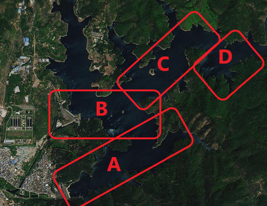
Image 3: Dividing the reservoir in four parts
Result and Analysis
Using Hypack software to process the data according to the following several steps.
1) Create a new processing project in Hypack and set the corresponding geodetic survey parameters.
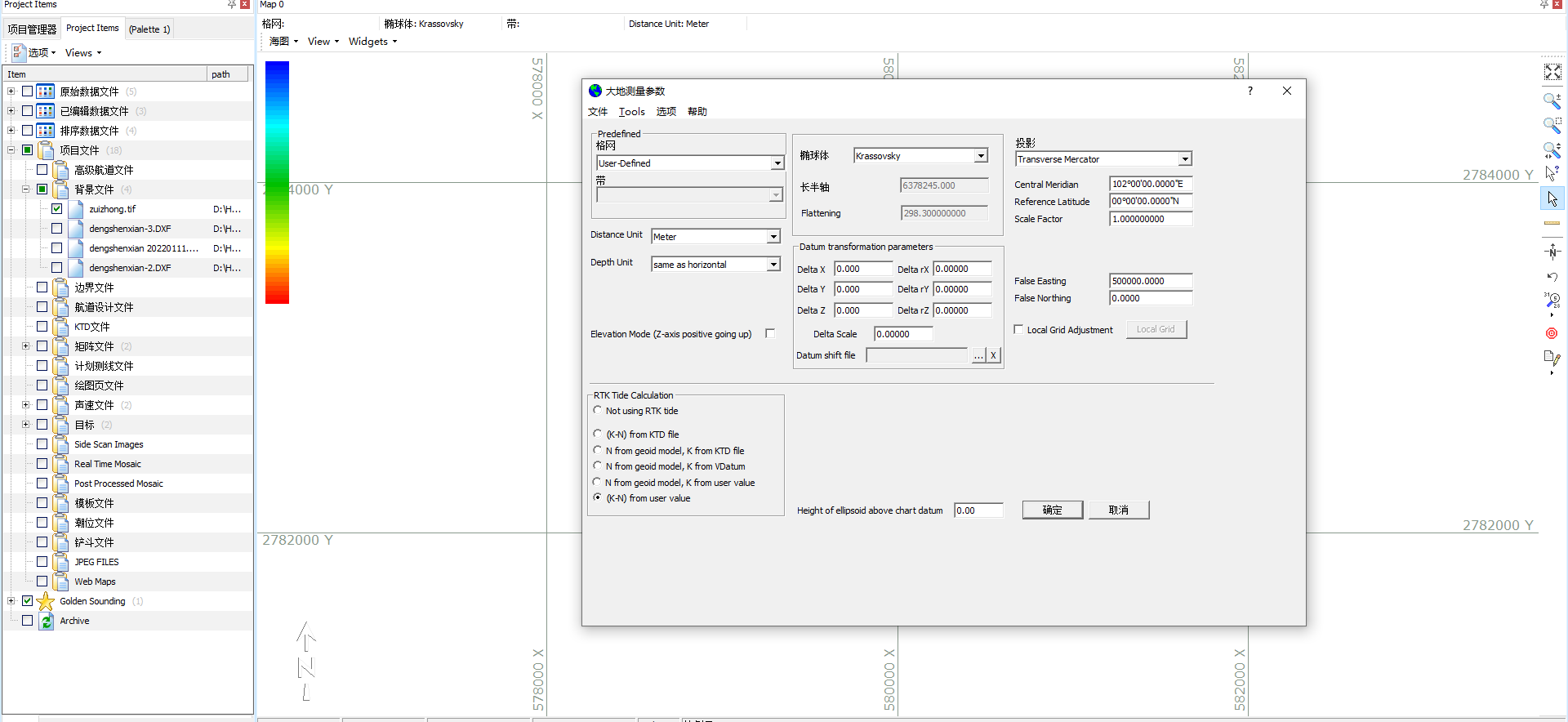
2) Import survey data and load corresponding sound velocity data.

3) Calibrate the instrument installation and obtain the instrument installation deviation parameters.
4) Filter data by eliminating noise points and outliers.

5) Save the processed survey data as an XYZ file.
6) Create TIN model and TIF image.


It can generate contour map including contour lines at 1m elevation interval in DXF format, which complying with the survey specification.


Summary and Main Learnings From the Reservoir Survey
The analysis of the survey results of the underwater topography in this reservoir area shows that MS400U Multi-beam Echosounder performs well and stably even in deep water environments.
At the same time, with the post-processing function of Hypack, it can generate great results and diverse display forms.
Compared with singlebeam, multibeam improves the scanning density of sounding points and increases efficiency. It took two days from installation and test to the end of the survey to complete the full coverage survey of the whole area.
Do you have questions about this case study?
Get in touch with Hydro-Tech, and they would be happy to answer any questions you have about pricing, suitability, availability, specs, etc.


![Do-Giant-Tortoises-Make-Good-Neighbors-1[1].jpg](https://cdn.geo-matching.com/vRMO2Edp.jpg?w=320&s=a6108b2726133ff723670b57bc54c812)


