
Enhanced Monitoring in Hydropower Stations: The Critical Role of Detailed 3D Reconstruction

1. Background
Due to factors such as water levels, temperature fluctuations, aging, and creep, concrete in dams can develop various defects over time, including cracks, spalling, seepage, and detachment. These issues can significantly impact the safe operation of hydroelectric power stations. Therefore, regular inspection and analysis of dam concrete is crucial to understand the operational status of the dam and ensure its safe functioning.
The catastrophic potential of dam failures has been demonstrated repeatedly through several high-profile international incidents:
1963 Vajont Dam Disaster, Italy: An overwhelming landslide caused the dam to overtop, drowning five villages and killing approximately 2,000 people.
2017 Oroville Dam Failure, USA: Severe erosion of the emergency spillway structures led to the evacuation of 16,000 residents due to imminent threat of flooding.
2018 Solai Dam Collapse, Kenya: After heavy rainfall, the dam burst, resulting in 48 deaths, impacting 300 households, and leaving 500 people missing.
2018 Laos Dam Collapse: A dam under construction by a South Korean company failed, killing 35 and causing 99 others to go missing.
1975 Banqiao Dam Failure, China: Perhaps one of the deadliest, this event affected 11 million people, submerged 29 counties and cities, destroyed over 5.96 million buildings, and resulted in extensive agricultural and economic losses.
Traditional dam inspection methods typically involve manual interpretation from operational platforms or using small vehicles equipped with high-definition cameras. However, these methods struggle with defects detection in very high arch dams and often have blind spots. Close-range photogrammetry offers a solution by rapidly producing high-resolution, three-dimensional models of complex dams over large areas. These detailed models enable thorough analysis of cracks and structural issues, providing essential data for targeted preventative measures and enhancing safety standards.
2. Project Overview
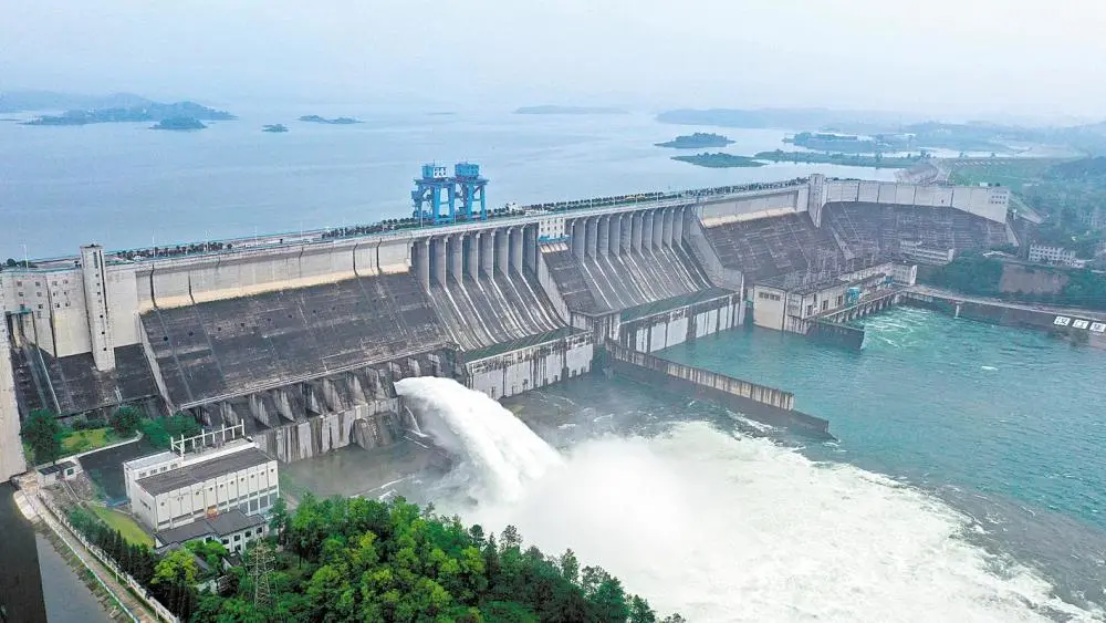
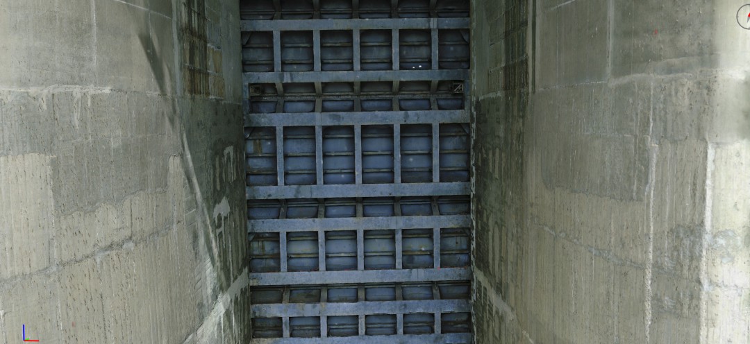
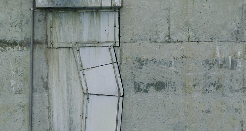
Scope of Work: The Danjiangkou Hydropower Station project involved comprehensive high-precision, millimeter-level modeling of the entire facility. The process was conducted via fully automated drone flights, with no model corrections post-flight.
Dam Specifications: The hydropower station consists of several components including the main dam for water retention and flood discharge, power station buildings, a ship lift system, and water diversion channels. The dam is constructed of concrete and stretches 1,141 meters length, with a total length of 3,442 meters. The crest elevation stands at 176.6 meters, with a maximum height of 117 meters.
Challenges: The project environment was complex, featuring high-voltage power lines, pylons, and large water drop areas. The extensive operational scope and certain areas were inaccessible through conventional imaging techniques.
Project Equipments
Drone: DJI Matrice 300 RTK
Camera: SHARE 5-lens oblique camera - PSDK102S V3
Software: DPGO Close-Range Photogrammetry Intelligent Flight Planning Software
The PSDK102S V3 5-lens oblique camera, weighing approximately 1041g, integrates five 25-megapixel image sensors, delivering an effective total of over 125 million pixels. This camera supports control-free operations, achieving centimeter-level positional accuracy. After the gimbal is detached, it can be adapted to fixed-wing drone models, making it a versatile and open-source payload for aerial mapping.

1) Initial Terrain Data Acquisition
The process of gathering initial terrain data took approximately 20 minutes. The task was configured with the following parameters:
Flight Altitude: 200 meters
Longitudinal/Lateral Overlap: 80%; 70%
Flight Speed: 5 m/s
Distortion Correction: Disabled
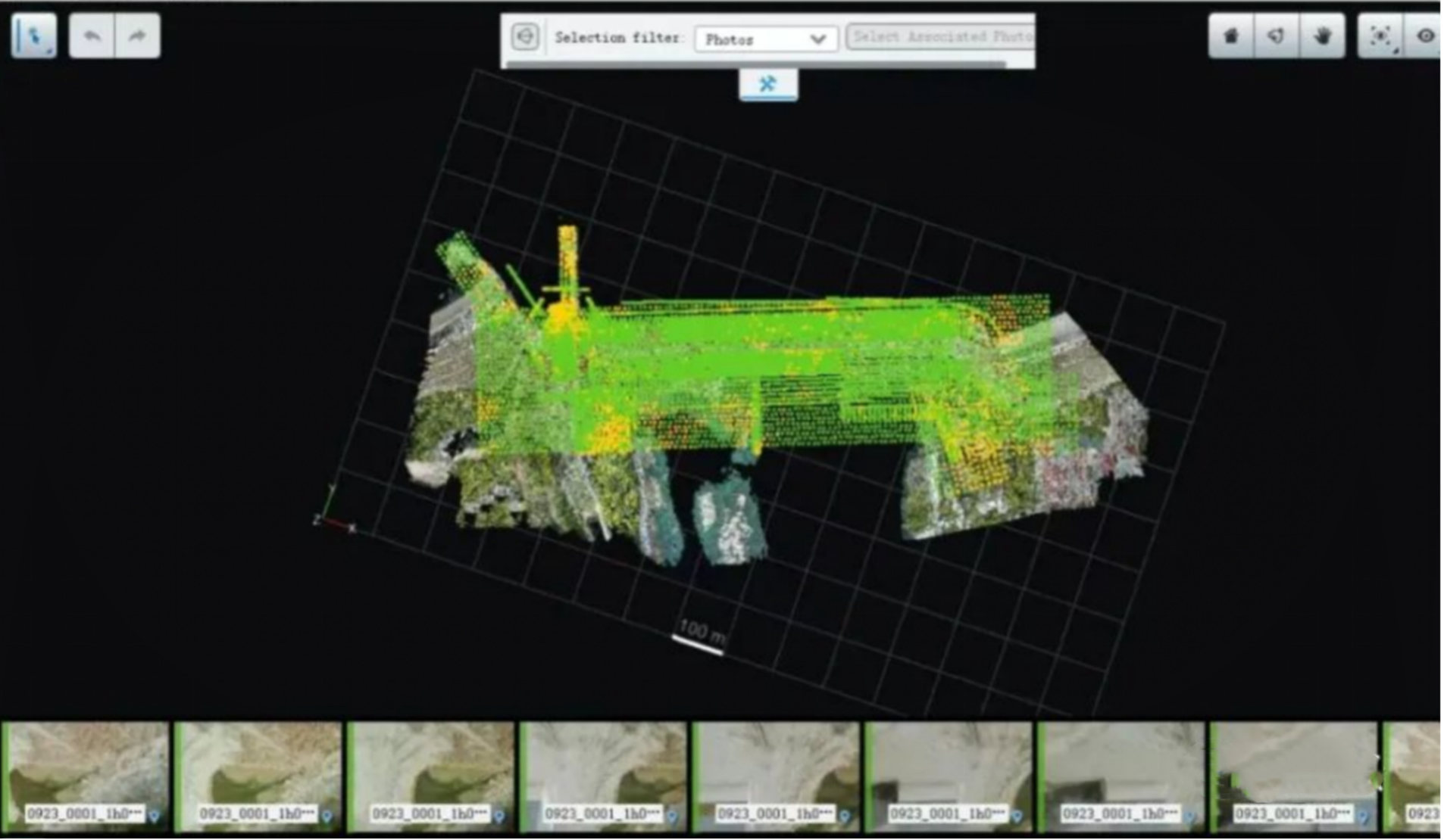
After data collection, the data underwent automatic processing using DPone software to generate point cloud LAS data. This processing took 30 minutes, completing the entire initial terrain data collection in one hour.
2) Close-Range Photogrammetric Planning with DPGO
Utilizing the initial terrain data, the close-range photogrammetric flight planning software, DPGO, was employed to execute 3D flight planning for the Danjiangkou Hydropower Station. This software automatically generated flight paths for close-range photography, targeting distances of 10-20 meters from the subject.
During the planning phase, the default direct frontal view was used, and the only adjustment rquired was shooting distance. Once all settings were unified, the software conducted a safety check of the flight path to ensure the security of the flight operations.

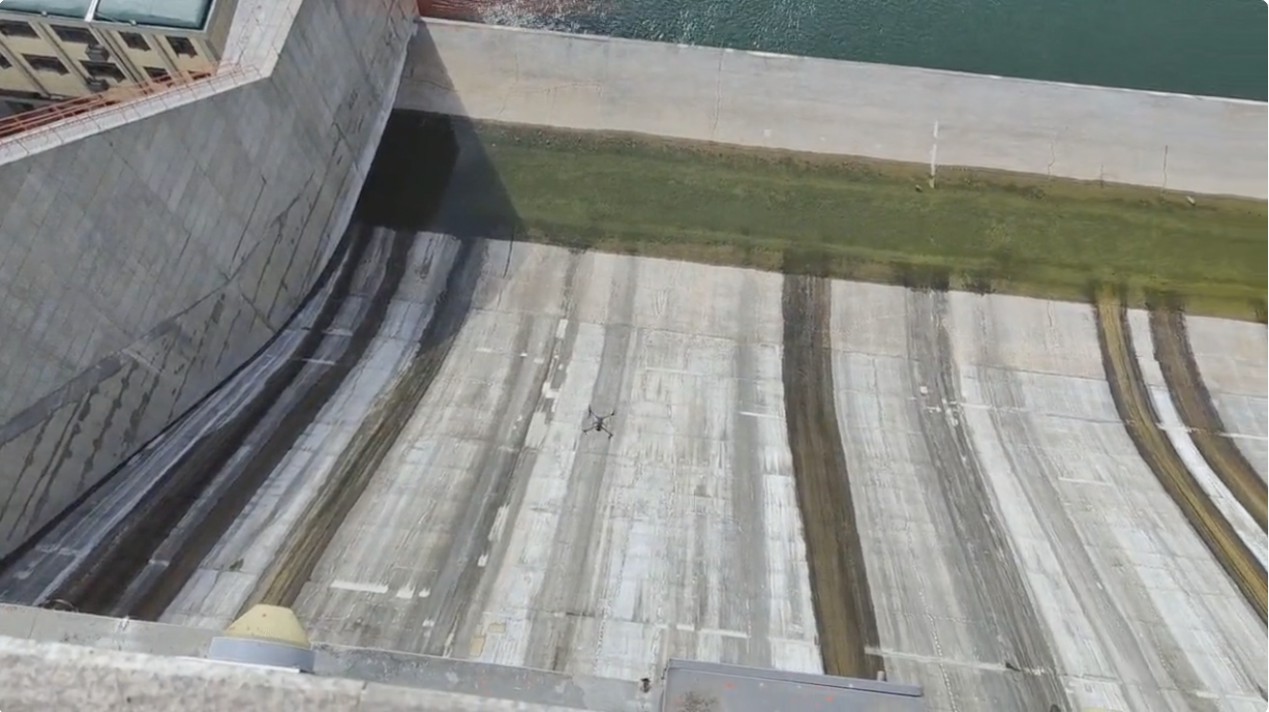
3) Close-Range Automated Flight
The flight plan was loaded into the DJI Pilot, a screen-equipped remote controller, enabling the drone to perform intelligent close-range flights along preset routes and capture high-resolution images. This automated flight operation successfully gathered 60,000 photographs over a span of 20 hours, maintaining complete automation throughout the process.

5) Delivery of Results
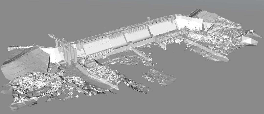
The entire process of acquiring detailed 3D models was streamlined through a one-time flight planning and data capture, followed by automated modeling without the need for manual corrections. The complete model featured a coherent data structure with clear textures and reliable accuracy, significantly enhancing efficiency.
The entire workflow, from data collection to processing, was completed within a week, yielding high-precision 3D models that fully met the project requirements. With these detailed digital reconstructions, every feature of the dam could be meticulously analyzed, providing a robust data foundation for future monitoring on further digital-twin platforms. Such platforms might include inclinometer readings, subsidence changes, GPS surface displacement monitoring, deep displacement monitoring, and rainfall measurements. This comprehensive approach enhances the understanding and management of geological changes and risks.


Do you have questions about this case study?
Get in touch with SHAREUAV Ltd., and they would be happy to answer any questions you have about pricing, suitability, availability, specs, etc.


![Do-Giant-Tortoises-Make-Good-Neighbors-1[1].jpg](https://cdn.geo-matching.com/vRMO2Edp.jpg?w=320&s=a6108b2726133ff723670b57bc54c812)


