
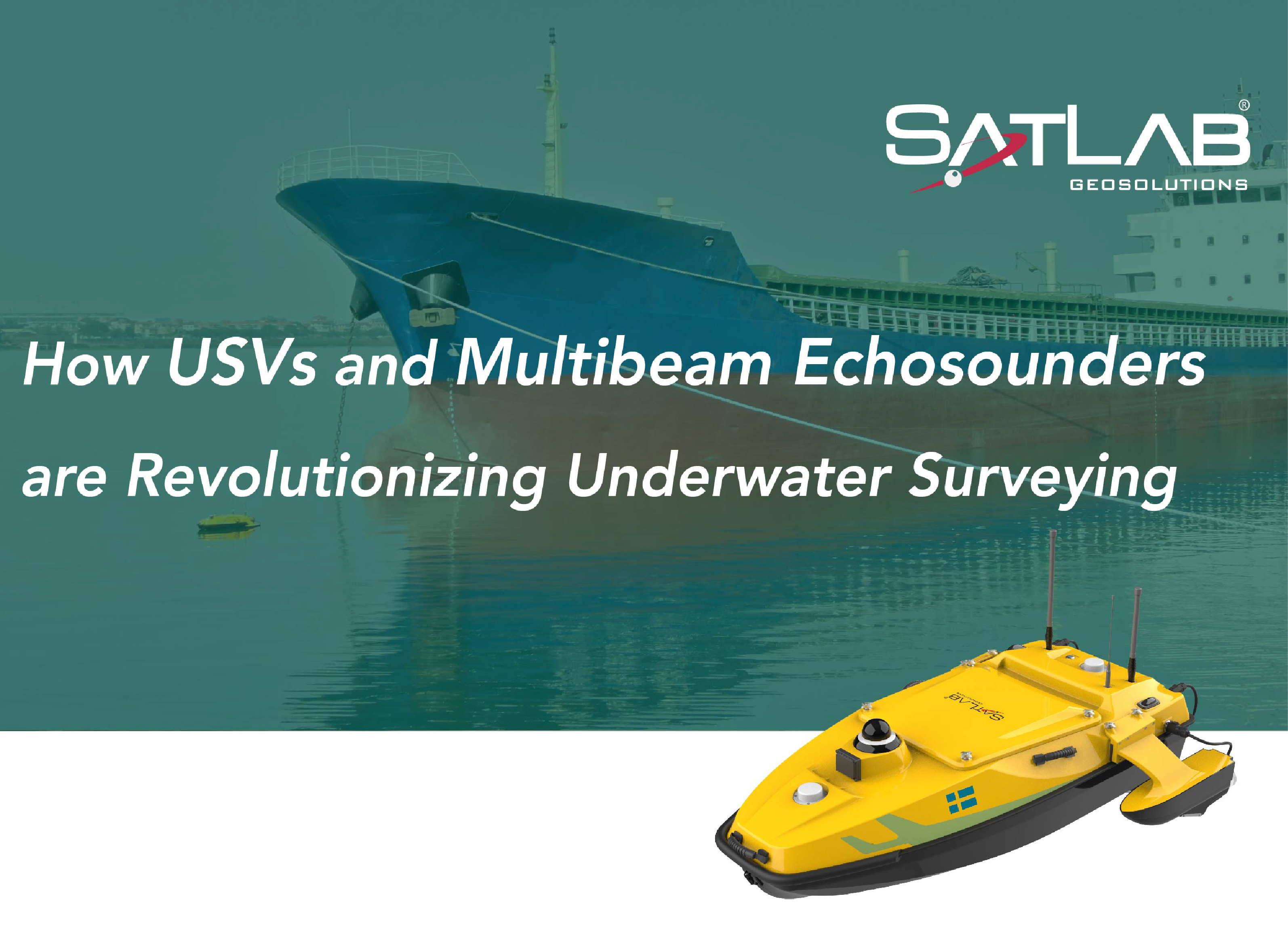
How USVs and Multibeam Echosounders are Revolutionizing Underwater Surveying
Introduction
Underwater surveying plays a critical role in various aspects of our world. From enabling safe navigation for ships and charting underwater resources to monitoring coastal erosion and underwater environments and inspecting infrastructure like pipelines and cables laid across submerged areas, these surveys are vital. However, traditional surveying methods are often expensive, time-consuming, and limited by factors like water depth and visibility.
Fortunately, technological advancements are revolutionizing this field. Unmanned Surface Vehicles (USVs) coupled with Multibeam echosounders (MBES) are ushering in a new era of underwater surveying, providing high-resolution 3D maps of the seabed. The integration of USVs and MBES is a significant leap forward, transforming underwater surveying and paving the way for a more sustainable future for our oceans. Let's dive into a specific example of how USVs and MBES are used for underwater pipeline surveys.
Project Background
The project involved surveying the underwater topography of a key waterway near a cargo terminal.
Over time, sediment can accumulate on the seabed, reducing water depth. Bathymetric surveys help identify areas requiring dredging to maintain the necessary depth for large cargo vessels, minimizing the risk of grounding, which can damage the ship and cause environmental harm. Multibeam technology is ideally suited for this task, generating high-precision, high-resolution underwater terrain data.
.png")
Traditional Challenges
Traditional surveying methods rely on large survey vessels that require complex equipment installation and are susceptible to interference during navigation, which is suited for deep and open water areas, but not ideal for shallow, congested areas like the waterway in this project.

Solution
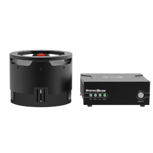
The shallow water depth and presence of passing ships in the project area made a USV-mounted portable multibeam echosounder system the ideal solution. The SatLab's newly released HydroBoat 1500 USV is an advanced USV specifically designed for multibeam bathymetry surveys. The innovative quad-thruster configuration resembles a trimaran hull, providing superior stability; in addition, even if two thrusters malfunction, the remaining thrusters can still propel the vehicle, ensuring continued operation.

The HydroBoat 1500 USV with the HydroBeam M4 multibeam echosounder offered several advantages:
Efficient data collection: USVs can cover large areas quickly and autonomously, while multibeam echosounders provide a wider area coverage compared to single-beam sonars.
Improved Safety: USVs can be deployed in hazardous or hard-to-reach areas, reducing risks to personnel.
Better Data quality: USVs can collect data more consistently than manned vessels, potentially leading to more accurate results.
Implementation Scheme
Field Data Collection
· Route Planning: Survey line layout: Parallel lines were laid out to cover the entire survey area, with spacing adjusted based on water depth. Perpendicular check lines ensured measurement accuracy.
· Tide observation: RTK tide verification ensured accurate water depth measurement. Throughout the process, the GNSS system was continuously monitored for any abnormalities to ensure the precision of the water depth measurements.
· Installation and calibration: The transducer was installed within the moon pool of the HydroBoat1500 and underwent roll/pitch/yaw calibration to compensate for any positional deviation.

Data Post-processing
Using SLHydro multibeam post-processing software, the data is post-processed according to the workflow of terrain drawing, water depth data inspection, chart editing, and graphic drawing, and finally a chart is generated.

Results
l High-Resolution Underwater Terrain Maps
The project successfully generated high-resolution underwater terrain maps using the HydroBoat 1500 USV integrated with HydroBeam M4 multibeam echosounder. These detailed maps provide a clear picture of the underwater terrain and landforms of the key waterway, which is crucial for future maintenance efforts.

l Meeting IHO Standards
Calibration area analysis confirmed that the HydroBeam M4 meets the stringent IHO Class A accuracy standards for underwater measurements, which ensures the reliability of the collected data.

Benefits
The HydroBoat 1500 USV and HydroBeam M4 multibeam echosounder system successfully completed the underwater terrain measurement of this key waterway. The HydroBoat 1500 USV features a unique moon pool design and comes equipped with a waterproof mounting bracket. In addition to the M4 multibeam sonar system, it can effortlessly integrate third-party multibeam echo sounder systems. It also supports mounting other sensors onboard, such as ADCPs and side scan sonars, making it highly adaptable for various functionalities and measurement requirements.
Conclusion
This project demonstrates the effectiveness of USV and MBES technology in providing high-quality data to support critical tasks such as waterway maintenance, safe ship passage, and navigation route management. In conclusion, the integration of USVs and MBES represents a significant leap forward in underwater surveying technology. This powerful combination promises to enhance efficiency, safety, and data quality across a broad spectrum of industries, ultimately contributing to a more comprehensive understanding and sustainable management of our underwater world.
Do you have questions about this case study?
Get in touch with SatLab, and they would be happy to answer any questions you have about pricing, suitability, availability, specs, etc.


![Do-Giant-Tortoises-Make-Good-Neighbors-1[1].jpg](https://cdn.geo-matching.com/vRMO2Edp.jpg?w=320&s=a6108b2726133ff723670b57bc54c812)


