

The Nujiang Project - Navigating Challenges and Innovating Solutions in High-Altitude Mapping
1. Background
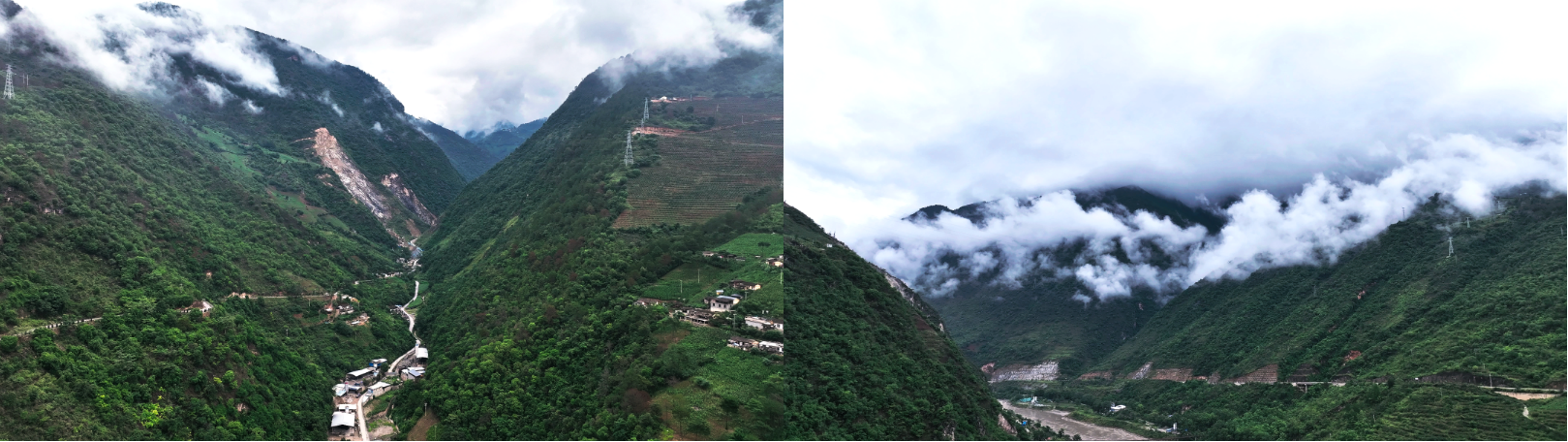
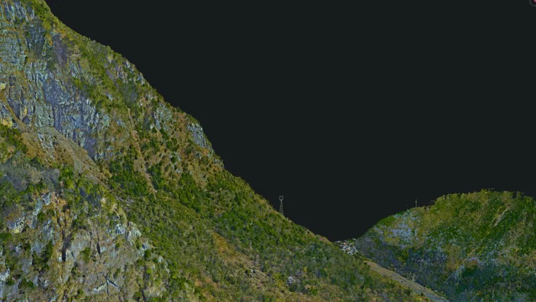
The Nujiang River, originating from the Tibetan Plateau, cascades down creating a breathtaking spectacle as it joins the Jinsha and Lancang rivers, contributing to the unique "Three Parallel Rivers" landscape. This natural marvel is framed by the towering peaks of the Biluo Snow Mountain and the Gaoligong Mountains, defining the rugged terrain of the Nujiang Lisu Autonomous Prefecture. The area's complex geography not only offers a visual feast but also presents a formidable challenge for mapping and surveying tasks.
2. Challenge: Mapping in a High-Altitude Terrain
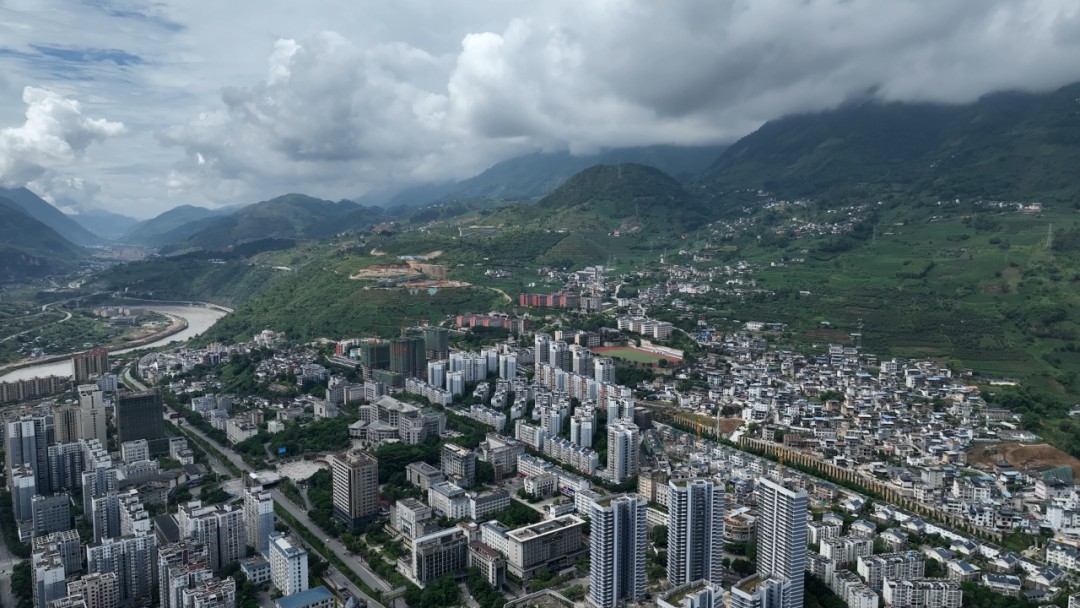
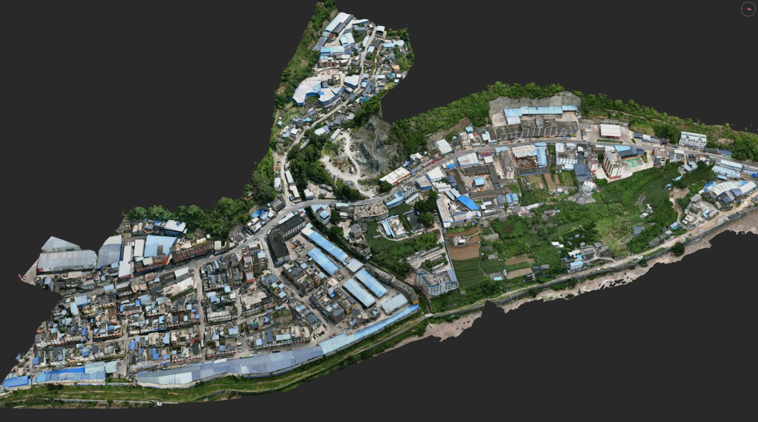
The project, led by the Chengfeng team, aimed to map a 15 square kilometer area with an elevation difference of up to 800 meters, achieving an average resolution of 1.5 cm across the region and reconstructing a realistic 3D model.
Traditional surveying methods were impractical due to the high-altitude, steep terrain, and variable climate. The need for high-precision data collection, while ensuring safety, posed a significant challenge, demanding extraordinary technical capabilities and equipment resilient against complex terrain and adverse weather conditions.
3. Solution: Innovative Approach and Cutting-Edge Technology
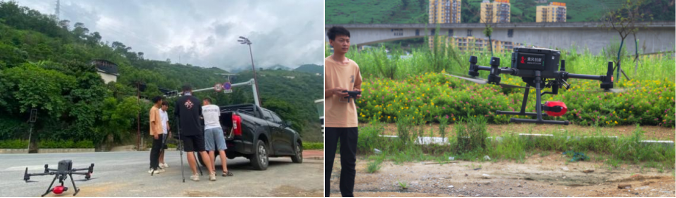
To overcome these challenges, the project team adopted the PSDK 102S V3 equipped with the DJI M300 RTK drone for three-dimensional data collection.

This approach allowed for detailed mapping of the terrain, navigating through a complex environment characterized by high fluctuations in elevation, low-lying clouds and fog, and diagonally strung high-voltage lines across mountains. It effectively overcame the large-scale limitations of conventional aerial survey methods.
By dividing the area into smaller zones based on elevation and conducting two-tiered flight paths twice, the team ensured safety and achieved high overlap and clarity, even in lower altitudes.
The use of PSDK 102S V3 camera's self-developed three-axis gimbal increased flight speed in for individual flight task. The gimbal stabilizes the camera against wind and throughout extensive maneuvers, resulting in sharp images with accurate posture details. Such quality facilitates aerial triangulation processing and allowing for seamless operations and significantly improving work efficiency in a single effort.
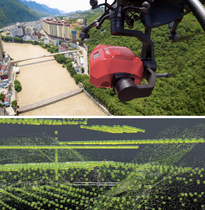
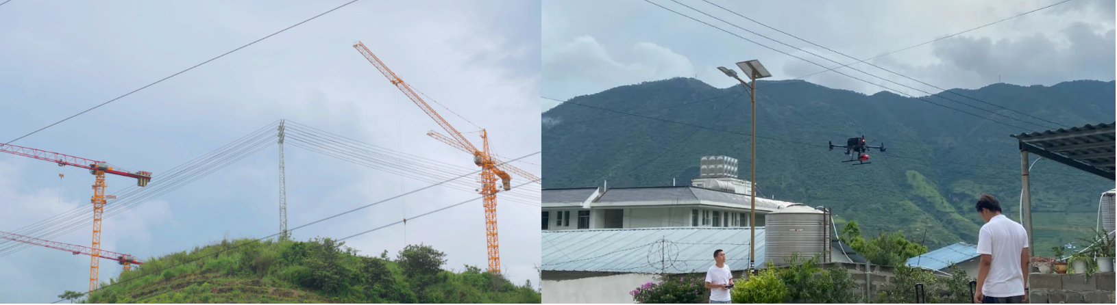
The camera’s real-time offset algorithm techniques were used to avoid clouds and high-voltage lines while capturing high-resolution imaging of steep mountain faces. This includes adjusting camera angles to directly face and fully cover the mountainsides and combining lateral flight paths with variations in altitude for optimal coverage.
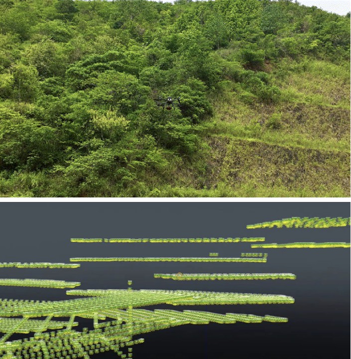
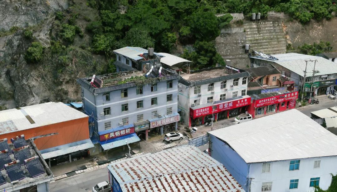
In addition to mountainous terrains, these special techniques were also utilized in densely populated urban areas featuring high-rise buildings to meet project specifications and substantially improve the quality of models in confined spaces.
4. Results: High Precision Data Collection and 3D Reconstruction
Despite unpredictable weather conditions, the team capitalized on every opportunity to launch their drones, significantly reducing indoor workloads through the camera's automated adjustments for light sensitivity and white balance.

This optimized streamlined the data collection process, eliminating irrelevant information and reducing image file sizes by 40% without compromising clarity, thereby facilitating faster rendering and verification processes.
The reduction in data storage requirements not only eased the pressure on indoor rendering tasks but also enabled the team to perform aerial triangulation checks directly in the field.
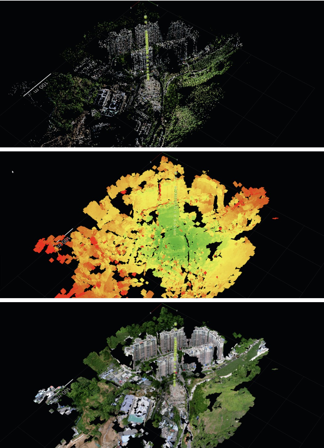
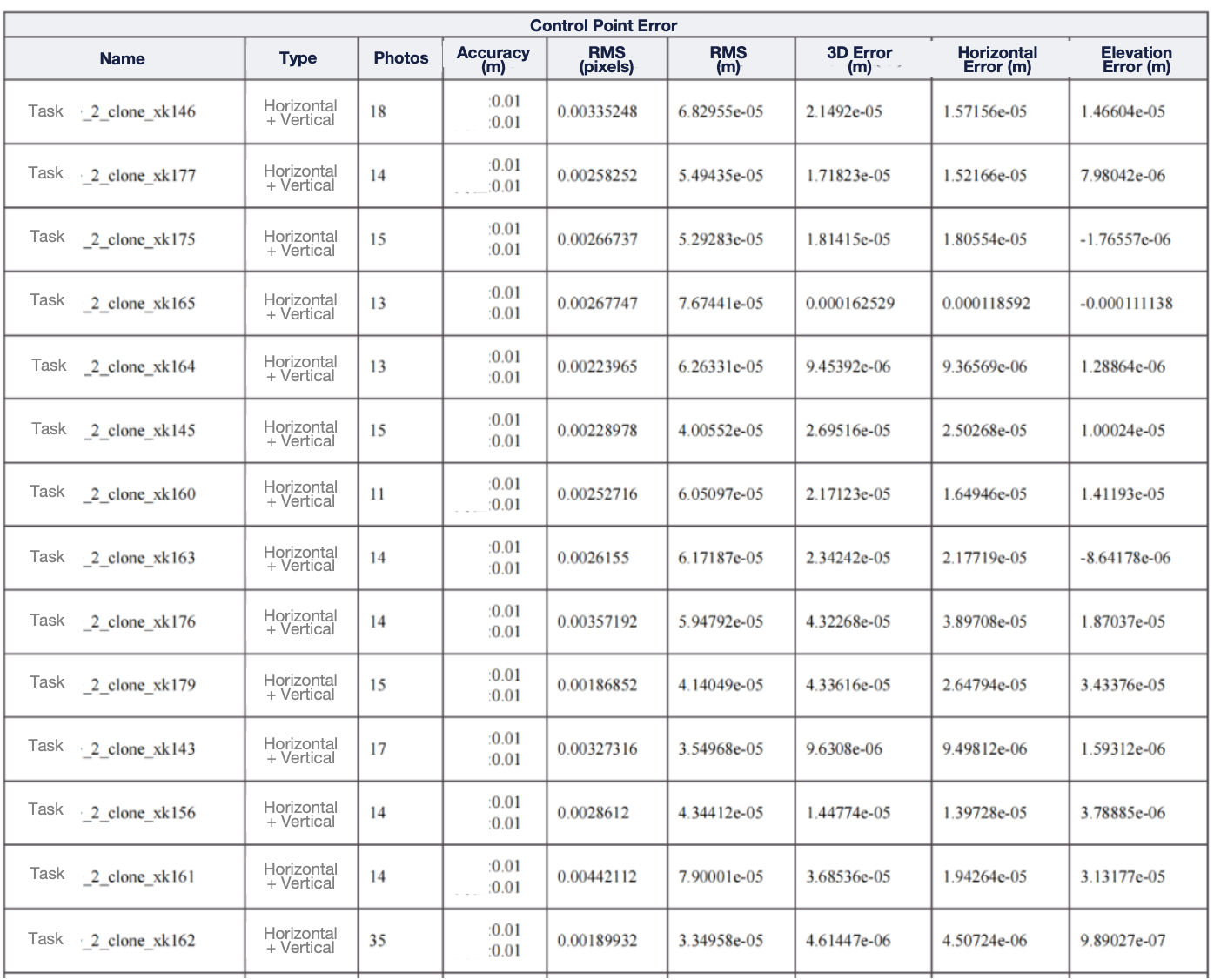
In just eight days, the team completed 300 flights, capturing 410,000 photographs, and successfully reconstructed a 15 square kilometer area with an elevation difference of 800 meters in Context Capture with absolute precision of less than 2cm. This project not only demonstrated the feasibility of high-precision mapping in challenging terrains but also set a new benchmark for surveying efficiency and data quality.
5. Conclusion: Breaking New Ground in Digital Mapping
The Nujiang project is a testament to the power of innovation and technology in overcoming environmental barriers. By transitioning from traditional manual survey methods to advanced drone mapping techniques, the team has significantly enhanced the productivity of the surveying industry. This project not only contributes valuable 3D data for the Nujiang region but also offers new insights and methodologies for mapping complex terrains, paving the way for the development of high-quality digital assets in similar challenging environments.

Do you have questions about this case study?
Get in touch with SHAREUAV Ltd., and they would be happy to answer any questions you have about pricing, suitability, availability, specs, etc.


![Do-Giant-Tortoises-Make-Good-Neighbors-1[1].jpg](https://cdn.geo-matching.com/vRMO2Edp.jpg?w=320&s=a6108b2726133ff723670b57bc54c812)


