
Revolutionizing Geological Exploration and Surveying with SHARE 100M PRO

Introduction
Geological surveying involves investigating and researching geological conditions such as rocks, stratigraphy, minerals, groundwater, and landforms. Traditional geological exploration requires geologists to physically visit the site to measure various fundamental geological parameters. However, the complexity and diversity of geological features often lead to extended project durations and high manual costs.
Solutions
Utilizing drone photogrammetry and collecting visible light image data, which, after further processing, generates a 3D model of the mining area with geographic coordinates. This model provides crucial data for resource exploration, preliminary reserve estimation, blasting, transportation, ore mixing, and other related activities.
Survey Area Overview
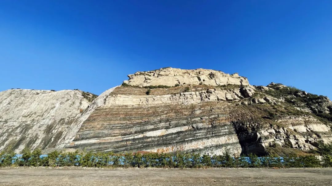
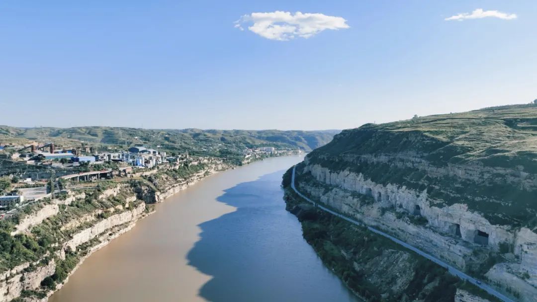
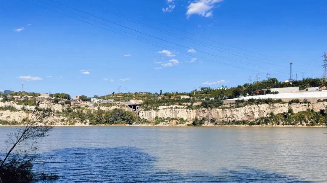
The project is located within the Shanxi section of the Yellow River Basin, characterized predominantly by loess plateaus. The project areas are scattered along the Yellow River, with some positioned on cliff faces adjacent to the river. These cliffs are topped by national highways with heavy traffic, creating a complex survey environment and increasing operational difficulty.

Field Operations
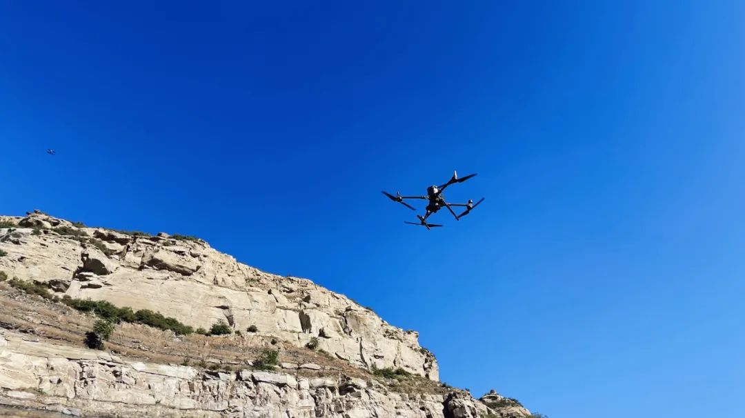
We used the DJI M300 drone equipped with the SHARE 100M PRO 102MP medium-format aerial camera. This combination introduces drone aerial photogrammetry into geological surveying, allowing comprehensive, multi-angle data collection of the target areas.

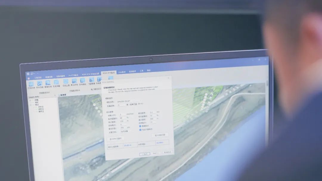
1) Initial data collection and close-range flight route planning:
The SHARE 100M PRO camera was used for circular flights to capture basic cliff data. This data was then used to plan detailed photogrammetry flight routes, with the 100M PRO camera (fitted with a 50mm lens) capturing data at a distance of 35 meters and achieving a resolution of 2.5mm.

2) Efficient imaging
To ensure consistent coloration across the cliff face, the operation was conducted when the sunlight was directly illuminating the cliff. The medium-format camera’s efficiency allowed for the collection of 327 photos in just 20 minutes. The captured images were vibrant, evenly colored, and free of significant shadows, indicating excellent image quality.

Data Processing
The aerotriangulation took 3 minutes, and the 3D reconstruction of the 19,378 sqm cliff face at 2.5mm resolution was completed in 2 hours and 43 minutes in DJI Terra.

Pre-set ground control points (GCPs) on the cliff face were clearly visible in both the raw images and the model. Accuracy validation showed a 3D mean error of approximately 2mm, meeting surveying-grade requirements.
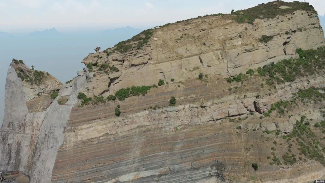

The generated 3D model provides fundamental geological parameters such as structure, dip, and elevation directly from the model.
Solution Advantages
The combination of DJI Matrice 300 and SHARE 100M PRO provides a high-resolution 3D data acquisition solution capable of millimeter-level accuracy.
With medium-format sensor the SHARE 100M PRO is more efficient, saving field operation time. Additionally, its high-definition real-time image transmission significantly reduces operational risks in complex cliff environments. The images can be processed through software databases to determine lithology and stratify rock layers directly.
Solution Significance
This approach aids geologists in preliminary exploration and rock layer composition analysis, providing a fundamental reference for comprehensive evaluations of surrounding geological terrains and regional development planning. It reduces the cost of field surveys and significantly enhances the efficiency of geological surveys.

During the exploration, combining geological drilling data enables real-time updates of 3D structural data, including borehole deviation, sample analysis, lithology, and coordinates, establishing an intelligent, digital geological resource database.
In the resource extraction phase, this precise database supports critical tasks such as construction reference, real-time excavation analysis, and safety factor simulations, ensuring smooth data flow across all processes and enabling comprehensive coverage of exploration, extraction, and maintenance in an intelligent approach.
Do you have questions about this case study?
Get in touch with SHAREUAV Ltd., and they would be happy to answer any questions you have about pricing, suitability, availability, specs, etc.


![Do-Giant-Tortoises-Make-Good-Neighbors-1[1].jpg](https://cdn.geo-matching.com/vRMO2Edp.jpg?w=320&s=a6108b2726133ff723670b57bc54c812)


