
What Is Ground Sample Distance, How Is It Calculated, and How Will It Affect Your Drone Data?
If you use an aerial drone to survey land, you need to know about ground sample distance or GSD for short. Calculating GSD is essential to determining the scale of your mapping project and ensuring reliable results. Without it, you run the risk of collecting inaccurate data or having a map that isn’t useful. Whether you’re hired to determine the exact boundaries of a piece of land, to map the flow of a river, or to create a 3-D model of new development, GSD is a metric you simply can’t do without.
What is ground sample distance?
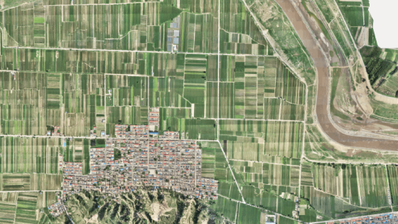
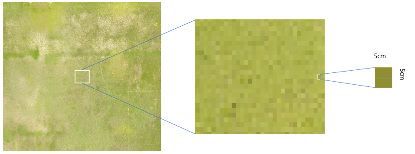
Drone maps, like any digital image, are essentially combinations of small squares of a single colour, called samples. In this case, a sample is equivalent to a single pixel. The GSD describes the distance between the centre point of two consecutive pixels. GSD is an important calculation for both aerial photography and photogrammetry, which is a commonly used technique for creating 3D topographic maps.
Understanding the size of each pixel is necessary to grasp the full scale of your map and make decisions based on clear information. Getting GSD right is paramount. An error of a centimetre or less may seem minor. However, if the mistake is extrapolated over hundreds of thousands of pixels, it will create a serious mismatch between your map and reality, making measurements near impossible. To play it safe, land surveyors always use the lowest possible value when calculating GSD.
What is GSD used for?
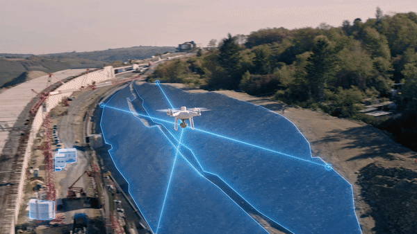
GSD is a factor for anyone who uses aerial surveying to create accurate maps and models. Of course, surveyors work in a variety of industries, and their work is indispensable to many people. In virtually any sector where surveyors rely on accurate measurements, GSD is an important calculation.
Areas where GSD matters:
- Construction: drones are used to survey entire construction sites at a reduced price, as well as determine the dimensions of various elements of a project.
- Cartography: It’s of no surprise that mapmakers have quickly adopted drone mapping technology.
- Mining: Drones are used to effectively and safely survey open-pit mines and quarries in ways humans can’t. They are also useful for measuring stockpile volumes.
- Firefighting: Drones are being implemented in the fight against forest fires, such as for prescribed burns.
- Architecture: Similar to construction, architects use drone mapping to build accurate 3-D models and plan for all of the ins and outs of a worksite.
- Land boundaries: Aerial mapping can be used to determine land ownership and settle disputes.
While all of these surveying jobs require an accurate GSD calculation, the specifics of the task will impact the type of drone you use.
What GSD accuracy level do you need?
Somewhat inversely, pixels with a higher GSD will be less accurate, as that means a single pixel represents a larger amount of land. The level of GSD accuracy necessary depends on the kind of job you’re doing and what kinds of details you need. As a general rule of thumb, projects with a larger scale will allow a higher GSD, while projects with smaller details will require a lower GSD.
If, for example, you’re working on a construction project and need to know the distance between two beams, you would need a GSD that is small enough to be able to identify the size of each and place them. However, if you’re trying to mark property lines on a very large piece of land, you’ll probably want to fly higher.
Ultimately, the right GSD will be the one that allows you to take detailed images while still flying high enough to avoid an excessive photo count. Too high a GSD, and you’ll be left with blurry images that don’t tell you anything. Go too low, and your survey will take up extra GB and possibly take longer than expected to complete, even with advanced software like DJI Terra, which is optimized to process your data and transform it into 3D models and usable maps.
How to calculate GSD
Calculating ground sample distance requires only a few data points and is completed either by hand or with a calculator tool. To calculate GSD by yourself, you’ll need to know the sensor height and width, and image height and width on your drone, as well as both the focal length and flight height. Each of these stats should be available on your drone. You can then plug each number into two basic formulas, one for the GSD height and one for the GSD width.
- GSDh= flight height x sensor height / focal length x image height;
- GSDw= flight height x sensor width / focal length x image width
The relevant GSD number will be whichever value is the lowest, to ensure you’re using the worst-case scenario.
Alternatively, if math isn’t your strong suit, you can use an online calculator tool. These tools will have the technical specifications of a drone model, such as the image, sensor length and height, already on record; meaning all you have to do is select your drone and enter the flight height.
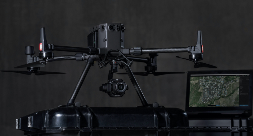
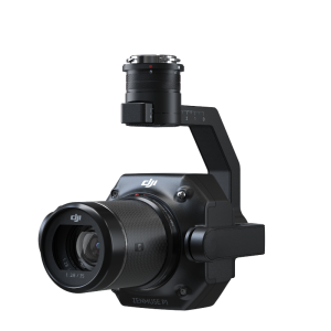
Unbeatable accuracy with the Matrice 300 RTK
Need a drone that makes next-generation mapping possible? The Matrice 300 RTK was designed with surveyors in mind and contains all of the features you’re looking for. This drone can measure accurately to the centimetre and is tough enough for any job. Combine this with the Zenmuse P1 camera and intuitive drone mapping software like DJI Terra, and the knowledge of how to use GSD calculations to maximize results, and you’re ready to take care of any aerial surveying job.
Do you have questions about this case study?
Get in touch with DJI ENTERPRISE, and they would be happy to answer any questions you have about pricing, suitability, availability, specs, etc.


![Do-Giant-Tortoises-Make-Good-Neighbors-1[1].jpg](https://cdn.geo-matching.com/vRMO2Edp.jpg?w=320&s=a6108b2726133ff723670b57bc54c812)


