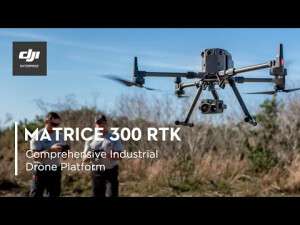
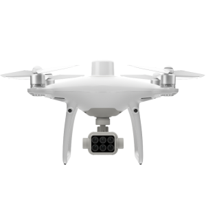
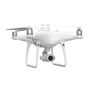
Matrice 300 RTK
A New Standard for the Commercial Drone Industry - Built Tough. Works Smart.
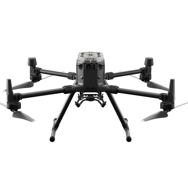
The Matrice 300 RTK is DJI’s latest commercial drone platform that takes inspiration from modern aviation systems. Offering up to 55 minutes of flight time, advanced AI capabilities, 6 Directional Sensing & Positioning and more, the M300 RTK sets a whole new standard by combining intelligence with high-performance and unrivalled reliability.

DJI ENTERPRISE
Shenzhen, CN
Description
DJI AirWorks
Through the annual AirWorks conference, DJI drives the commercial drone industry forward as AirWorks is a hub for innovation and growth, enabling participants in this ecosystem to exchange ideas, gain more control of drone technology, and steer the future development of the industry.
Join hundreds of commercial drone professionals and technology experts at the in-person DJI AirWorks conference in Las Vegas from October 10-12, where you can be a part of the leading discussion on the future of drone technology, share your growth stories, and exemplify the impact of drone technology on your business.

- 15 km Max Transmission1
- 55-min Max Flight Time2
- 6 Directional Sensing & Positioning
- Primary Flight Display
- IP45 Rating
- -20°C to 50°C Operating Temperature
- Hot-swappable Battery
- UAV Health Management System
Superior Performance
Improved Transmission System
The all-new OcuSync Enterprise enables transmission up to 15 km away and supports triple-channel3 1080p video. Real-time auto-switching between 2.4 GHz and 5.8 GHz4 enables more reliable flight near high-interference environments, while AES-256 encryption offers secure data transmission.
- 15km - Transmission Range
- 1080p - Triple-channel Video
- 2.4 /5.8GHz - Real-time Auto-switching
Enhanced Flight Performance
The refined airframe and propulsion system design gives you a more efficient and stable flight, even in harsh conditions.
- 55-min Max Flight Time
- 7 m/s Max Descend Speed5
- 7000 m Service Ceiling6
- 15 m/s Wind Resistance
- 23 m/s Max Speed
Multiple Payload Configurations
Configure your M300 RTK to fit your mission needs. Mount up to 3 payloads simultaneously, with a maximum payload capacity of 2.7 kg.
- Single Downward Gimbal
- Single Upward Gimbal x Single Downward Gimbal
- Single Upward Gimbal x Dual Downward Gimbals
Advanced Intelligence
Smart Inspection Live Mission Recording
Record mission actions such as aircraft movement, gimbal orientation, photo shooting, and zoom level to create sample mission files for future automated inspections.
AI Spot-Check7
Automate routine inspections and capture consistent results every time. Onboard AI recognizes the subject of interest and identifies it in subsequent automated missions to ensure consistent framing.
Waypoints 2.0
Create up to 65,535 waypoints and set multiple actions for one or more payloads, including 3rd party ones, at each waypoint. Flightpath planning is also optimized to maximize flexibility and efficiency for your missions.
Smart Pin & Track8
PinPoint
Mark an object in camera or map view with a quick tap, and advanced sensor fusion algorithms will immediately calculate its coordinates, which are projected to all camera views as an AR icon. The location of the subject is automatically shared with another remote controller, or to online platforms such as DJI FlightHub9.
Smart Track
Identify and follow moving subjects like people, vehicles, and boats with the Smart Track function, where auto-zoom is applied for steady tracking and viewing. The subject’s dynamic location is continuously acquired and shared to another remote controller or to DJI FlightHub9.
Aviation-Grade Situational Awareness
The M300 RTK adopts a new Primary Flight Display (PFD) that integrates flight, navigation, and obstacle information to empower the pilot with exceptional situational awareness.
Flight Information
Flight information such as aircraft attitude, altitude, and velocity, as well as wind speed and wind direction, are all intuitively presented.
Navigation Display
Pilots can also view the live status of the aircraft’s heading, trajectory, PinPoint information, and home point projection, in a more efficient way. Visualize all nearby obstacles at once with the new obstacle map, so you can be fully informed.
Advanced Dual Control
Either operator can now obtain control of the aircraft or payload with a single tap. This creates new possibilities for mission strategies as well as higher flexibility during operations.
Safety and Reliability
A Powerful Vision System You Can Rely On
To enhance in-flight safety and aircraft stability, dual-vision and ToF sensors appear on all six sides of the aircraft, offering a maximum detection range of up to 40 m, with options to customize the aircraft’s sensing behavior via the DJI Pilot App. Even in complex operating environments, this 6 Directional Sensing and Positioning system helps keep the aircraft and the mission safe.
Professional Maintenance for Your Drone Fleet
The new integrated Health Management System displays the current status of all systems, notification logs, and a preliminary troubleshooting guide. Also in the system are the aircraft’s flight logs, duration, and mileage throughout its entire lifecycle, and tips on aircraft care and maintenance.
Redundancy Systems for Safer Flights
The M300 RTK’s built-in advanced redundancy systems help keep your critical missions going even in unexpected scenarios.
More Adaptable Than Ever Before
- IP45
- Self-Heating Battery
- -20°C to 50°C
- Anti-Collision Beacon
- AirSense ADS-B Receiver
Accessories
Battery Station
The battery station manages up to 8 flight batteries and 4 remote controller batteries, while fast charging allows you to conduct your missions without running out of power.
TB60 Intelligent Flight Battery
The high-capacity, hot-swappable TB60 Intelligent Flight Battery lets operators change batteries without powering off, saving time during critical missions.
DJI Smart Controller Enterprise
The DJI Smart Controller Enterprise comes with an ultra-bright 5.5-inch 1080p display that maintains clear visibility even in direct sunlight.
- Twice as bright as conventional smart devices at 1000 cd/m2
- Supports DJI Pilot and 3rd party app
- HDMI port
- -20℃ to 40℃ operating temperature
- Advanced Dual Operator Mode
- microSD card slot
D-RTK 2 Mobile Station10
Gain improved relative accuracy with centimeter-level precision positioning data using the D-RTK 2 High Precision GNSS Mobile Station, which supports all major global satellite navigation systems and provides real-time differential corrections.
CSM Radar11
For an added safety measure, a Circular Scanning Millimeter-Wave (CSM) Radar with a detection range between 1 to 30 m can be mounted on top of the aircraft.
Compatible Payloads
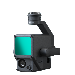
Zenmuse L1
An integrated Lidar + survey-grade RBG solution for true-color point clouds
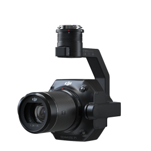
Zenmuse P1
A 45MP full-frame sensor with 3 lens options for photogrammetry flight missions
Purpose-built Applications
DJI Pilot
DJI Pilot is developed specifically for enterprise users to unleash the power of their DJI drones. With development made specifically for the M300 RTK, DJI Pilot optimizes your flight capability for peak performance.
Applications
Geomatics
Digitize surveying workflows and improve efficiency in data collection and analysis.
Firefighting
Fight fires and save lives without endangering personnel.
Search & Rescue
Act quickly to locate missing people and better plan rescue missions.
Law Enforcement
Quickly assess a situation and plan accordingly while improving officer and bystander safety
Powerline Inspection
Easily visualize extensive power line networks in remote areas.
Oil & Gas
Conduct inspections of pipelines, well sites, and more while keeping workers away from risky areas.
Footnote
1. Unobstructed, free of interference, when FCC compliant. The maximum flight range specification is a proxy for radio link strength and resilience. Always fly your drone within a visual line of sight unless otherwise permitted.
2. Actual flight time may vary because of the environment and payload configurations.
3. Each RC supports two streams. Triple-stream channelling is only supported with dual RC.
4. Due to local policies, some countries do not support 5.8 GHz transmission.
5. Achieved forwarding Flights using S Mode.
6. The service ceiling of 7000 m is achievable with high-altitude propellers.
7. This feature is only supported when the aircraft is paired with the Zenmuse H20 Series payloads.
8. This feature is only supported when the aircraft is paired with the Zenmuse H20 Series payloads.
9. Support for location sharing via DJI FlightHub is coming soon.
10. D-RTK 2 Mobile Station for Matrice 200 Series V2 and Phantom 4 RTK can be upgraded to support Matrice 300 RTK.
11. The CSM Radar will be available soon.
Do you have questions about this product?
- Questions about price, availability, and/or retailers
- Questions about technical specifications and usage
- Questions about suitability for your project or application
Specifications
-
Environment
-
Min. operation temperature [°C]
-20
Max. operation temperature [°C]
50
Max. wind speed [m/sec]
15
-
Battery and Power
-
capacity
5935 mAh
energy
274 Wh
Battery type
LiPo 12S
operating temperature
-4°F to 122°F (-20°C to 50°C)
charging time
Using BS60 Intelligent Battery Station: 220V input: 60 minutes (fully charging two TB60 batteries), 30 minutes (charging two TB60 batteries from 20% to 90%); 110V input: 70 minutes (fully charging two TB60 batteries), 40 minutes (charging two TB60 batteries from 20% to 90%)
-
Imaging/scanning devices
-
Onboard imaging/scanning devices
-
Platform
-
Brand
DJI
Max. payload [kg]
2.7
Max. stay in the air [min]
55
Max. speed [km/h]
1.38
Max. height above sea level [m]
7000
Maximum rate of ascent
S mode: 6 m/s; P mode:5 m/s
Maxirum rate of descent
S mode: 5 m/s; P mode:4 m/s
Weight (with cooling fan)
Approx. 3.6 kg (without batteries); Approx. 6.3 kg (with two TB60 batteries)
-
Operation Characteristics and Safety
-
Automatic launch and landing
Y
Autonomous emergency landing
Y
Collision avoidance systems (CAS)
Y
-
Dimensions
-
Height [cm]
43
Width [cm]
67
Length [cm]
81
Weight of battery [kg]
1.35
Number of rotors
4
-
Navigation Sensors
-
Type of GNSS receiver and captured signals
GPS+GLONASS+BeiDou+Galileo
Correction services [PPK, RTK]
RTK
Positioning Accuracy
When RTK enabled and fixed: 1 cm+1 ppm (Horizontal) 1.5 cm + 1 ppm (Vertical)
-
General
-
Product Name
Matrice 300 RTK
-
Included software and automatically generated
-
Type of software included
Flight planning
Automatically Generated Products
Flight planning software
DJI Pilot
Photogrammetric software
DJI TERRA
Point cloud processing software
DJI TERRA
Documents
Brochure
m300-rtk-brochure-en-digital.pdf
7.9 MB
Videos


