DJI TERRA
Make the World Your Digital Asset
Capture, analyse and visualize your environment with DJI Terra, an easy to use mapping software developed to help industry professionals transform real-world scenarios into digital assets. Create efficient flight paths using predefined waypoint actions and adjustable parameters like altitude, speed, gimbal pitch angle, aircraft heading and more. For more complex and tight missions that require high attention to detail, use 3D Flight Visualization to design and simulate tasks on existing 3D model

DJI ENTERPRISE
Shenzhen, CN
Description
Mission Type
Waypoints Mission Planning
Create efficient flight paths using predefined waypoint actions and adjustable parameters like altitude, speed, gimbal pitch angle, aircraft heading and more. For more complex and tight missions that require high attention to detail, use 3D Flight Visualization to design and simulate tasks on existing 3D models.
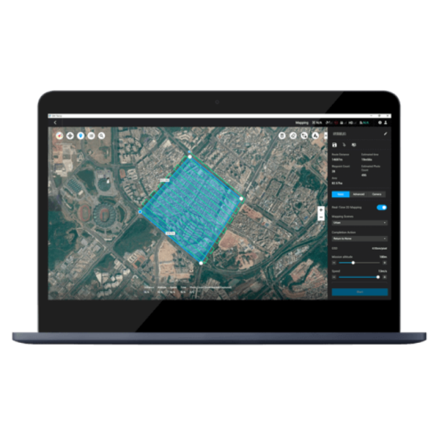
Area Mission Planning
With just a few taps on the screen, you can automate complex missions, allowing you to seamlessly capture imagery which can be processed to produce a variety of maps and models for further analysis, and to aid decision-making.
Oblique Mission Planning
When accuracy is essential and details are vital to your critical operations, Oblique lets you capture a rich 3D model data set by adjusting the angle of the camera at a tilted angle, giving you an extra crisp view of the asset.
Corridor Mission Planning
Create automated flight missions around roads and railways by simply drawing a line on the map. Adjust mission settings to change the total area mapped, giving you the flexibility to choose between creating high-definition 2D maps and 3D models or quick overviews.
Seamless Workflows, Accurate Results
Unparalleled efficiency and user experience
Import images with ease while navigating the intuitively designed interface effortlessly.
Bulk process up to 400 images/1 GB of RAM *, minimizing the wait time between field work and digital visualization.
*The processing capacity of 400 images/1 GB of RAM is estimated using the size of images captured using the Phantom 4 RTK. This is the equivalent of processing 8 gigapixels of data/1 GB of RAM.
Meet and exceed your project standards
Generate highly detailed 2D orthomosaics and 3D models with enhanced absolute accuracy by setting Ground Control Points (GCPs) and checkpoints, so you can measure and inspect with ease.
View a quality report of your mission to ensure the results meet your accuracy standards.
Compatibility and flexibility
Convert the coordinates of your maps and models into 8500+ major coordinate systems by simply selecting the output that fits your needs.
Incorporate POS data, GCPs, or both sets of data to create georeferenced maps and models with enhanced accuracy directly in the target coordinate system required by the project.
Mapping
2D Maps
Real-time Mapping
Quickly generate a 2D orthomosaic of the selected area in real-time. Not only is this ideal for creating detailed flight paths in remote areas but it’s also useful for time-sensitive missions that require quick decision-making on site.
2D Reconstruction
Generate high resolution orthomosaics, enabling you to get detailed and accurate measurement results for all your critical projects.
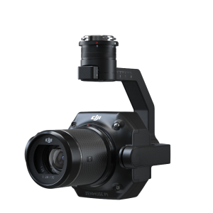
2D Multispectral Reconstruction
Process multispectral images to generate vegetation index maps including NDVI and NDRE. Create prescription maps for variable rate application using DJI’s Agras drones to improve crop yields while driving down costs.
*Aircraft supported: P4 Multispectral
Multispectral Imaging Bands supported:
Blue (B): 450 nm ± 16 nm, green (G): 560 nm ± 16 nm, red (R): 650 nm ± 16 nm,
red edge (RE): 730 nm ± 16 nm, near-infrared (NIR): 840 nm ± 26 nm
Vegetation indices supported: NDVI, GNDVI, NDRE, LCI, OSAVI.
3D Models
Real-time 3D Point Cloud2
When efficiency is key, quickly render and visualize a 3D point cloud of the mapped area. Make decisions based on the preliminary model and check for completeness immediately or plan 3D flights on-site.
2. Feature only available when using the Phantom 4 RTK (Remote Controller), Phantom 4 Pro + V2.0 or Phantom 4 Pro V2.0.
3D Reconstruction
Get sharp and realistic representations of your surroundings throughout various industrial applications, be it accident reconstruction, recreating thin power lines and complex vertical structures, managing major construction projects and more. The CUDA-based reconstruction algorithms are capable of quickly processing large amounts of data to deliver quality results.
Data Analysis
2D & 3D Measurements
Acquire key dimensions across an array of terrains with easy-to-use analysis tools that enable you to obtain a variety of measurement data based on linear, area and volumetric measurements.
Annotation
Edit labels of measurements on existing models, which can be used for reporting and improving communication throughout ongoing projects.
Photo Inspection
Closely inspect every photo of the model so you can pinpoint and highlight any critical elements in the real world.
Seamless Connection with Your Fleet of DJI Drones
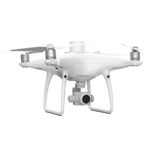
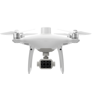
DJI Terra is compatible with the following Phantom 4 Series drones:
Phantom 4 RTK (Remote Controller)
Phantom 4 Pro V2.0
Phantom 4 Pro + V2.0
Phantom 4 Pro
Phantom 4 Advanced and Phantom 4
The Beginning of Next Generation Mapping Solutions
Harness the power of AI-driven mapping solutions designed to take your industrial projects to the next level. Whether it’s object classification, site inspections and more, you can start developing task-specific mapping solutions to seamlessly carry out missions.
1. Data acquisition
Define mission objective, plan desired flight plan, and with a tap of a few buttons, autonomously collect critical data so you can achieve the required outcome.
2. Data Processing
Utilize refined image recognition technology to generate 2D and 3D data, resulting in a more realistic representation of your assets, objects, surroundings and more.
3. Data Application
Implement tools and machine learning techniques, which can be used across a variety of different industries – like classification algorithms for identifying trees, objects, and other scenarios.
4. Execution
Take the required action, and enjoy more efficient processes with machine control – be it automated crop spraying, monitoring work sites, transporting materials and more.
Do you have questions about this product?
- Questions about price, availability, and/or retailers
- Questions about technical specifications and usage
- Questions about suitability for your project or application
Specifications
-
Required Computer System
-
System includes hardware
N
Operating system(s)
Windows 7 or above (64 bits) system
Min. RAM memory [Mb]
16384
Preferred RAM memory [Mb]
65536
Min. graphic card
NVIDIA graphics card with at least 4GB VRAM (must have a compute capability of 3.0 or above)
Hardware handling of big data sets
NVIDIA 1050 Ti
CPU (min.)
Any CPU (Intel i5/ i7/ Xeon recommended)
CPU (preferred)
Intel i7/Xeon CPU quad-core /hexacore or above
64-bit version of software available
Y
GPU based calculations
Y
Supported special hardware
DJI P4 Series
-
Images and data
-
Oblique Images
Y
UAS Images
Y
Input image formats
JPEG
Export data formats
GeoTiff, LAS,I3S,OSGB, B3DM, S3MB,ply,obj,pnts,xml
Scanned analogue Aerial Photos
Y
Digital Aerial Nadir Frames
Y
Linear array sensors
N
-
DEMs & Orthoimages
-
True orthoimage generation
Y
Automatic matching
Dense matching, 3D points computed up to every pixel of each original image
Mosaicing of orthoimages
Y
Dense DSM creating capability
Y
DSM to DTM filtering
N
Dense Image Matching
Y
-
General
-
Year of introduction
2019
Year of last update
2020
-
Orientation and triangulation
-
Automatic aerotriangulation
Y
Automatic interior
Y
Automated blunder detection
Y
Self calibration
Y
images simultaneously processed
Y
-
Measurement tools
-
Length
Y
Area
Y
Volume
Y
Documents
Brochure
terra-v2-1-brochure-a5-digital-en.pdf
1.01 MB


