Empowering Data Collection: GIS Applications and Smartphones Revolutionize Spatial Insights
A Geographic Information System (GIS) is an environment for collecting, managing, and analyzing data. GIS applications for data collection in the field using smartphones analyze the spatial location and organize layers of information into visualizations using maps and 3D scenes.
With this unique capability, GIS reveals deeper insights into data, such as patterns, relationships, and situations, assisting users in making smarter decisions. Therefore, any spatial-related activity can benefit from working with GIS.
GIS applications for data collection can establish a connection with an external GNSS receiver and perform data capture using said receiver.
What GIS applications for data collection with smartphones exist in the market?
Some of the currently available applications are:
1. Qfield GNSS
This application can utilize internal GNSS (Global Navigation Satellite System) such as GPS, GLONASS, Galileo, or BeiDou. Qfield can also connect to external GNSS receivers via Bluetooth, TCP, or UDP NMEA streams.
2. SW Maps
SW Maps is a cartography and GIS application that allows us to edit, present, and capture data in the field. It also supports static recording for post-processing using kinematic or Internet connection.
3. Survey Master
Survey Master (SM) is a professional surveying software designed for Android operating systems and developed by ComNav Technology. Like the previous ones, it has the capability to connect to an external antenna, allowing it to capture data in real-time.
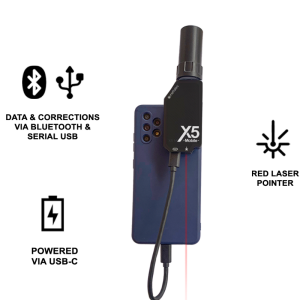
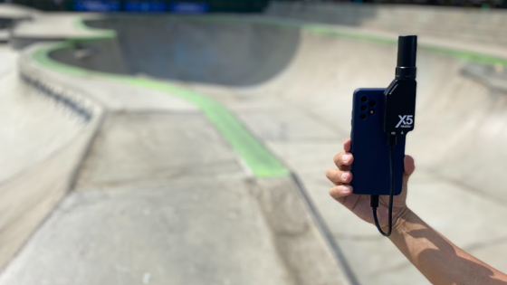
What is SW Maps, and how can we use it with the Metattec “X5 Mobile” Receiver?
SW Maps is an open-source cartography and GIS application for Android devices; it enables the collection, editing, sharing, and presentation of geographic information. Its ability to connect to a GNSS receiver via Bluetooth or Serial USB connection allows us to perform field data collection, capturing points, lines, or polygons with our Android device (phone, tablet, etc.).
It is suitable for various applications, including watershed management, forestry, environmental studies, and topography. In the application, we can view base maps from different categories and themes (Google Street View, Google Satellite, Google Hybrid, Google Terrain, or OpenStreetMap).
The collected information can be processed in any Geographic Information System software.
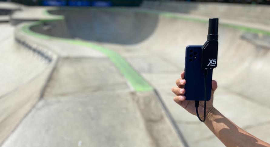
Recording Raw Data with X5 Mobile (PPK Method)
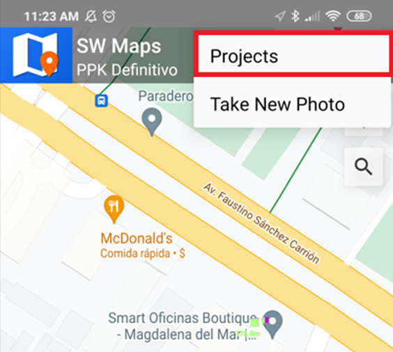
Upon opening SW Maps, it will prompt us to continue with an existing project or create a new one. When opening the application for the first time, the latter option will always be presented.
Once the application is open, we need to go to the option indicated in the image and then select the "u-blox RTK" option. It is essential to keep the "Log to file" option enabled (image 3) to record raw data.
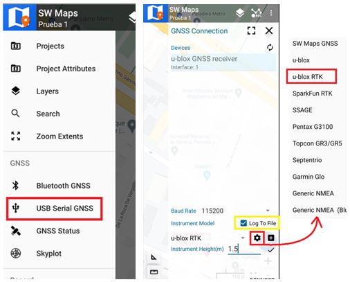
We input the measured height, press the "Connect" button, and verify a successful connection. From that moment, raw data recording will commence.
Data Collection:
• Open the "Layers" option.
• Proceed to create a point layer as indicated.
• Then, go to the indicated option to create the points layer.
• Select the blue button and choose "Record Using GPS."
• Position and level at the point to be taken, then press the small button indicated.
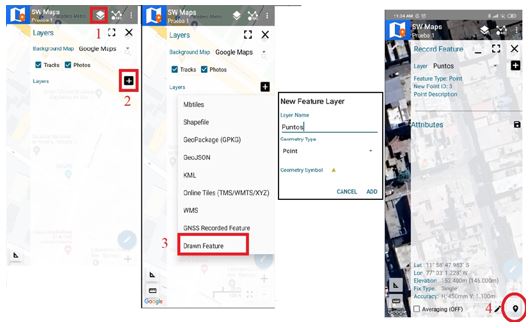
*Raw data will be stored in the SW_Maps/RawData/CaptureDate directory.
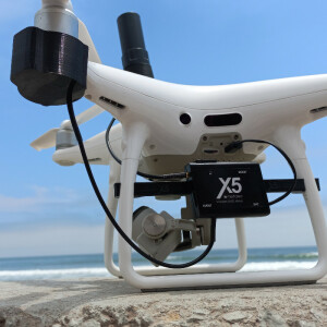
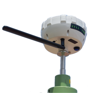
If you want to learn more about this innovative device and the compatible applications, we invite you to read more about our X5 Mobile at the following link, a high-precision GNSS receiver that works connected to an Android phone or tablet and offers two correction options: PPK and NTRIP.
Do you have questions about this case study?
Get in touch with METTATEC, and they would be happy to answer any questions you have about pricing, suitability, availability, specs, etc.


![Do-Giant-Tortoises-Make-Good-Neighbors-1[1].jpg](https://cdn.geo-matching.com/vRMO2Edp.jpg?w=320&s=a6108b2726133ff723670b57bc54c812)


