


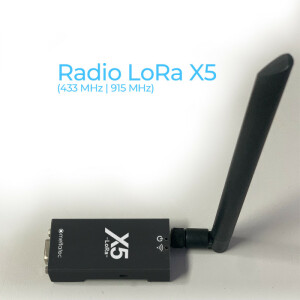
X5 PPK Module for DJI Phantom
Convert your Phantom 4 Pro v.1 / v.2 / Advance into a PPK system. Easy integration without the need to open or modify your Drone.
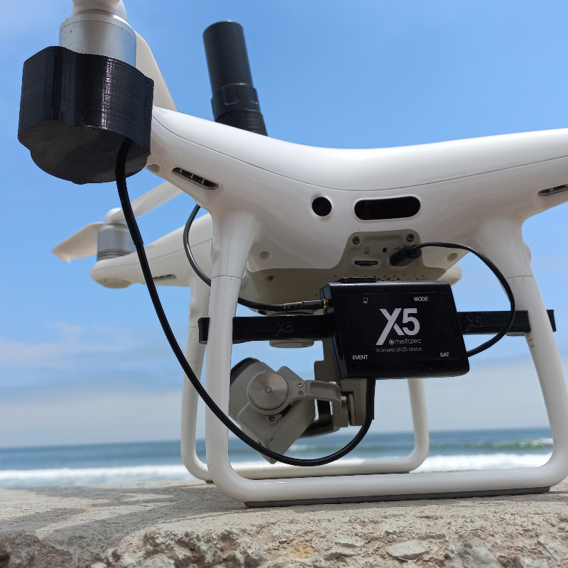
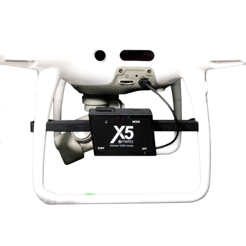
The X5 PPK Module for Phantom 4 Pro is a-non intrusive GNSS adapter system to connect to a DJI Phantom 4 Pro v.1/v.2 or Advance Drone. It contains its own high-quality GNSS Receiver module with state-of-the-art components,

METTATEC
San Borja, PE
Description
Main Advantages:
- Contains its own high quality GNSS Receiver module with state-of-the-art components
- No need to open or modify your Drone (keep your Drone’s original warranty)
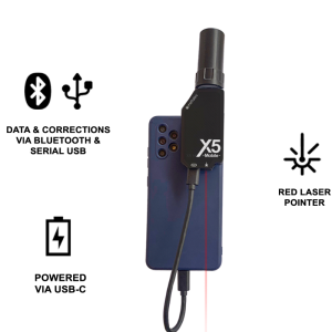
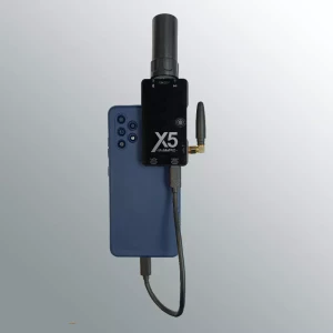
- The X5 PPK Module attaches and disattaches in seconds
- No Batteries required
- Ultra-fast image triggering detector sensor
- Lightweight microelectronics: 80 grams
Trigger Sensor
A sensor installed externally on the P4P drone detects the triggering of each photograph and records a time stamp in the log file of the MULTIBAND X5 GNSS module. Timestamps are extracted from the module after flight and combined with the in-flight imagery as centimeter-accurate position geotags (geotagging) using various specialized software options available on the market. The new X5 GNSS Module is a centimeter-accurate multiband GNSS system for UAV mapping.
The X5 GNSS receiver module is a multiband GNSS system, with centimetre precision for UAV mapping.
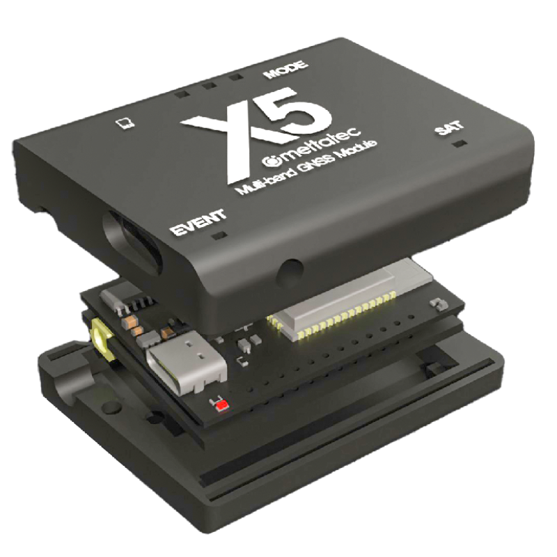
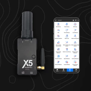
Module Components
- GNSS X5 Module unit with Micro-USB cable for power up (plug and play)
- Multi-band Aerial Antenna HeliX5 for UAV
- Antenna mount, connection cable and high resistance 3M synthetic velcro
- Photo Trigger Sensor attached to the module support
- 16Gb MicroSD memory card for recording GNSS data
Do you have questions about this product?
- Questions about price, availability, and/or retailers
- Questions about technical specifications and usage
- Questions about suitability for your project or application
Specifications
-
General
-
Type
Aerial
Height [m]
0.052
Depth [m]
0.037
Width [m]
0.013
Total Weight [kg]
0.050
-
Performance
-
No. channels
184
Tracked satellite signals
GPS/QZSS L1 C/A, L2 GLONASS L1OF, L2 BeiDou B1l, B2l Galileo E1-B/C, E5b
Reacqisition time [s]
2
-
Environment
-
Operating temperature: min. [°C]
40
Operating temperature: max. [°C]
85
-
Communication: general
-
Bluetooth
Y
-
Communication: links
-
Radio modems
Wi-Fi 2.4 GHz 802.11b/g/n
-
Power
-
Operating power: min. [V]
5
Operating power: max. [V]
5
Typical consumption [W]
2.5
Connectors
USB
Documents
Brochure
user-manual-gnss-x5-ppk-module-with-antenna-rev04.pdf
851.84 KB

Videos


