


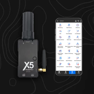
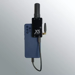
X5 Mobile NTRIP + PPK for Android & Windows devices
The X5Mobile is a high precision GNSS receiver that works connected to a cell phone or tablet with Android operating system.
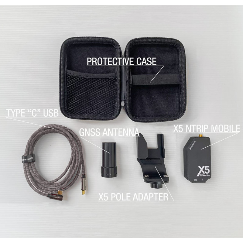
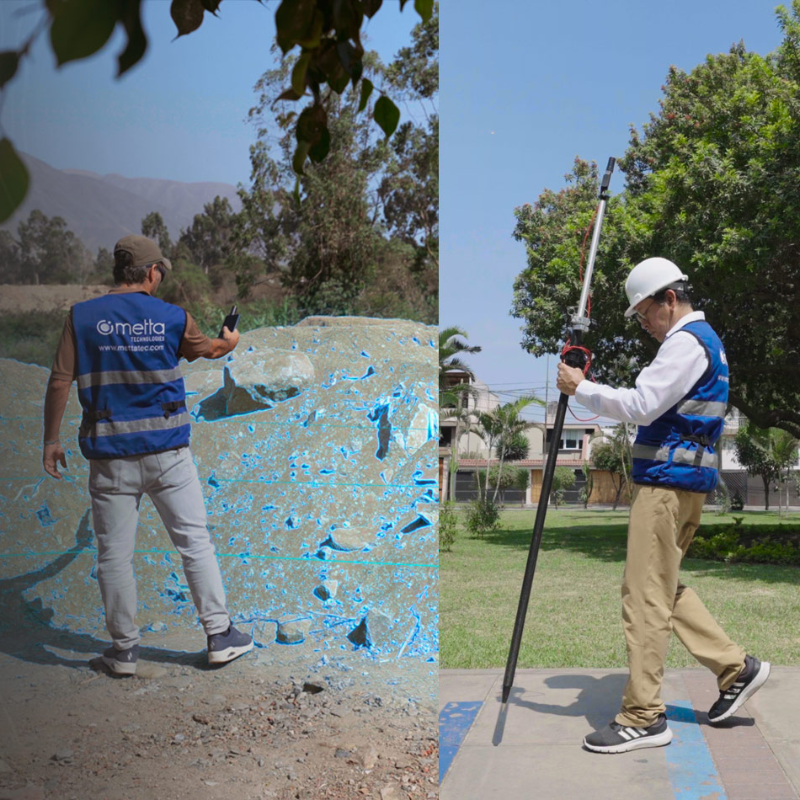
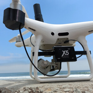
The X5Mobile is a high-precision GNSS receiver that works connected to a cell phone or tablet with the Android operating system and has two correction options: PPK and NTRIP which receive data through the Internet connection of the device using a USB connection or Bluetooth. It has a red dot laser for ease of use in geodetic surveys.

METTATEC
San Borja, PE
Description
Main advantages:
- Uses the same GNSS L1/L2/e5 technology found in professional GNSS receivers with state-f-the-art components
- Simultaneous reception of all constellations: GPS, GLONASS, GALILEO and BEIDOU
- Multi-band PPK and NTRIP corrections with fast convergence times and robust performance, delivers centimeter-level accuracy with a Fix in Seconds solution
- Allows Geodetic Surveys and Photogrammetry with high precision geotagging
- Includes its own L1/L2/e5 multiband helical GNSS antenna
- Data transfer connection via USB port and Bluetooth
- Compatible with GIS Apps and Photogrammetry Apps that operate with NMEA data
- It has a red dot laser for easy location of the points to be georeferenced in the field
- Solid ABS plastic housing
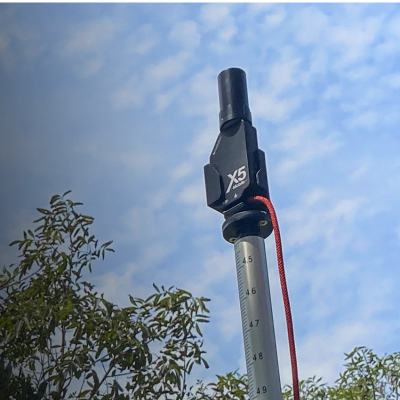
- Includes accessory to install on pole or pole with 5/8″ thread
- In summary: Precision at the centimeter level in a small module with very low consumption.
Compatible with GIS Applications for Android Operating System:
- SW Maps
- FieldGenius
- Survey Master
- Mapit GIS / Mapit NTRIP Client
- YCServer NTRIP Client
- RTK camera (Photogrammetry)
- …and other applications that work with NMEA data
Compatible Android Apps:
- SW Maps
- FieldGenius
- Survey Master
- Mapit GIS / Mapit NTRIP Client
- YCServer NTRIP Client
- RTK camera (Photogrammetry)
Do you have questions about this product?
- Questions about price, availability, and/or retailers
- Questions about technical specifications and usage
- Questions about suitability for your project or application
Specifications
-
General
-
Type
Land
Height [m]
0.085
Depth [m]
0.04
Width [m]
0.015
Total Weight [kg]
0.070
Housing Material
Plastic
-
Performance
-
No. channels
184
Tracked satellite signals
GPS/QZSS L1 C/A, L2 GLONASS L1OF, L2 BeiDou B1l, B2l Galileo E1-B/C, E5b
Reacqisition time [s]
2
-
Power
-
Operating power: min. [V]
4.75
Operating power: max. [V]
5.5
Typical consumption [W]
2.5
Connectors
BlueTooth, USB Serial
Videos
