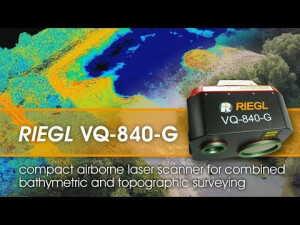
VQ-840-G
Compact Topo-Hydrographic Airborne Laser Scanner with Online Waveform Processing and Full Waveform Recording
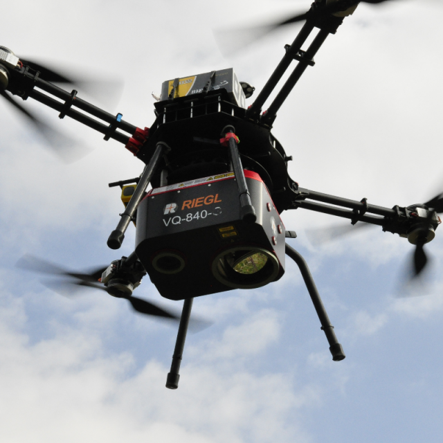
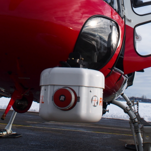
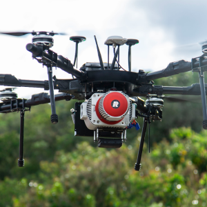
The RIEGL VQ-840-G is a fully integrated compact airborne laser scanner for combined hydrographic and topographic surveying. The system can be offered optionally with an integrated and factory-calibrated IMU/GNSS system and with an optional camera or IR rangefinder on request. The VQ-840-G is a compact and lightweight Lidar system to be installed on various platforms including UAVs.

RIEGL | Innovation in 3D
Horn, AT
Description
The RIEGL VQ-840-G is a fully integrated compact airborne laser scanner for combined hydrographic and topographic surveying. The system is offered with an integrated and factory-calibrated GNSS/IMU system and can be complemented with an optional camera and further options to acquire additional data for even more precise mission results. The VQ-840-G is a compact and lightweight LiDAR system to be installed on various platforms including UAVs.
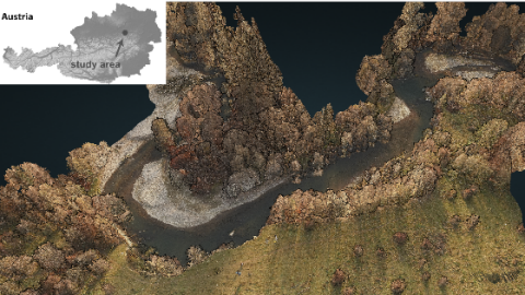
The scanner carries out laser range measurements for high-resolution surveying of underwater topography with a narrow, visible green laser beam, emitted from a pulsed laser source. Subject to clarity, at this particular wavelength the laser beam penetrates water enabling measurement of submerged targets.
Do you have questions about this product?
- Questions about price, availability, and/or retailers
- Questions about technical specifications and usage
- Questions about suitability for your project or application
Specifications
-
General
-
Year of introduction
2018
Year of last update
2022
Total Weight [kg]
15
Power requirements
18-34V DC, 110W
Type of GNSS/INS positioning system
optional
Camera
optional
Data storage facilities
CFAST, up to 512 GB
Postprocessing software
RiMTA ALS, RiACQUIRE, RiPROCESS, RiWORLD
-
Application
-
Main applications
Mapping of Coastal Lines; Coastline and Shallow Water Mapping; Surveying for Hydraulic Engineering; Hydro-Archaeological-Surveying
-
Measurement Characteristics
-
Scanning method
rotating scan mirror
Min. pulse frequency [Hz]
5000
Max. pulse frequency [Hz]
200000
Max. field of view [deg]
40
Max. number of recorded echoes per pulse
5
Full-wave form digitization
Y
-
Operation Characteristics
-
Platform
Helicopter, Fixed-wing, Gyroplane, RPAS (UAV/UAS)
Min. flying height [m]
3
Max. flying height [m]
250
-
Laser Pulse Characteristics
-
Type/class laser
3B
-
More information
-
Distinguishable features
designed for combined topographic and hydrographic airborne and UAV-based survey; high accuracy ranging based on echo digitization and online waveform processing with multiple-target capability; concurrent comprehensive full storage for all measurements for subsequent full waveform analysis; high spatial resolution due to measurement rate of up to 200 kHz and high scanning speed of up to 100 scans/sec; integrated inertial navigation system; additional, fully integrated infrared laser rangefinder (on request); integrated digital camera (optional); compact, lightweight and robust housing compliant with typical hatches in aircrafts and with stabilized platforms;
-
Application areas
-
Select an application area:
Documents
Brochure
datasheet_vq-840-g
Other documents
-
Infosheet BLS Overview.pdf1.53 MB
Videos


