

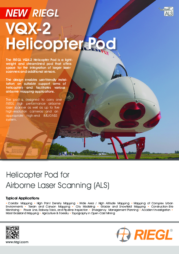
VQX-2 Helicopter Pod
Helicopter Pod for Airborne Laser Scanning (ALS)
The RIEGL VQX-2 Helicopter Pod is a lightweight and streamlined pod that offers space for the integration of larger laser scanners and additional sensors.

RIEGL | Innovation in 3D
Horn, AT
Description
The RIEGL VQX-2 Helicopter Pod is a lightweight and streamlined pod that offers space for the integration of larger laser scanners and additional sensors.
The design enables userfriendly installation on suitable support arms of helicopters and facilitates various airborne mapping applications.
The pod is designed to carry one RIEGL high performance airborne laser scanner as well as up to five high-resolution cameras and an appropriate high-end IMU/GNSS system.
Minor Change Approval is already available for Airbus Helicopters AS350 series helicopters.
Do you have questions about this product?
- Questions about price, availability, and/or retailers
- Questions about technical specifications and usage
- Questions about suitability for your project or application
Specifications
-
General
-
Total Weight [kg]
55
Year of introduction
2023
Camera
optional cameras with various camera orientations
Type of GNSS/INS positioning system
high-performance IMU/GNSS system
Postprocessing software
RiACQUIRE, RiPROCESS, RiUNITE
-
Application
-
Main applications
Corridor Mapping • High Point Density Mapping • Wide Area / High Altitude Mapping • Mapping of Complex Urban Environments • Terrain and Canyon Mapping • City Modeling • Glacier and Snowfield Mapping • Construction-Site Monitoring • Power Line, Railway Track, and Pipeline Inspection • Emergency Management Planning • Accident Investigation • Moist Grassland Mapping • Agriculture & Forestry • Topography in Open-Cast Mining
-
Measurement Characteristics
-
Full-wave form digitization
Y
Max. field of view [deg]
depends on integrated scanner
Max. number of recorded echoes per pulse
depends on integrated scanner
Max. pulse frequency [Hz]
depends on integrated scanner
Min. pulse frequency [Hz]
depends on integrated scanner
multiple pulses in air
Y
Scanning method
depends on integrated scanner
Scan frequency [Hz]
depends on integrated scanner
-
Operation Characteristics
-
Platform
Helicopter
-
Laser Pulse Characteristics
-
Type/class laser
depends on integrated scanner
-
More information
-
Distinguishable features
robust and reliable helicopter pod • uncompromising lightweight construction • quick installation and removal • turn-key solution ready to install (including power cabling) • GNSS antenna to be mounted appropriately • Minor Change Approval for Airbus Helicopters AS350 series
-
Application areas
-
Select an application area:
Land Surveying and Cadastre, Cultural Heritage, Mining, Defense and Security, Other
Documents
Brochure
RIEGL VQX-2 Preliminary Brochure.pdf
3.66 MB
Other documents
-
RIEGL VUX-160-23 Datasheet.pdf2.67 MB
-
RIEGL VQ-780II-S Datasheet.pdf5.39 MB
Related products


