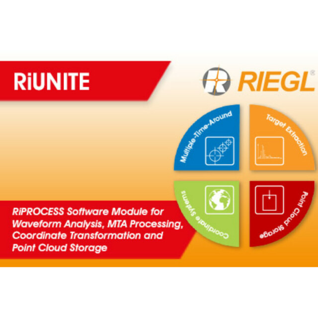
RiUNITE
RiPROCESS Software Module for Waveform Analysis, MTA Processing, Coordinate Transformation and Point Cloud Storage
RiUNITE is the core software module for LiDAR data processing in RIEGL's RiPROCESS point cloud management suite for kinematic laser data.

RIEGL | Innovation in 3D
Horn, AT
Description
It facilitates the four main tasks required for accurate point cloud generation.
- Waveform Analysis = RiANALYZE Functionality
RiUNITE extracts discrete targets from the digitized echo signals by means of Full Waveform Analyis (FWA). It also handles Online Waveform Processed (OWP) targets.
- Multiple-Time-Around Resolution = RiMTA Functionality
High measurement rates over long ranges typically result in range ambiguities. The data of instruments with Multiple-Time-Around (MTA) capability include information which is used by RiUNITE to resolve these ambiguities.
-Coordinate Transformation = RiWORLD Functionality
RiUNITE combines the laser scan data in the Scanner's Own Coordinate System (SOCS) with the recorded position and orientation data (POS) to a dataset in a geocentered coordinate system (e.g. WGS84, ITRS, ETRS).
- Point Cloud Storage
RiUNITE reads and writes the RIEGL Data Base (RDB). RDB is the central data storage format for visualization, filtering, and adjustment, that serves all major RiPROCESS software modules.
Do you have questions about this product?
- Questions about price, availability, and/or retailers
- Questions about technical specifications and usage
- Questions about suitability for your project or application
Specifications
-
Other
-
Typical applications
• data processing of all types of kinematic laser scanning • airborne laser scanning • unmanned laser scanning • mobile laser scanning
Distinguishing features
• extraction of echo signals from recorded waveform data • resolution of Multiple-Time-Around (MTA) range ambiguities • transformation of extracted echoes from the local instrument coordinate system to a global coordinate reference system • efficient organization of massive point cloud data for fast data storage and retrieval
-
General
-
Year of initial introduction
2021
Supported Systems
RIEGL Laser Scanners
Documents
Brochure
datasheet_RiUNITE


