
Point Cloud Processing Software
With Point Cloud Software the Point Clouds can be stored, processed, analyzed and visualized. Browse this overview of Point Cloud Processing Software packages or read our buyer's guide below. Point Clouds are data sets containing a large number of three-dimensional points. These points are captured by UAS Lidar Systems or created by overlapping images using Photogrammetric Imagery Processing Software.
Showing 1-15 of 39 results

HERON Desktop

LixelStudio Point Cloud Processing Software

CoProcess

FJD Trion Model Point Cloud Processing Software

PCA-LiDAR Point Cloud Processing and Analyzing Software
Galaxy Onboard
Aura
ClearEdge3D EdgeWise
MAGNET Collage Web
CoPre LiDAR Processing Software
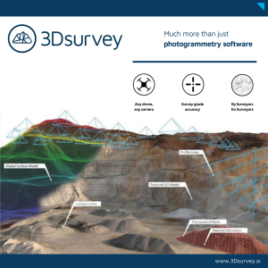
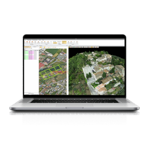
3Dsurvey Software
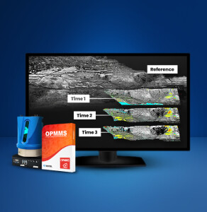
OPMMS
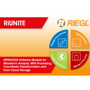
RiUNITE

VisionLidar365
Need some help? Ask a Geo-matching expert!
Our team and network of 1000+ manufacturers and developers is here to assist you.

Things to Consider When Choosing Point Cloud Processing Software
The Most Important Qualities and Possible Workflow Requirements
Before investing in point cloud processing software, potential buyers should consider the specific qualities of the software as well as their own current and future workflow requirements. This article provides some useful pointers.
Geospatial data is often received from the measuring equipment such as Lidar or multibeam echosounders in the form of point clouds. This means that most workflows using geospatial data will at some point deal with the processing of point clouds. These processing operations range in complexity, as does the software developed for this job. To help any potential buyer invest in point cloud processing software, this article outlines the most important qualities of potential software as well as the possible workflow requirements.
Photogrammetry?
Point clouds and photogrammetry nowadays go hand in hand, as technologies are improving and photogrammetric equipment and software are producing more accurate results. Depending on the challenges, Lidar, photogrammetry or a combination of the two may be the best solution for a project. When selecting software, it is important to think about whether you will use a point cloud method or photogrammetry in your projects, as some software packages are capable of handling both types of data while other software is specialized in one or the other.
Inputs/Outputs
In terms of input, point clouds are large collections of points in three-dimensional (X, Y, Z) space and are available in different file formats including LAS, LAZ, TXT, XYZ and XTF. Information may be assigned at each point, and this information can be useful and important for a workflow. Through the pipeline that transforms raw point cloud data into useable models and datasets, the point cloud will be cleaned and information added at numerous steps. Such information can be the classification of points, the return number that is present in many Lidar measurements, and other information. Some sensor software will add information and classification to the point cloud, and when point clouds are obtained through external sources (e.g. online databases) useful information may be available with the point cloud as well. Making use of this available information can prevent unnecessary and costly extra steps in your workflow.
The is a practically limitless variety of outputs that can be extracted from a point cloud. Some types of software present a larger range of capabilities than others. When choosing the right processing software, the bottleneck is formed by the operations required to produce the final output of a workflow. These final outputs can be solid 3D models used for analytic simulation purposes or 3D printing, but they can also be purely numerical results. For example, numerical results can be relevant when the values related to the object of interest are too small to be visualized (e.g. temporal changes in land elevation).
Operations
The processing operations are at the core of processing software. These operations can vary greatly in complexity and purpose, and it is important to define the operations required for your future workflows before investing in new point cloud processing software.
Common Operations
To optimize the subsequent workflow, point clouds undergo common operations such as filtering and thinning. Thinning can make unnecessarily dense point clouds easier to work with. Filtering the dataset based on classification, height or other properties additionally removes the unwanted points to ensure that only the relevant data carries on through the rest of the pipeline. Besides this, data can be georeferenced, allowing the user to apply it in combination with other datasets of the same area, for example. Depending on the source of the point cloud and the state in which it is imported into the software, georeferencing and thinning may be a required functionality or may already have been done by the data supplier or sensor software.

Figure 1: Common workflow for constructing 3D objects from point clouds. (Image courtesy: made in lucid charts)
Operations for Analysis
Processing point cloud data for the purpose of analysis requires different operations than workflows aimed at visualizing point clouds or creating solid models. Analytical processes will often require code imports and other flexible options to extract numerical results from the dataset.
Operations for Visualization
Some software is more suitable for creating visual outputs of processed point cloud data than other software. If the main outcome of a workflow is to visualize the results (such as a textured 3D model), then this should be the main directive of the processing software. Software for visualizing point cloud data often has photogrammetric capabilities as well, providing a full photogrammetry pipeline into which images can be given as input or the photogrammetry-derived point cloud containing visual properties can be imported.
Automated Processes
Standard operations performed on point clouds may require several steps and user input at various stages in the pipeline. These processes can be automated and optimized, thus saving the user valuable time and effort in constructing the data processing pipeline. This pipeline can then be automatically applied to future data processing, saving the operator the time required to manually set and start each task in the pipeline. More elaborate software may also have similar automated processes for more complex operations.
Complex Operations
For more specialized outputs, complex operations may be involved that are not easily done in smaller steps or with standard software. Several types of complex operations that can be relevant in a workflow, but are not present in all point cloud processing software, are listed below.
Transformations
Point clouds can be transformed into numerous types of terrain models to give a clearer, more effective and more efficient representation of the terrain. Terrain model transformations are generally split into two categories: rasters and triangulations. Each comes with its advantages, and the choice about which transformation to apply should depend on the situation. Besides terrain models, point clouds can also be used to create 3D solid models which have numerous applications, such as simulations and printing. There are large numbers of interpolation techniques available with which a point cloud can be transformed and constructed. It is important to be knowledgeable about the available interpolation options in order to select the best method for every situation and to analyse the accuracy of the result.
Time Series
In some projects, the user may want spatial data on a temporal scale, such as for timelapse movies or to analyse and visualize changes in data over time. This extra dimension can be added to a model in different ways, depending on how the user wishes to visualize it.
Interoperability with Other Data Types
Point clouds can be combined with other types of datasets to complement the information presented in the model. Such extra data can be numeric, but images and surface textures can also be used to add to 3D models. Depending on the project and the specific workflow, such operations may thus be essential and must be taken into consideration when investing in point cloud processing software.
Classification & Clustering
Depending on the source and format, point clouds may come with information classifications for each point. Nevertheless, it may be part of a workflow to classify the points in a point cloud based on custom parameters. This can be done using unsupervised classification methods like K-means clustering, or supervised classification using machine learning methods such as the Random Forest classifier and Support Vector Machine classifier.
Classifying a point cloud is an important step in organizing and preparing the data for the subsequent operations. Essentially, it allows the user to filter out large portions of the input point cloud, greatly increasing the relevance of the remaining data. For every layer of classification, more points can be filtered out. This removes noise and scatter from the dataset, preventing these points from polluting further operations and improving the accuracy and processing speed. Naturally, besides improving performance, classification is also a mandatory step for many processes, such as when collecting points in order to create a 3D model of the building presented by the green points in Figure 2.

Figure 2: An example of point cloud filtering using AI classification: some points can be classified as noise and scatter and then eliminated to prevent them from polluting further operations and results. (Image courtesy: Teledyne Caris)
Support
A strong understanding of what kind of support is available in conjunction with a software package can prevent users from wasting precious time and resources when their knowledge is lacking. There are various degrees of customer support and some software companies offer training. Software that is free to use, or available at low prices, may offer less of a customer support service but may provide more documentation, tutorials or – if there is a large user base – online Q/A forums.
The necessary support is largely dependent on the technical level of the intended users of the software. If this technical level is relatively low, the buyer should prioritize the available support and training as well as a clear interface of the software itself, as this also tends to vary strongly between brands.
Release Notes
Even the largest platforms in the world will occasionally have bugs. What is important is that these bugs are fixed quickly and that the changes are communicated with users. For this reason, buyers should check the software release notes and update frequency before investing in order to see whether the software is properly maintained. Forums can help to provide an indication of the speed and support offered by a vendor.
Cost
The pricing of point cloud processing software varies greatly – ranging from free software supported by online information only, to the higher-priced software packages from larger companies which come with support lines and training. The cheaper plans are often not available for commercial use or lack one or more essential functions for survey and mapping use. The latter obstacle can be circumvented by post-processing the data, but this may require additional software or specific skills.
Brand-specific Software
Some software is specialized to work only with measuring equipment of a specific brand. The efficiency and accuracy of this software is optimized for the data provided by these sensors. When looking to invest in processing software, a buyer should ideally first check the software specialized for the brand of their existing measuring equipment before considering other options.
Conclusion
Since point cloud processing software can be specialized to perform processing in specific directions (classification, visualization, analysis), a clear definition of the workflow will help the buyer to purchase the right software for the job. First, define the type of output that the software will need to produce. When the output is known, the processes required to obtain this output can be identified. This is also based on the type of input data and the required processing speed. Lastly, take into consideration the technical level of the users who will work with the software to ensure that a lack of knowledge or support will not impact on the success of future projects.


