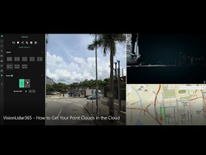

VisionLidar365
A 100% Secure Web Point Cloud Sharing Platform
Discover VisionLidar 365. The perfect way to securely share your Point Cloud Projects with your clients and co-workers. A 100% online & secure sharing platform suitable for Land Surveyors, Civil Engineers, Architects & more.

Geo-Plus
Laval, CA
Description
• Bring your Point Cloud and imagery everywhere with our VisionLidar 365.
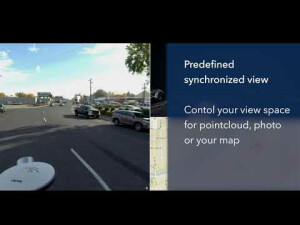
• Publish to the web and mobile devices your GIS portfolio of 3D data from point clouds, imagery and documents in PDF, etc.
• Online simple and powerful measuring of points, lines, height, width, perimeter, area, and volumes.
• Universal overlay of 3D images on the point cloud from (FARO, LEICA, BLQ, Teledyne, Jakarto, Topcon, Z+F and much much more).
• Collaborate with your team and client.
• Overlay vector data (points, lines and polylines) over maps and panoramas.
• Easy inventory of assets with PDF and other file attachments.
• Define users viewing rights.
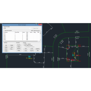
• Vector data digitization tool, points, polylines, polygons, to create data layers in your GIS and CAD environment.
• Plugin for AutoCad Map and ArcGis online.
Do you have questions about this product?
- Questions about price, availability, and/or retailers
- Questions about technical specifications and usage
- Questions about suitability for your project or application
Specifications
-
Hardware/software requirements
-
Use of GPU
Y
RAM [GB]
2
Stereo Display
Y
-
Other
-
Support
Y
Training
Y
-
Files and Registering
-
Input formats
.E57, .LAS, .LAZ, .PTS, ..
Geo-referencing
Y
Automatic Target Detection
Y
Stitching multiple scans
Y
-
Pre-processing and Automatic Filtering
-
Image matching facilities
Y
Removal of individual outliers
Y
Removal of vegetation
Y
Removal of buildings
Y
Bare ground DEM generation
Y
-
Manual Measurements
-
3D Coordinates extraction
Y
Length and Height
Y
Angle
Y
Distance
Y
Area
Y
Volume
Y
-
Interoperability
-
Assigning colour from imagery to points
Y
Image overlay on TIN
Y
CAD software
Plugin for AutoCad Map and ArcGis online
Integration with other data types
.obj, .ply, ..
-
General
-
Year of initial introduction
2018
Year of last update
2022
Source of Point Clouds
Airborne Lidar, Indoor TLS, Outdoor TLS, Photogrammetric, Radar
Supported Systems
Any
-
Analysis
-
Aspect and slope
Y
Individual tree heights
Y
-
Automatically Generated Products
-
Regular Grid DEMs
Y
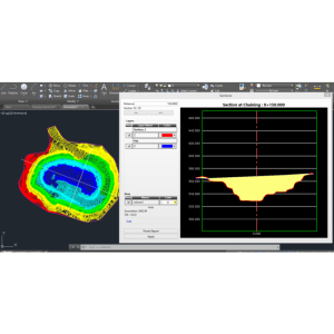
Cross sections
Y
TIN
Y
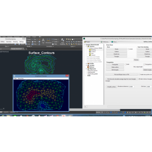
Contour Lines
Y
Break lines
Y
Boundary detection of solids
Y
Building footprints
Y
Building roofs
Y
-
Solid Modelling
-
Lines
Y
Planes
Y
Cubes
Y
Spheres
Y
Cylinders
Y
NURBS
Y
-
Visualisation and Editing
-
Zoom, pan and rotate
Y
Fly-throughs
Y
Adding Points
Y
Removing Points
Y
Point Reduction
Y

