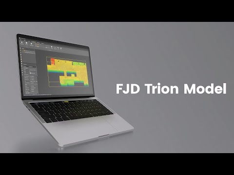


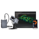
FJD Trion Model Point Cloud Processing Software
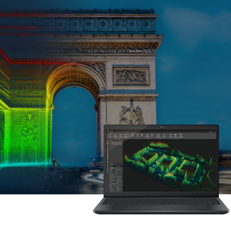
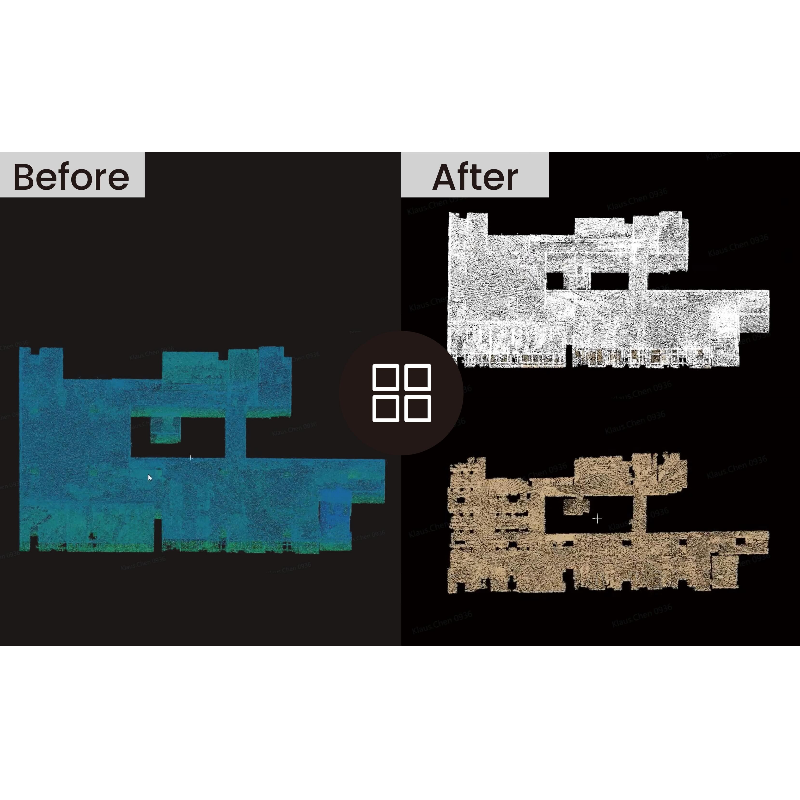
FJD Trion Model by FJDynamics offers easy point cloud data manipulation and analysis, featuring a user-friendly interface and advanced algorithms. The software supports popular point cloud data formats, ensuring compatibility and flexibility for seamless data processing. Advanced algorithms enable precise rendering and correction of point cloud data, while automated classification streamlines data analysis and management.

FJDynamics
Singapore
Description
This eliminates the need for tedious manual processes, allowing professionals to focus on their core tasks and make informed decisions.
Industry-specific Applications
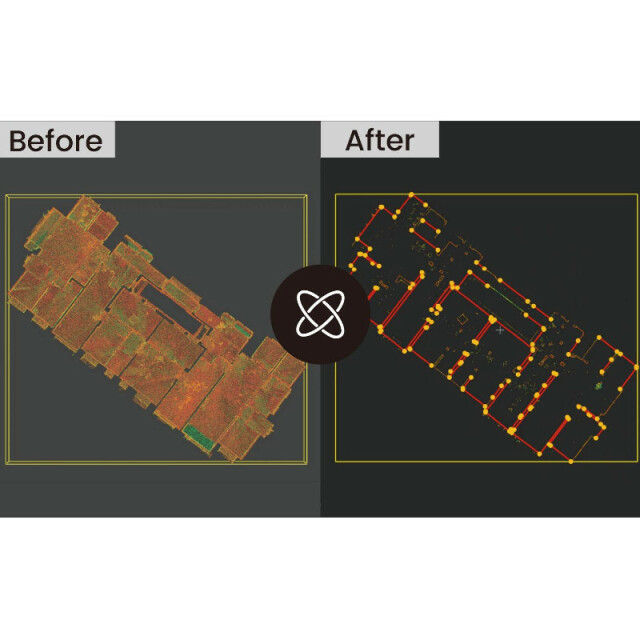
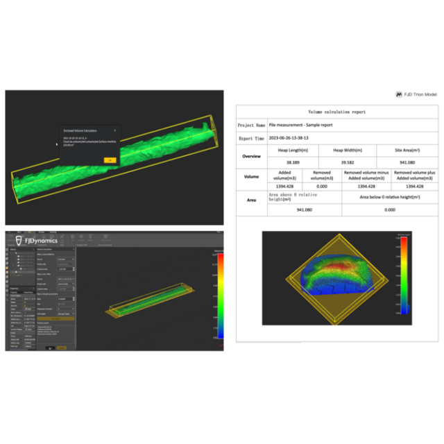
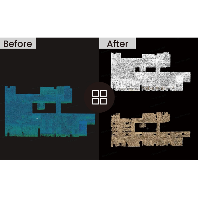
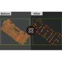
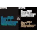
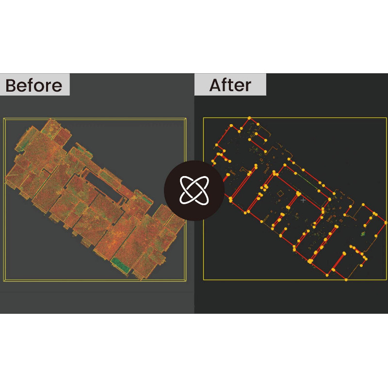
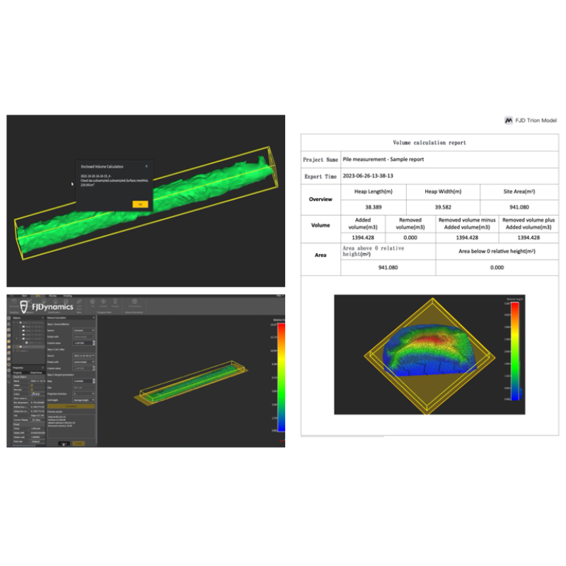
The software has many industry-specific applications, catering to the unique needs of various sectors. For urban planners, it enables the extraction of vector contour lines from point cloud data, providing vital information for efficient urban planning. In the forestry industry it simplifies data editing by effortlessly extracting attributes such as single tree location, tree height, and crown width. For mining and tunneling applications, volume can be calculated with just a few clicks. This information can be batch-extracted and used to create comprehensive reports, offering valuable insights for forest surveying, management, and planning.
Do you have questions about this product?
- Questions about price, availability, and/or retailers
- Questions about technical specifications and usage
- Questions about suitability for your project or application
Specifications
-
Hardware/software requirements
-
RAM [GB]
32
HD [GB]
64
Use of GPU
Y
Processor
Recommended configuration: Intel® CoreTM i7-10700 CPU @ 2.90 GHz (or an AMD CPU with equal performance)
List software environment, e.g. Microstation
Recommended configuration: Processor: Intel® CoreTM i7-10700 CPU @ 2.90 GHz (or an AMD CPU with equal performance) Memory: 32 GB Graphics card: NVIDIA GeForce GTX 1650 Ti 4G Hard disk drive: 64 GB Screen resolution: 1680 × 1050 or above
Stereo Display
Y
Stand-alone
Yes
-
Other
-
Training
Y
-
Files and Registering
-
Input formats
.las, .ply, .pts, e57
Geo-referencing
Y
Output formats
LAS cloud (.las, .laz), ASCII cloud (.txt, .asc, .neu, .xyz, .pts, .csv), Model entities (.bin), E57 cloud (.e57), PLY mesh (.ply), DXF geomeetry (.dxf), Point Cloud Library cloud (.pcd), Point+Normal cloud (.pn), Point+Value cloud (.pv)
Automatic Target Detection
Y
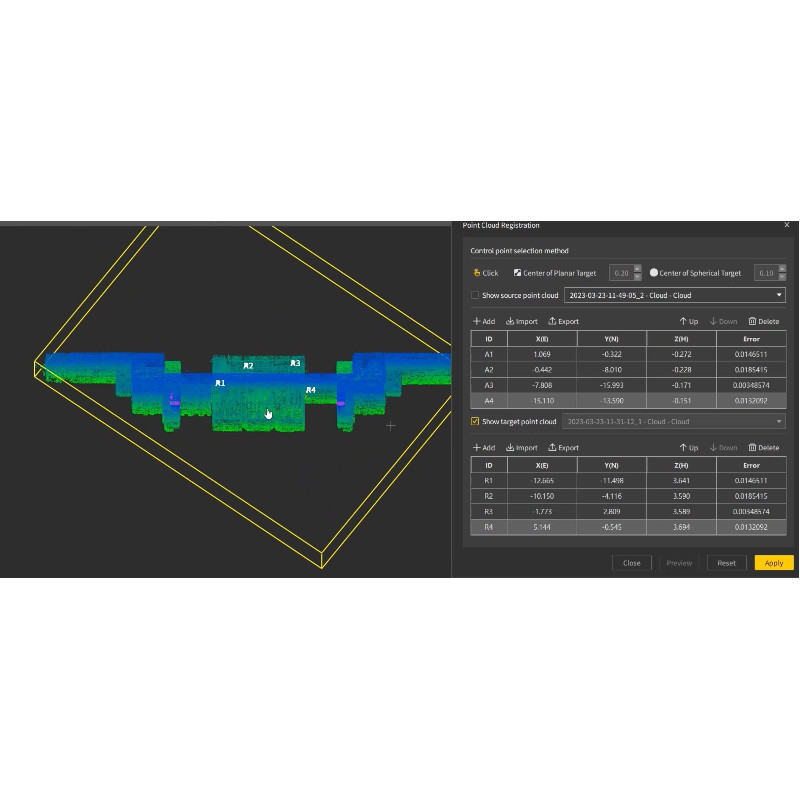
Stitching multiple scans
Y
-
Pre-processing and Automatic Filtering
-
Image matching facilities
Y
Removal of individual outliers
Y
Removal of vegetation
Y
Removal of buildings
Y
Bare ground DEM generation
Y
-
Manual Measurements
-
3D Coordinates extraction
Y
Length and Height
Y
Angle
Y
Distance
Y
Area
Y
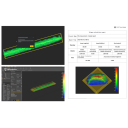
Volume
Y
-
Interoperability
-
Assigning colour from imagery to points
Y
Image overlay on TIN
Y
-
General
-
Source of Point Clouds
Airborne Lidar, Indoor TLS, Radar
Year of initial introduction
2022
Year of last update
2023
Modules
Point Cloud Mapping and Processing, Point Cloud Registration, Coordinate Transformation, RTK-based Registration, Point Cloud Colorization, Point Cloud Classification, Triangular Mesh (TIN, Surface Triangular Mesh, Fill Holes), Volume Calculation (Enclosed Volume, Grids Volume). 6 versions: Basic, Drawing, Forest, Pro, Robotics
-
Analysis
-
Individual tree heights
Y
-
Automatically Generated Products
-
Regular Grid DEMs
Y
Cross sections
Y
TIN
Y
Contour Lines
Y
Break lines
Y
Boundary detection of solids
Y
Building footprints
Y
-
Solid Modelling
-
Lines
Y
Planes
Y
-
Visualisation and Editing
-
Zoom, pan and rotate
Y
Fly-throughs
Y
Adding Points
Y
Removing Points
Y
Point Reduction
Y
Videos


