


PCA-LiDAR Point Cloud Processing and Analyzing Software
One Step Solution
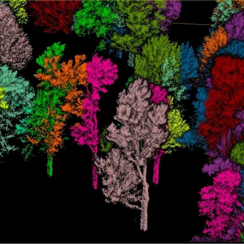
Automatic processing, such as filtering, classification and individual tree segmentation.

Geosun Navigation
Wuhan, CN
Description
What can the PCA post-processing software do?
Focus on LiDAR Point Cloud Processing , Analysis and Application. World's Leading ONE-STEP solution simple operation!
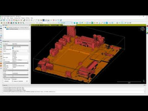
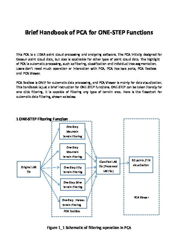
The PCA initially designed for Geosun point cloud data. The highlight of PCA is automatic processing, such as filtering, classification and single tree segmentation. Users don’t need much operation or interaction with PCA. PCA has two parts, PCA Toolbox and PCA Viewer.
PCA Toolbox is ONLY for automatic data processing, and PCA Viewer is mainly for data visualization.
The main features
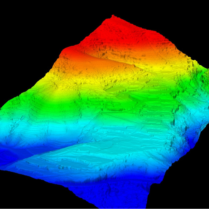
Extremely high density
Massive data
Precise location
Penetration of vegetation
Fusion of RGB and point cloud
Performing strip adjustment
No outliers
Single tree segmentation and information extraction
The tutorial of installation and data processing
Do you have questions about this product?
- Questions about price, availability, and/or retailers
- Questions about technical specifications and usage
- Questions about suitability for your project or application
Specifications
-
Hardware/software requirements
-
RAM [GB]
16
HD [GB]
60
Use of GPU
N
Stereo Display
Y
Stand-alone
Yes
-
Files and Registering
-
Input formats
LAS
Output formats
LAS,DWG
-
Pre-processing and Automatic Filtering
-
Image matching facilities
Y
Removal of individual outliers
Y
Removal of vegetation
Y
Removal of buildings
Y
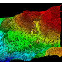
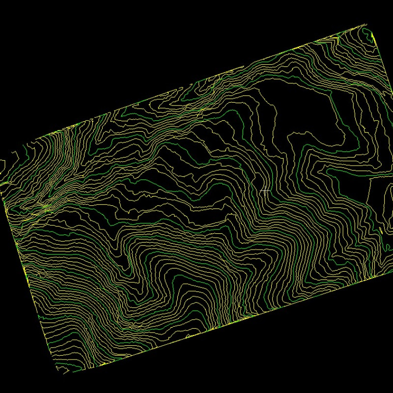
Bare ground DEM generation
Y
-
Manual Measurements
-
3D Coordinates extraction
Y
Length and Height
Y
Angle
Y
Distance
Y
Area
Y
-
General
-
Year of last update
2023
Source of Point Clouds
Airborne Lidar
Supported Systems
Windows
-
Automatically Generated Products
-
Regular Grid DEMs
Y
Cross sections
Y
TIN
Y
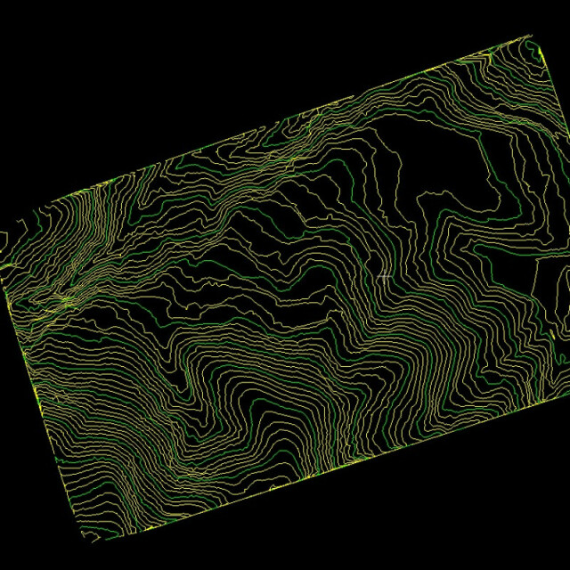
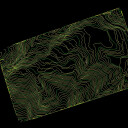
Contour Lines
Y
Break lines
Y
Boundary detection of solids
Y
Building footprints
Y
Building roofs
Y
3D City modelling
Support
-
Solid Modelling
-
Lines
Y
-
Visualisation and Editing
-
Zoom, pan and rotate
Y
Fly-throughs
Y
Adding Points
Y
Removing Points
Y
Point Reduction
Y
Documents
Brochure
pca-userguide.pdf
2.24 MB
Videos
