


CoProcess
Advanced Lidar Data Processing Software
The CoProcess, developed by CHCNAV, is a powerful software solution tailored to post-processing massive point cloud data. As a fully integrated platform, CoProcess seamlessly processes point cloud data captured in the field into various multi-format deliverables. Point cloud management, measurement tools, and visualization are just parts of the software solution, which also features a free configuration viewer. Creation of Digital Elevation Models (DEMs) and Digital Terrain Models (DTMs), semi-automatic feature extraction, automatic data classification, road design, and more are all possible with CoProcess. The software's intuitive interface and advanced processing capabilities make it a valuable tool for professionals from different industries, such as surveying, construction, urban planning, and infrastructure development.

CHC Navigation | CHCNAV
Shanghai, CN
Description
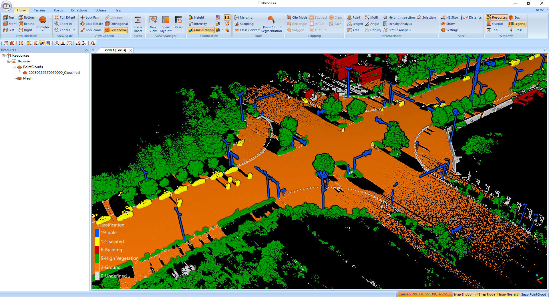
MASSIVE DATA CLASSIFICATION
CoProcess uses advanced CHCNAV algorithms to automatically and manually classify point cloud data into various categories, including ground, vegetation, buildings, roads, power lines, and others. This classification process allows for the efficient and accurate extraction of valuable information from the point cloud data, such as creating 3D models of buildings, mapping vegetation coverage, and identifying potential obstacles for infrastructure planning and maintenance.
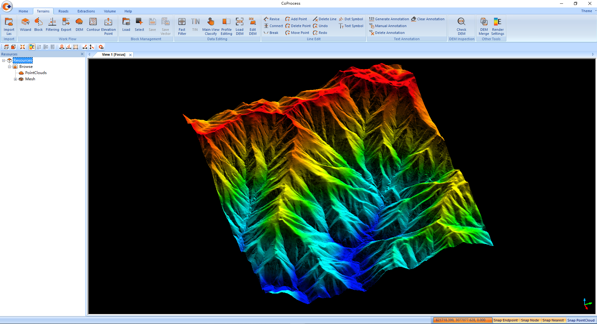
AUTOMATIC DEM/DSM GENERATION
CoProcess is a comprehensive software solution for generating DEMs or DSMs from point cloud data, from the initial field data collection to the final rendering. The process includes a specialized algorithm for efficient measurement noise filtering, automatic ground point filtering, and seamless DEM/DSM data export based on the required configuration. In addition, CoProcess provides various editing functions to further enhance the quality of the DEM/DSM data.
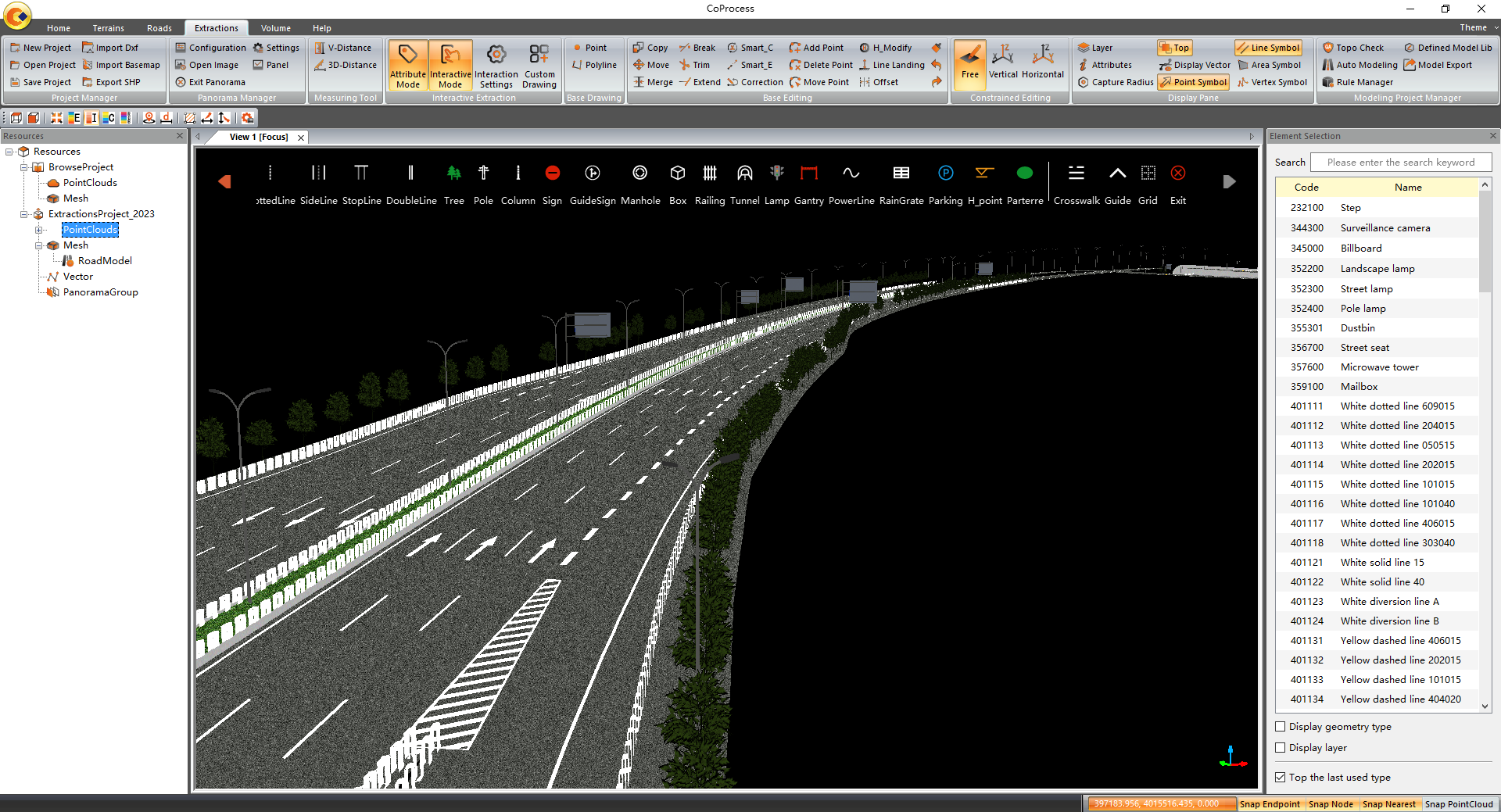
POWERFUL FEATURE EXTRACTION
CoProcess's robust feature extraction module supports both automatic and manual extraction of road features. Extracted features can be easily converted to DAT and DXF formats for seamless integration with software such as AutoCAD and ArcGIS, significantly improving work efficiency and productivity compared to traditional survey methods.
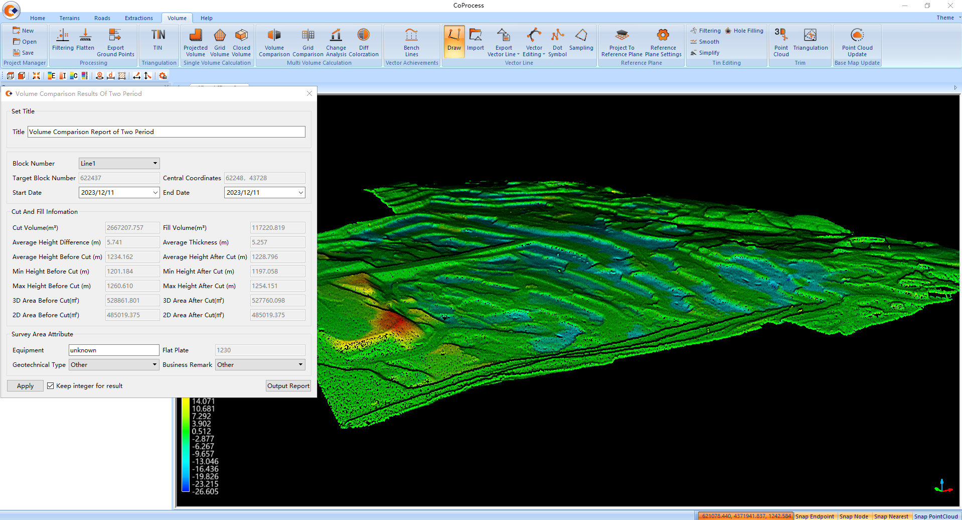
VOLUME CALCULATION AND ANALYSIS
CoProcess supports volume calculation from point clouds using the grid method, with results that can be easily exported in DXF format. It also facilitates the analysis of volume differences between successive LiDAR data sets, providing detailed reports for informed decision-making.
USER-FRIENDLY INTERFACE DESIGN
CoProcess has an intuitive user interface with four main modules: Foundation, Terrain, Road, and Volume. The CoData point cloud format enhances the user experience when importing and visualizing large datasets. The interface and module layout are customizable to suit the user's preferred work habits. With an integrated workflow wizard and user manual, CoProcess is easy to learn and master, making it an effective tool for even new users.
Do you have questions about this product?
- Questions about price, availability, and/or retailers
- Questions about technical specifications and usage
- Questions about suitability for your project or application
Documents
Brochure
CoProcess_DS_EN.pdf
2.66 MB
Videos


