VMX-2HA
High Speed, High Performance Dual Scanner Mobile Mapping System
The RIEGL VMX-2HA is a High Speed, High Performance Dual Scanner Mobile Mapping System which provides dense, accurate, and feature-rich data at highway speeds.

RIEGL | Innovation in 3D
Horn, AT
Description
With 3.6 million measurements and 500 scan lines per second, this turn-key solution is ideally suited for survey-grade mobile mapping applications.
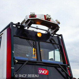
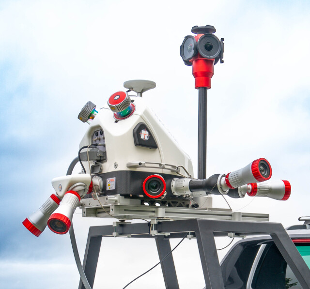
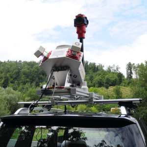
This powerful technology comprises two RIEGL VUX-1HA²² High Accuracy LiDAR Sensors and a high performance INS/GNSS unit, housed in an aerodynamically-
shaped protective cover.
A camera interface for up to 9 optional cameras enables complementation of the LiDAR data with precisely geo-referenced images.
A high-speed 10 GigE Link is provided for aquisition of 3.6 mio. meas./sec. and image data with up to 240MP resolution.
Do you have questions about this product?
- Questions about price, availability, and/or retailers
- Questions about technical specifications and usage
- Questions about suitability for your project or application
Specifications
-
General
-
Year of initial introduction
2017
Year of last update
2023
Application
Outdoor
-
Lidar Sensor
-
Brand
RIEGL VUX-1HA
Number of laser scanners
2
Laser safety classification
1
Min. Range [m]
1.2
Max Range [m]
420
Beam diameter at exit [mm]
4.5
Beam divergence [mrad]
0.5
Intensity recording [bit]
16
Max. vertical field of view [deg]
360
Max. measurement rate [kHz]
1800
Scans per second
500
Export formats
LAS, ASCII, interface to 3rd party software
-
Operation
-
Built-in Stabilisation
Y
Main applications
Transportation Infrastructure Mapping;Rail Mapping;Road Surface Measurements;City Modeling;;Rapid Capture of Construction Sites and Bulk MaterialSurveying in Open-Pit Mining;GIS Mapping and Asset Management;As-Built Surveying;
Distinguishing features
High laser pulse repetition rate of up to 2 MHz;500 scan lines per second;Range 420 m;Eye safe operation at Laser Class 1;Field of view 360°;Multiple target capability;Aerodynamically-shaped protective cover;interface for up to 9 optional cameras;High-Speed 10GigE link;
Training provided
Y
-
Camera System
-
Brand and model
RIEGL cameras (5MP, 12MP, 24MP) high resolution DSLR camera up to 45MP, spherical cameras up to 72MP
Number of cameras
9
-
Dimensions & Environment
-
Min. Operation temp. [°C]
0
Max. Operation temp. [°C]
40
Max. humidity [%]
80
-
Included Processing Software
-
Photogrammetry Software
No
Laser Point Clouds Software
Yes, RIEGl Software
Documents
Brochure
brochure_vmx-2ha
Other documents
-
RIEGL VUX-1HA-22 Datasheet.pdf3.15 MB
-
RIEGL VMX-2HA-BC Infosheet.pdf3.68 MB
-
Infosheet MLS Overview.pdf5 MB


