
Implementing Our Mission of Building Bridges Between the Real and Digital Worlds, CHCNAV Offers Dealership Opportunities to Mobile Mapping professionals
To support the rapid growth of the Mobile Mapping Division, CHC Navigation opens dealership opportunities to Mobile Mapping professionals in several countries and regions. Our mission is to build bridges between the real and digital worlds, for greater interoperability and accessibility of data globally, in the most effective and affordable way.
“We foresee strong growth potential as most of our customers are looking for reliable and affordable technology solutions to move from 2D mapping to 3D reality capture using LiDAR and imagery”, - George Zhao, the CEO of CHC Navigation, for the Annual Leaders Outlook of Geospatial World, 2022.
CHC Navigation offers a complete portfolio of mobile mapping solutions for a variety of applications, such as road and highway corridor mapping and asset management, facade and heritage modelling, natural surface capture, power line inspection, digital terrain modelling (DTM), 3D city modelling, and more. Our solutions are ready for demanding surveying missions in the air, on the ground or on water, providing the highest data quality results.

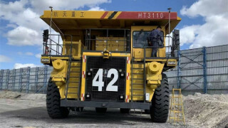
Figure 1. Making a topographic survey with the AlphaUni scanner and BB4 UAV.
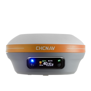
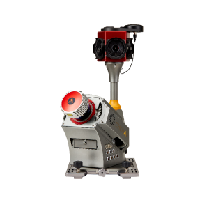
The terrestrial and airborne Mobile Mappers from CHCNAV are presented in 2 series: ‘AlphaAir’ and ‘AlphaUni’. They combine state-of-the-art high-performance hardware, such as long-range, precise laser scanners, high-resolution HDR panoramic cameras, and advanced GNSS receivers with high precision IMU.
AlphaAir Series
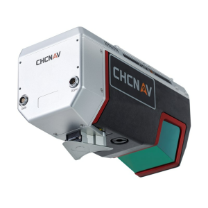
- AlphaAir 450 is a lightweight and rugged system that integrates a high-performance laser scanner with an industrial-grade professional 26 MP camera and a high-precision inertial navigation system for high-quality data collection.
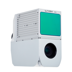
- AlphaAir 1400 and AlphaAir 2400 are the premium airborne laser scanners with the 1430 and 2150 m scanning range for the high-density corridor Lidar mapping applications, designed for use on various UAV platforms, helicopters, or small aeroplanes at up to 720 m and 1400 m operating flight altitudes respectively.

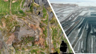
Figure 2. Power line Lidar imagery, captured by the AlphaAir 450 LiDAR.
AlphaUni Series
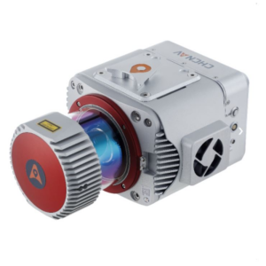
- AlphaUni 900 and Alpha 3D are high-precision, long-range laser scanners with the unique Waveform-LiDAR technology from RIEGL and a high-accuracy inertial navigation system, ready for demanding surveying missions in the air and on the ground and water, requiring the highest quality of data.
CHCNAV Unmanned Aerial Vehicles (UAV) are designed to meet professional applications such as survey and mapping projects related to infrastructure, utilities, mining, and agriculture, which may require a high payload, extended flight time, advanced camera stabilization, and fully autonomous control.
- BB4 UAV is a high-end unmanned aircraft system resulting from an alliance between the two industry leaders, where the scientific design and highly integrated production technology come from CHCNAV - a global manufacturer specializing in efficient geospatial measurement technologies, and its fully automated flight control system from DJI, the pioneer in the manufacturing of commercial UAVs. BB4 can be equipped with mobile mappers from CHCNAV.
- P330 PRO VTOL Drone is a high-performance vertical takeoff and landing (VTOL) fixed-wing unmanned aircraft system (UAS) equipped with the orthophoto camera and optional sensors, like an oblique camera for 3D modelling applications to address the most demanding mapping and topographic survey applications.

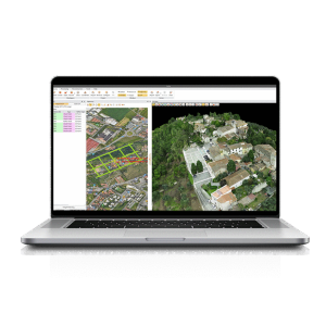
Figure 3. City planning project results were obtained by the CHCNAV mobile mapping solutions.
Additionally, clients can benefit from the complete workflow with the pre-and post-processing software suite, which can process captured raw data, including POS trajectories, Lidar data, and RGB images; and provide DEM/DTM generation, semi-automated feature extraction, automatic data classification, and dedicated power line and road inspection.
With its intuitive interface and efficient workflow, the CHCNAV software CHCNAV significantly improves the productivity of 3D mapping projects.

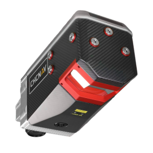
Figure 4. CoPre software: point cloud processing.
Whatever a project or budget, CHC Navigation’s complete portfolio of mobile mapping solutions provides clients with a choice to meet their needs and helps them to save time, reduce costs and complete their projects in the most effective way.
About CHC Navigation
CHC Navigation (CHCNAV) creates innovative GNSS navigation and positioning solutions to make customers' work more efficient. CHCNAV products and solutions cover multiple industries such as geospatial, construction, agriculture, and marine survey. With a presence across the globe, distributors in more than 100 countries, and more than 1,300 employees, today CHC Navigation is recognized as one of the fastest-growing companies in geomatics technologies.
CHC Navigation invites potential dealers to apply for cooperation. Our dealers have a choice to represent one or more mobile mapping products based on the potential customers’ needs in their region. We communicate openly and frequently, build mutual trust, and help generate larger gains for every dealer.
Do you have questions about this article?
Get in touch with CHC Navigation | CHCNAV, and they would be happy to answer any questions you have about pricing, suitability, availability, specs, etc.


