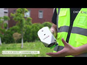


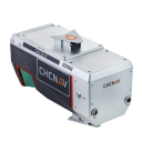
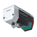


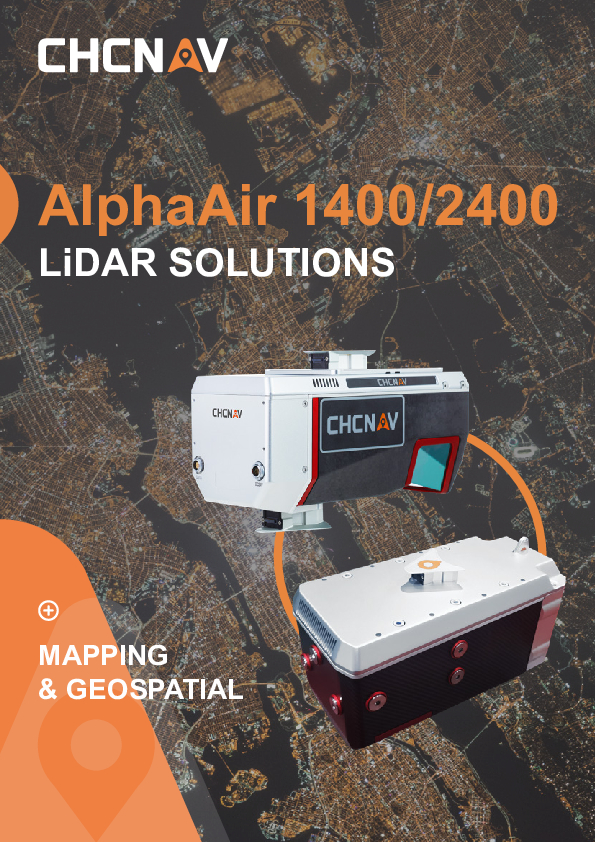
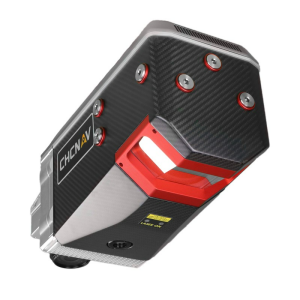
AlphaAir 1400
Premium Airborne Laser Scanner with 1430 m Range for High-Density Corridor LiDAR Mapping Applications
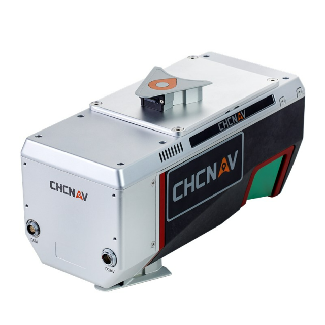
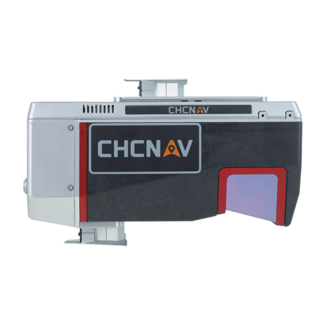
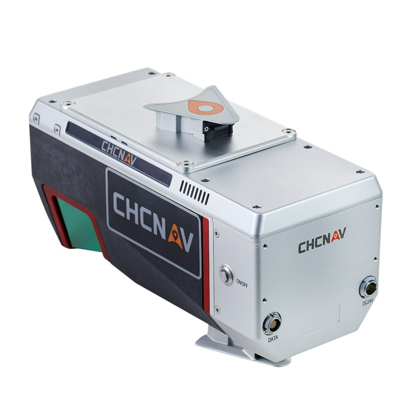
The AA1400 system integrates a Riegl's VUX-120 and the industrial-grade CHCNAV’s GNSS & high precision IMU making it possible to provide up to 1 cm accuracy, depending on the scanning range. The AlphaAir 1400 is a lightweight airborne laser scanner featuring an impressive combination of weight, range, accuracy, and pulse rate. The AA1400 belongs to the Alpha LiDAR series, known for its high accuracy and data quality without compromising reliability and specifically designed for use on UAVs.

CHC Navigation | CHCNAV
Shanghai, CN
Description
-
OUTSTANDING ACCURACY SCANNING
High-end GNSS + INS combined with Riegl VUX-120
The AlphaAir 1400 provides a survey-grade accuracy of 2 to 5 cm, with an operating flight altitude of up to 720 m by combining industrial-grade CHCNAV’s GNSS and high-precision IMU systems. The integrated VUX-120 features a wide 100-degree field of view and a high-speed data acquisition rate of up to 1.8 MHz with a scanning range of up to 1430 m delivering 1 cm linear accuracy. The continuously rotating polygon mirror wheel enables scan speeds of up to 400 lines per second, perfectly suited for fixed-wing UAV corridor mapping applications.
-
CABLE-FREE CONNECTION
Fast and easy installation
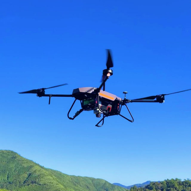
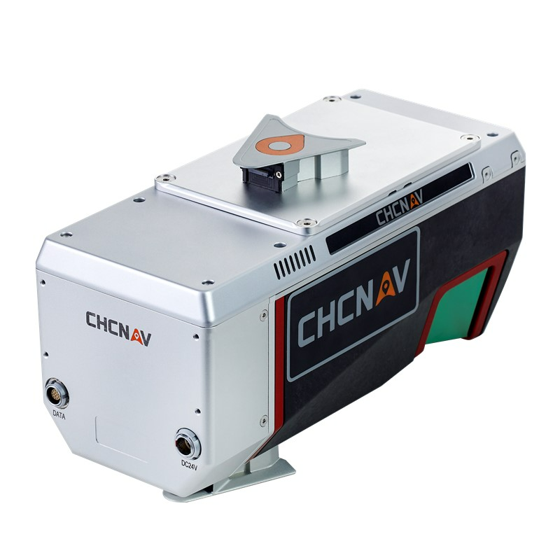
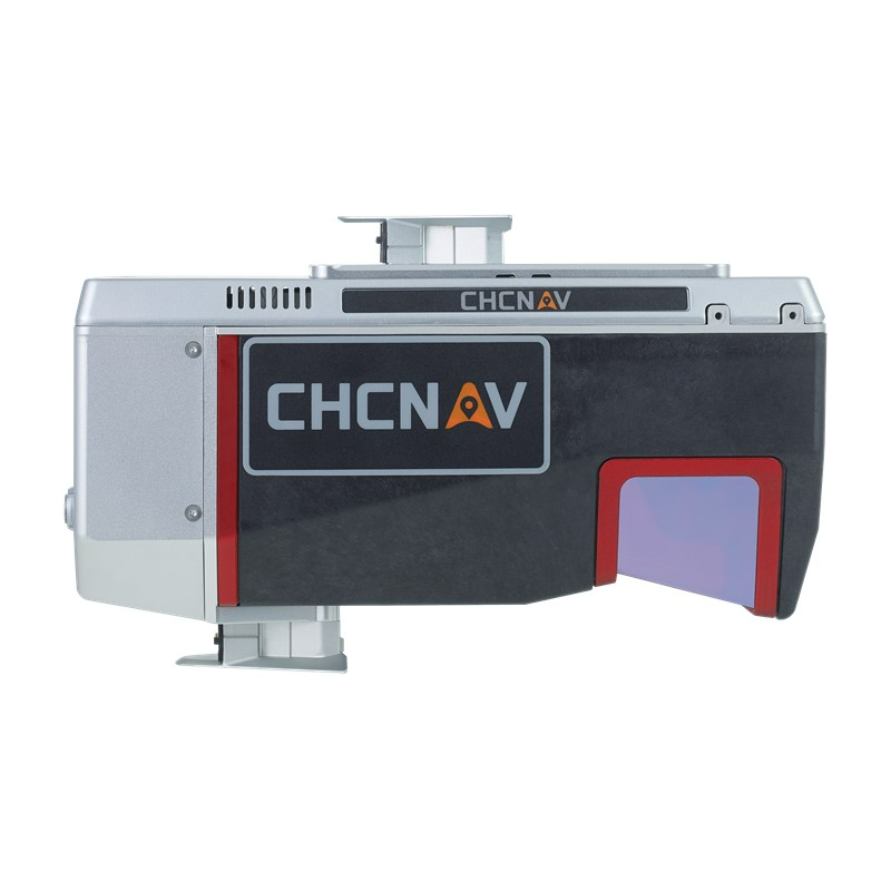
In one click, connect the AlphaPort to the power source; in the second click, start the LiDAR. The AA1400 eliminates the need for additional accessories and time for camera calibration. The AlphaAir1400 can be installed with increased protection against potential damage on the wide range of unmanned aerial vehicles.
-
LIGHTEST UNIT IN ITS CLASS
Only 3 kg weight for the complete system
The AlphaAir 1400 is a compact unit with an embedded remote control system and 1TB of internal data storage capacity. It is designed to take aerial drone surveying missions to the next level - to conduct safe operations at higher flight altitudes and cover larger areas per flight than is usually achievable.
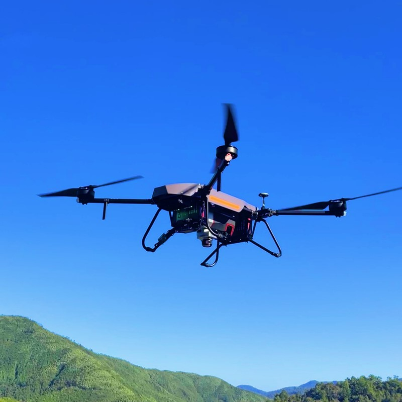
The AlphaAir 1400 is a lightweight airborne laser scanner featuring an impressive combination of weight, range, accuracy, and pulse rate. The AA1400 belongs to the Alpha LiDAR series, known for its high accuracy and data quality without compromising reliability and specifically designed for use on various UAV platforms, helicopters, or small airplanes at up to 720 m operating flight altitude.
The AA1400 system integrates a Riegl's VUX-120 with a unique forward and backwards-looking field of view (FOV) designed to minimize laser shadowing and provide geometry on complex vertical structures in a single pass. In addition, the VUX-120 airborne laser scanner features a wide 100-degree field of view and a high-speed data acquisition rate of up to 1.8 MHz and a scanning range of up to 1430 meters. The industrial-grade CHCNAV’s GNSS and high-precision IMU allow the AlphaAir 1400 to provide up to 1 cm accuracy, depending on the scanning range.
Do you have questions about this product?
- Questions about price, availability, and/or retailers
- Questions about technical specifications and usage
- Questions about suitability for your project or application
Specifications
-
Application
-
Main applications
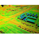
High-density point corridor mapping applications
Training, maintanence and support
Included
Distinguishable features
Long range scanning combined with the high-resolution imaging; high point density and superior data accuracy; light weight, compact design and user-friendly cable free installation
-
Measurement Characteristics
-
Scanning method
rotating polygon mirror
Range accuracy [mm]
10
Scanning Speed [measurements p second]
400
Max. field of view [degrees]
100
multiple pulses in air
Y
Min. pulse frequency [Hz]
150000
Max. pulse frequency [Hz]
1800000
Max. number of recorded echoes per pulse
15
Recording of intensity of return signal [bits]
16
-
Physical Properties
-
Height [cm]
16.7
Length [cm]
27
Width [cm]
11.7
Weight [kg]
2.98
Water and dust proof
IP64
-
Laser Pulse Characteristics
-
Laser Class
1 (in accordance with IEC 60825-1:2014)
Min. range of laser pulse [m]
5
Max. range of laser pulse [m]
1430
Wavelength [nm]
1550
Beam divergence [mrad]
0.4
-
Power Supply
-
Power consumption
60 W
Power requirements
wide range of input voltage 11 V ~ 34 V
Type of battery
External battery
-
Positioning System
-
Type of GNSS positioning sensors
Multiple GPS, GLONASS, Galileo, BeiDou, SBAS and QZSS constellation, L-Band
Typical positioning accuracy [cm]
1
Type of INS or IMU
IMU
Number of GNSS positioning sensors
1
Gyroscopes Bias In-Run stability [deg p hr]
0.025 mg, 1 sigma
-
Operation Characteristics
-
Mounting
The connection between equipment and aircraft uses quick disassembly structure, simple and easy to operate. There is no cable between unit and aircraft, camera and unit
Requirements for compatible UAVs
UAV platforms, helicopters or small airplanes
Camera included
Yes
Camera specifications
CHC AS-C4200 (calibrated Sony A7 RII). Modular upgrade options: DSLR, thermal, multispectral
Control and user interface
Up to 8 km, wireless control of instrument parameters and data recording in real time
-
Data and Software
-
Type of storage
SSD
Max. storage space [mb]
1000000
Included software
Performed with CoCapture UAV software and semi-automatic point cloud processing CoPre desktop software
-
General
-
Year of last update
2022
Year of introduction
2022
Documents
Brochure
alphaair-1400-2400-ds-en.pdf
1.45 MB


