


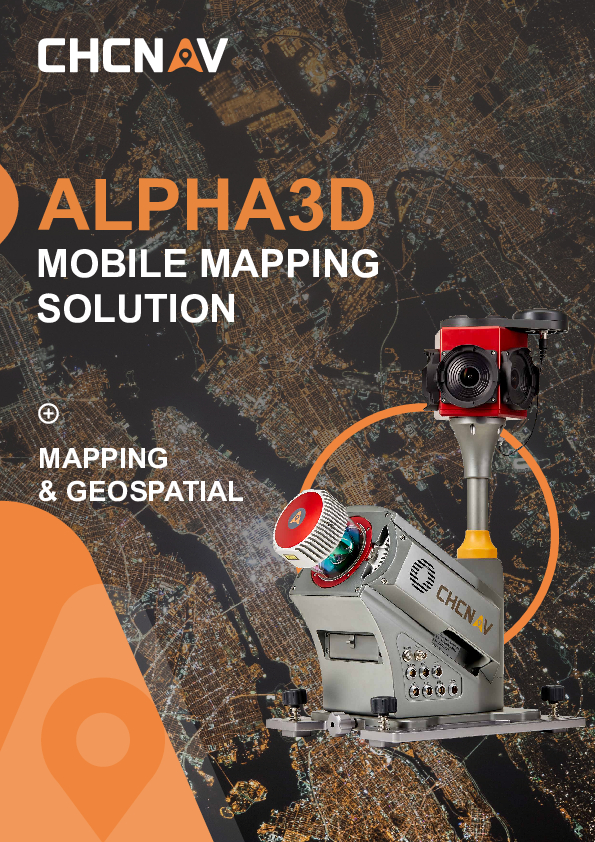
ALPHA3D
Advanced Mobile Mapping Solution for 3D Mass Data Acquisition
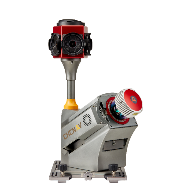
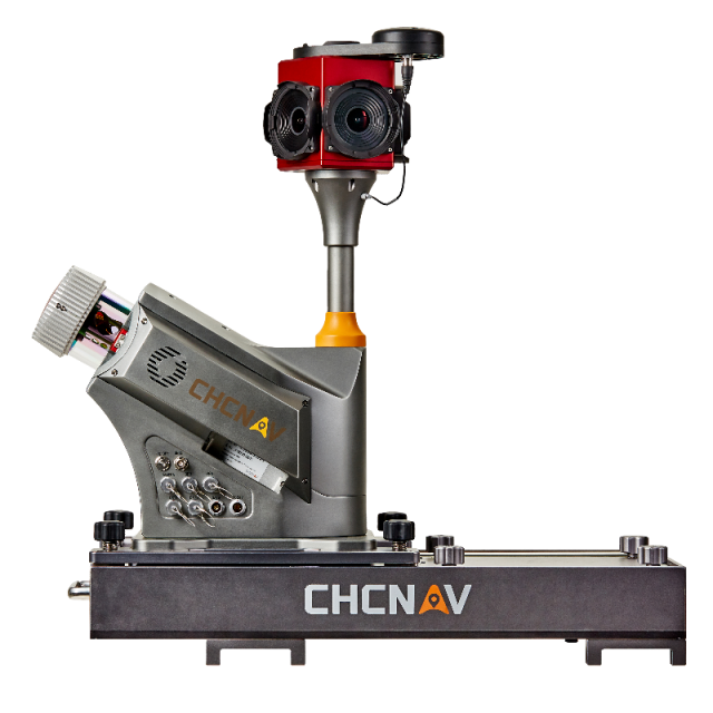
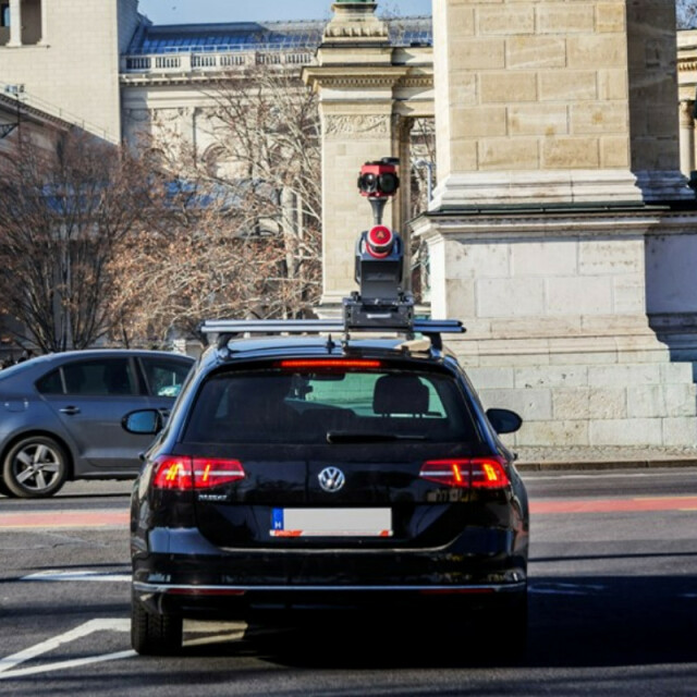
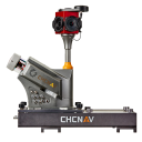
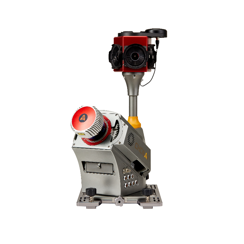
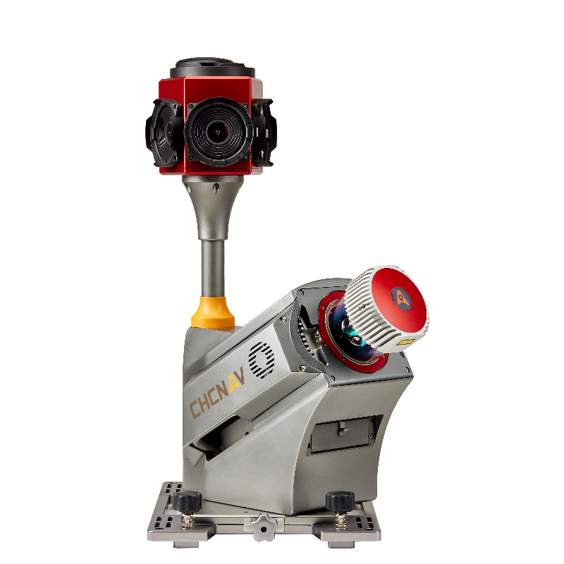
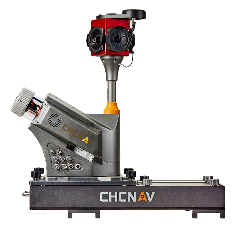
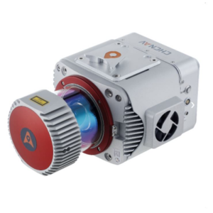
The Alpha3D combines state-of-the-art high-performance hardware, such as a long-range, ultra-high-speed, precise laser scanner, high-resolution HDR panoramic camera in combination with an advanced GNSS receiver and high precision IMU, in one instrument with lightweight and compact but at the same time rugged design. All these features keep Alpha3D as one of the most innovative mobile mapping systems in the market today.

CHC Navigation | CHCNAV
Shanghai, CN
Description
-
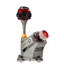
PREMIUM HIGH-PERFORMANCE LASER SCANNER
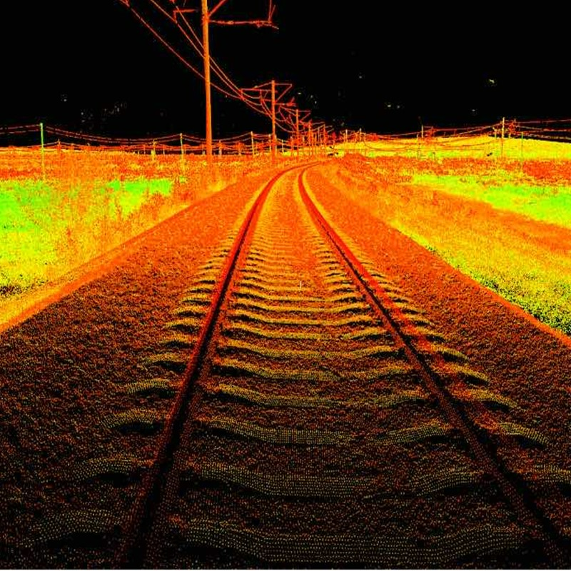
Long-range scanning up to 475 m
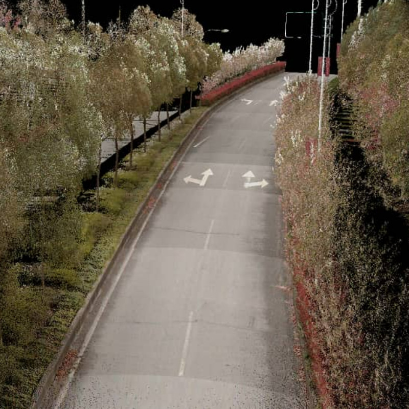
Provide high-speed scanning of 1.8 million points per second, high point cloud density even at fast driving speed, and extreme quality point cloud with low range noise.
-
HIGH-RESOLUTION 360° IMAGES
30 MP HDR panoramic camera with superb image quality
Support fully calibrated point clouds and panorama images. You can add imagery sensors to get extra information whenever your application needs it.
-
READY NOW TO ANTICIPATE FUTURE
Ready to add 2nd scanner for more density point clouds
Provide two RS232 ports for external device connection, 2nd GNSS antenna to work on railway or water applications, and an easy-in easy-out SSD hard disc for faster data transfer.
-
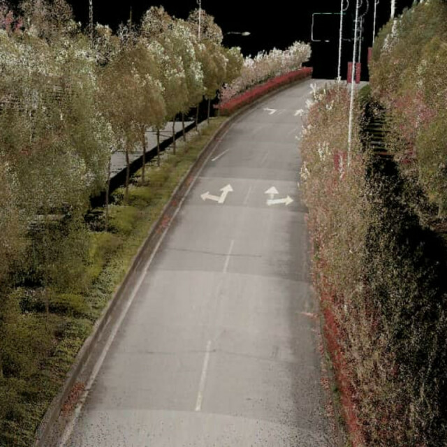
3D POINT CLOUD PROCESSING SOFTWARE
Powerful and accurate 3D point cloud generation
CoPre is an advanced, user-friendly 3D laser scanning pre-processing software that can process captured raw data, including POS trajectories, LiDAR data, and RGB images. CoProcess is a reality capture post-processing software providing DEM/DTM generation, semi-automated feature extraction, automatic data classification, and dedicated power line and road inspection modules. With its intuitive interface and efficient workflow, the software significantly improves the productivity of 3D mapping projects.
-
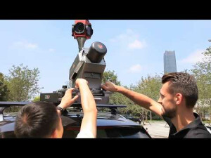
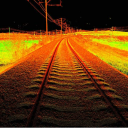
VEHICLE INDEPENDENT PLATFORM
Easily mounted on different vehicles, trains, railway trolleys, and boats.
Whatever the task is, the Alpha3D rapidly and efficiently collects high-density, accurate point clouds and robust image data but also adds extra information from additional sensors, such as a high-resolution camera, thermal camera, GPR, Echosounder, or extra profiler.
CHC Navigation offers geospatial professionals a premium, high-performance, vehicle-independent mobile mapping solution to capture 3D mass data in continuously changing world environments. Whatever the application, the Alpha3D mobile mapping system significantly increases your return on investment by completing work quickly and accurately.
The Alpha3D combines state-of-the-art high-performance hardware, such as a long-range, ultra-high-speed, precise laser scanner, high-resolution HDR panoramic camera in combination with an advanced GNSS receiver, and high precision IMU, in one instrument with a lightweight and compact but at the same time rugged design. All these features keep Alpha3D as one of the most innovative mobile mapping systems in the market today.
Do you have questions about this product?
- Questions about price, availability, and/or retailers
- Questions about technical specifications and usage
- Questions about suitability for your project or application
Specifications
-
General
-
Year of initial introduction
2019
Application
Outdoor
-
Positioning
-
GNSS receiver: Brand and model
Novatel
Number of antennas
2
Tracked GNSS signals
GPS, GLONASS, BEIDOU
Update rate of GNSS receiver
5
IMU: Brand and model
Honeywell 4930
IMU update rate [kHz]
600
Wheel sensor: Brand and model
DMI
Number of wheel sensors
1
Ground control point integration supported
N
-
Lidar Sensor
-
Max. vertical field of view [deg]
360
Brand
Riegl
Number of laser scanners
1
Laser safety classification
Level 1
Min. Range [m]
235
Max Range [m]
420
Max. measurement rate [kHz]
1000
Export formats
rxp
-
Operation
-
Max. speed [km/hr]
120
Main applications
Road, Rail, Tunnel
Training provided
Y
-
Camera System
-
Brand and model
Ladybug5+
Number of cameras
1
Spectral Bands [PAN, RGB, NIR, CIR]
RGB
FoV per camera [deg]
360
-
Dimensions & Environment
-
Weight [kg]
19.2
Min. Operation temp. [°C]
-10
Max. Operation temp. [°C]
40
Max. humidity [%]
80
-
Included Processing Software
-
Photogrammetry Software
CoPre
Laser Point Clouds Software
CoPre
Project Management Software
CoCapture
Documents
Brochure
alpha-3d-ds-en-0.pdf
1.58 MB


