USV Performs Lidar and Multibeam Survey at Trondheim Fjord in Norway
In this case study, we highlight the benefits of using the NORBIT WINGHEAD and iLiDAR integrated survey system on unmanned surface vehicles for shallow water surveys.
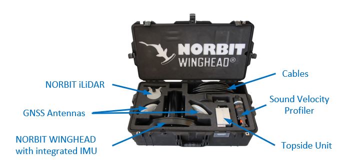
Used Sensors
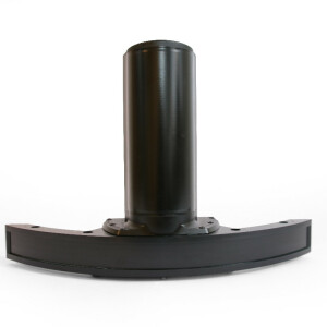
- NORBIT WINGHEAD® i77h, featuring integrated Applanix OceanMaster GNSS/INS system
- NORBIT iLiDAR
- NORBIT Sound Velocity Profiler
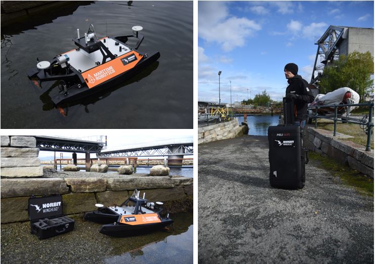
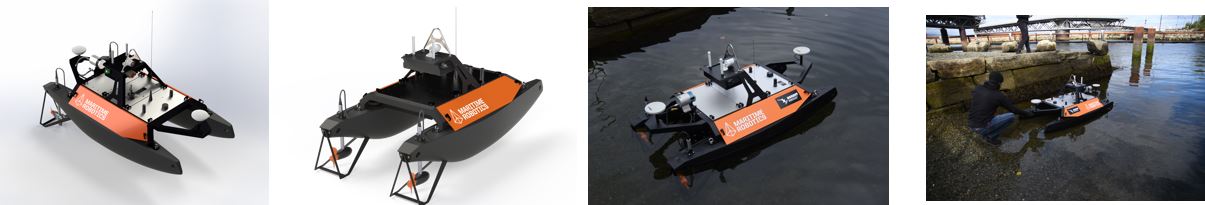
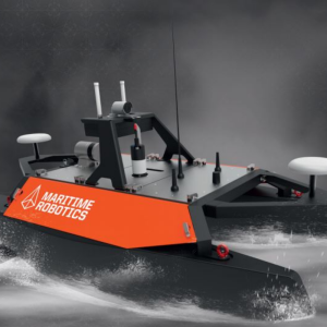
- Maritime Robotics Otter USV
WINGHEAD benefits:
- First cylindrical ultra-high resolution bathymetry sonar on the market
- 0.5 x 0.9°beam widths at 400kHz
- HD beamformer providing 1024 beams per ping
- High performance integrated GNSS/INS systems
- Integrated sound velocity probe
- Small form factor and low power consumption
- Designed for rapid mobilization on any platform
- Available with optional Lidar
The Otter is a versatile USV designed for seabed mapping and monitoring applications in sheltered waters, harbours, lakes and rivers.
- Best-in-class endurance for its size, operating up to 20 hours at 2 knots
- Max speed of 6 knots
- A payload capacity of up to 40 kg
- The modular solution easily split up into lightweight parts for easy transportation (smaller vans, boats, helicopters etc.), launch and recovery from cranes on ships or quayside
- Built-in AutoCast winch for SVP casts and planning functionality for automated deployment
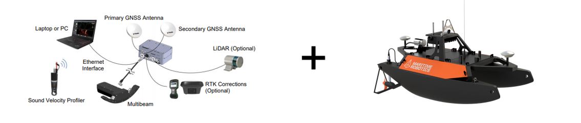
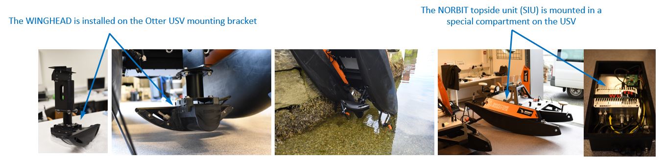
The highly integrated solution enables small form-factor and rapid deployment
- All sensors are interfaced to a small topside unit, where data is time-stamped by the integrated GNSS
- The sonar and surface SVP are interfaced to the topside unit via a single deck cable
- The GUI features an integrated INS setup wizard, as well as monitoring functions, to simplify the setup
- The survey system interfaces to an on-board computer via Ethernet connection for data acquisition
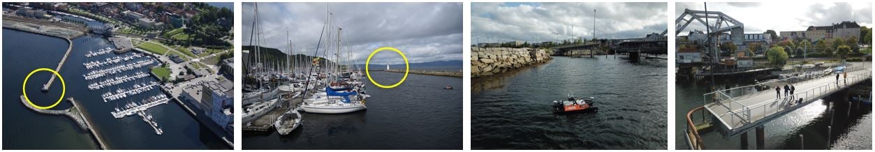
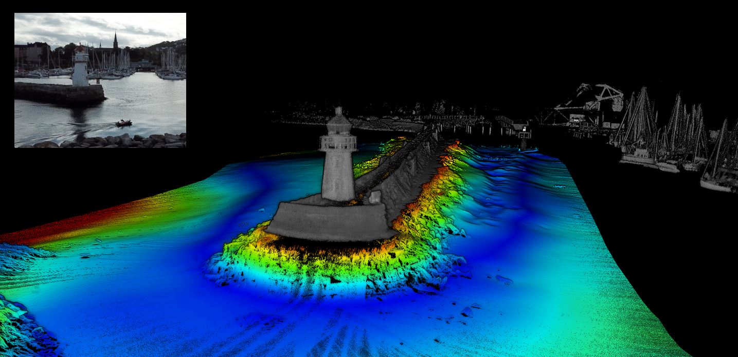
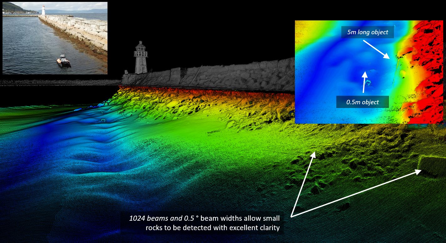
Skansen is a historic area in the city of Trondheim, Norway. A fortification in older days, it is now well known for its marina, train station and the Skansen Bridge, a 52m span bascule railway bridge that can open for marine traffic to access the Trondheim Fjord. The Skansen Bridge was designed by structural engineer Joseph Strauss, who also designed the Golden Gate Bridge in San Francisco. The main goal of the survey was to perform the inspection of the jetty and investigate if there has been any displacement of rocks forming the jetty. The survey was controlled remotely from the Skansen Bridge.
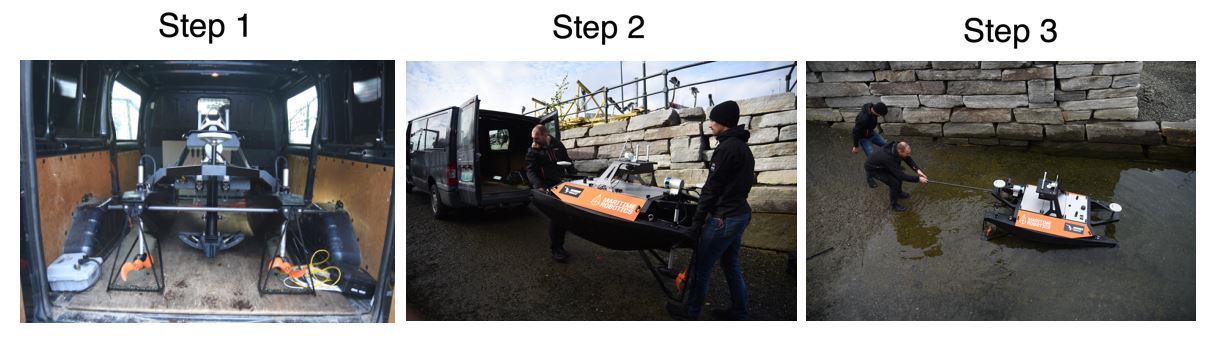
The entire system is designed for rapid mobilization and deployment.
- The USV is lightweight and can be transported in a van
- Easily deployed from a slipway, with all sensors pre-mounted on the USV
- Survey offsets are fixed and known, thus no measurements are required
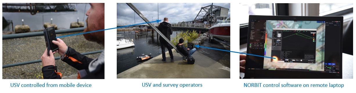
The entire system is controlled remotely from the quayside.
- The Otter USV is manoeuvred using a mobile device
- Easy-to-use control software is used to plan the survey and collect data
- All data is time-synchronized internally
- RTK GNSS positioning using Internet-based corrections (no cables, base stations or radios)
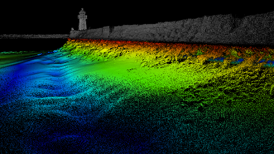
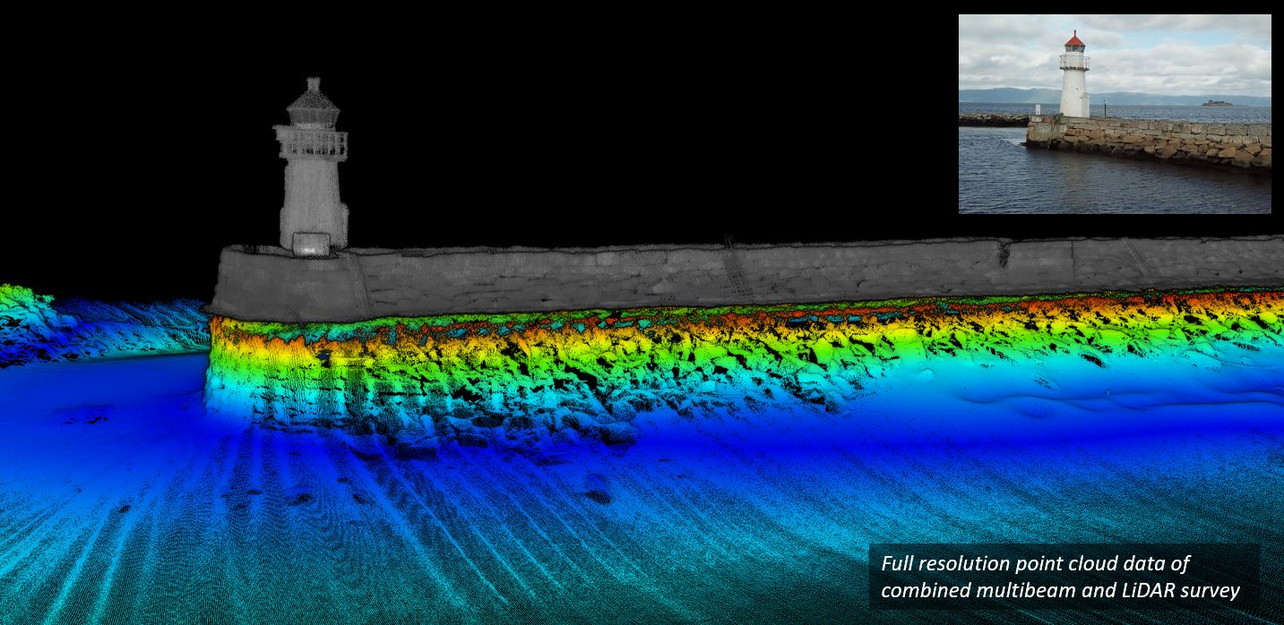
Combining NORBIT WINGHEAD and Lidar with the Otter USV enables a surveyor to get high-resolution data while drastically minimizing the mobilization time. The combination of NORBIT Multibeam and Lidar technology enables surveyors to collect point cloud data above and below the waterline from a portable, unmanned platform.
NORBIT’s curved array technology allows the beams to be steered electronically up to the waterline without having to physically rotate the sonar, which is ideal for combined Multibeam and Lidar surveys and allows the seamless transition between the two data types. Curved arrays produce narrower beams (higher resolution) across the entire swath compared to an equivalent flat array system. The combination of 1024 beams and 0.5°beam widths provides ultra-high-resolution point cloud data and facilitates the detection of small targets such as rocks, ropes, chains, anchors, etc. which may be hazardous to navigation in shallow harbours. The USV can operate in shallow, difficult-to-reach areas where it is difficult for conventional survey vessels to navigate.
Do you have questions about this case study?
Get in touch with Maritime Robotics, and they would be happy to answer any questions you have about pricing, suitability, availability, specs, etc.


![Do-Giant-Tortoises-Make-Good-Neighbors-1[1].jpg](https://cdn.geo-matching.com/vRMO2Edp.jpg?w=320&s=a6108b2726133ff723670b57bc54c812)


