Producing and Processing Canopy Height Models in Steep Terrain
The canopy height model (CHM) refers to the vertical distance of the branches and leaves of the forest canopy from the ground. It is the main parameter reflecting the structure and shape of the forest canopy. As an active remote sensing system, LiDAR has the characteristics of low cost, high operation efficiency, and can penetrate the vegetation area to return to the ground point echo. It is widely used to extract forest parameters, such as tree height, DBH, canopy volume, height, etc.
Usually, CHM is obtained by subtracting the digital surface model (DSM) from the digital elevation model (DEM). This formula will meet most CHM production requirements in most terrain settings. However, steep terrain can be sporadic and uneven. Using the above methods will lead to inaccurate canopy height calculated where terrain faults are located, causing spikes in the generated results. These results will not meet CHM industry standards.
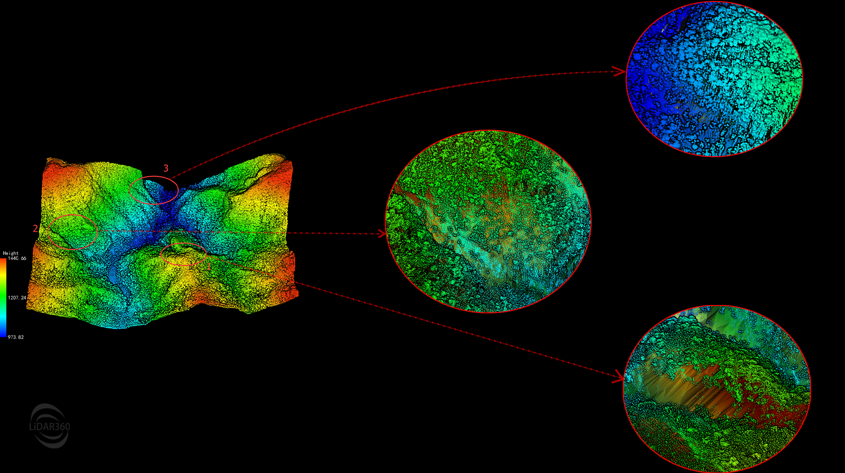
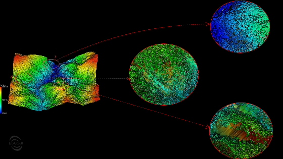
Topographic Fault Point Cloud Overlay TIN - Zoomed-In Locations Examined are the Subjects of Spiked Readings
LiDAR360 (V5.3) improves CHM production involving steep terrain for spiked occurrences In this example, we use the LiDAR360 "software's Toolbox > Data Management > > Point Cloud Tools > Denoising" to make the necessary corrections.
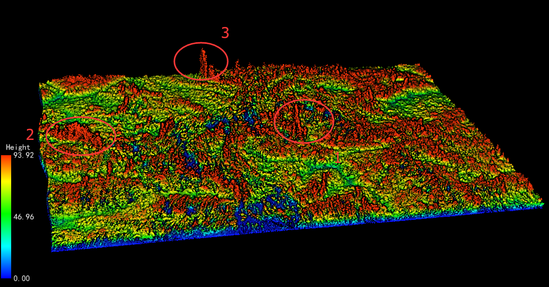
Spiked results at Topographic Faults – Pre-processed Example
The steps are as follows:
- Denoising: Toolbox > Data Management > Point Cloud Tools > Remove Outliers. Remove outliers, low points, etc., from the raw data to avoid the impact of noise on subsequent data production.
- Ground point classification: Toolbox > Classify > Classify Ground Points. Select the corresponding terrain scene according to the terrain of the survey area, and separate the ground points and non-ground points.
- Vegetation point classification: Toolbox > Classify > Classify by Deep Learning. Check the "Classify To Vegetation" option.
- Normalize based on ground points: Toolbox > Data Management > Point Cloud Tools > Normalize by Ground Points. Normalize the data to remove the influence of terrain fluctuations on the height of trees.
- Generate CHM: Toolbox > Terrain > DSM. Use the normalized point cloud data to generate a normalized digital surface model (nDSM), and select the vegetation classes in the “From Class” drop-down menu.
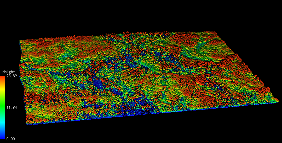
TheDespiked Data at Faults – Post-processed Results
Normalization can remove the effects of topographic relief, removing surface elements on the elevation value of point cloud data. Building a normalized digital surface model (nDSM) with the vegetation point cloud, and the generated nDSM is also equal to CHM. Note: If using the TIN interpolation method is preferred, use the TIN generated by the Spike Free TIN method to generate DSM.
Do you have questions about this case study?
Get in touch with GreenValley International, and they would be happy to answer any questions you have about pricing, suitability, availability, specs, etc.


![Do-Giant-Tortoises-Make-Good-Neighbors-1[1].jpg](https://cdn.geo-matching.com/vRMO2Edp.jpg?w=320&s=a6108b2726133ff723670b57bc54c812)


