


LiDAR360 V7
Map the World in 3D
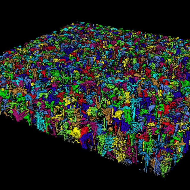
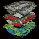
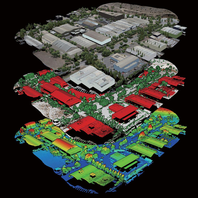
Launched in 2013, LiDAR360 is a professional processing platform for massive point cloud data Ldeveloped by GreenValley International. The platform employs over ten different types of international leading point cloud algorithms, artificial intelligence, and machine learning to promote the use of LiDAR across the industry and solve users' application problems while unlocking the full potential of their point cloud data. The software can analyze and process massive point cloud data, adapts to multiple platforms and devices, and provides more than 700 functions for efficient support of multi-industry applications. Up to now, the number of downloads has exceeded 100,000 worldwide, and the LiDAR360 is used actively in more than 130 countries and regions, receiving an array of praise from clients, contractors, governments as well as tertiary and research institutions.

GreenValley International
Berkeley, US
Description
300GB of Massive Data Processing
Multi-Source Data Fusion
Full Attributes Rendeing
Customized Workflows
One-Click Process Based Operation
Comprehensive Industry Application Processing
Do you have questions about this product?
- Questions about price, availability, and/or retailers
- Questions about technical specifications and usage
- Questions about suitability for your project or application
Specifications
-
Hardware/software requirements
-
RAM [GB]
8
HD [GB]
64
Use of GPU
Y
Processor
["64-bit"]
Stereo Display
Y
Stand-alone
Yes
List software environment, e.g. Microstation
Stand-alone
-
Other
-
Support
online / phone / user meetings
Typical applications
Powerline, BIM, Forestry, Mining
Distinguishing features
Model generation, swath alignment, regression modeling, danger points, etc
-
Files and Registering
-
Input formats
las, ply, pcd, kml, csv, lidata, limodel, etc.
Output formats
las, ply, pcd, kml, csv, lidata, limodel, etc.
Max. file size (#3D points)
32
Geo-referencing
Y
Automatic Target Detection
Y
Stitching multiple scans
Y
-
Pre-processing and Automatic Filtering
-
Image matching facilities
Y
Removal of individual outliers
Y
Removal of vegetation
Y
Removal of buildings
Y
Bare ground DEM generation
Y
-
Manual Measurements
-
3D Coordinates extraction
Y
Length and Height
Y
Angle
Y
Distance
Y
Area
Y
Volume
Y
-
Interoperability
-
CAD software
No
Hydrological software
No
Assigning colour from imagery to points
Y
Image overlay on TIN
Y
Integration with other data types
No
-
General
-
Year of last update
2022
Year of initial introduction
2016
Modules
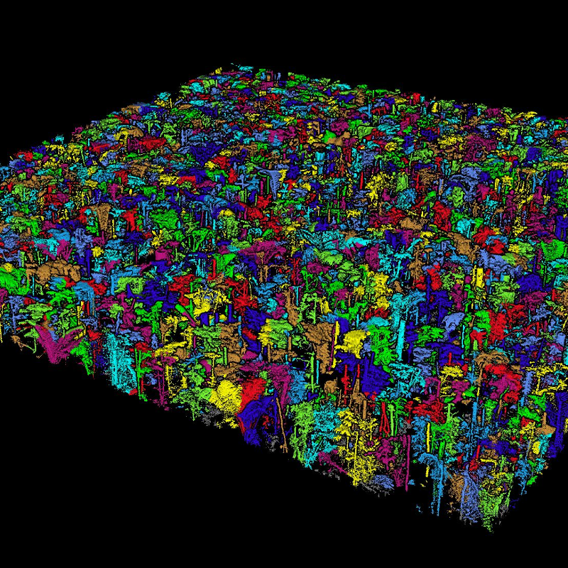
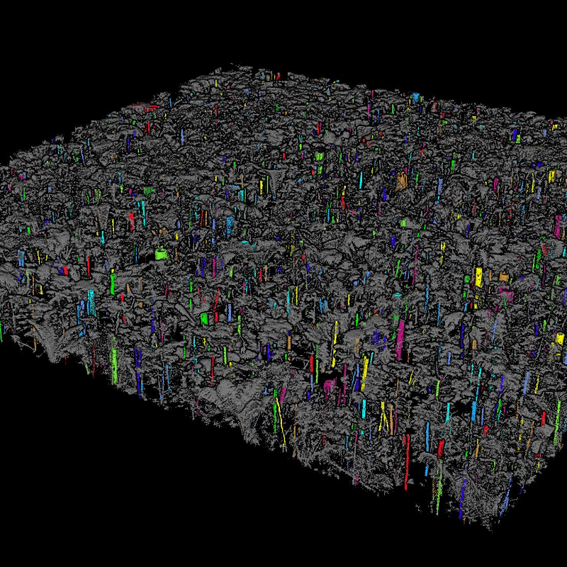
Terrain, ALS/TLS Forestry, Powerline, Geological Analysis, Building Modeling
Source of Point Clouds
Airborne Lidar, Indoor TLS, Outdoor TLS, Photogrammetric
Supported Systems
UAV, handheld, terrestrial, mobile
-
Analysis
-
Line of sight
Y
Aspect and slope
Y
Individual tree heights
Y
Simulation facilities
no
Time series analysis
Y
-
Automatically Generated Products
-
Regular Grid DEMs
Y
Cross sections
Y
TIN
Y
Contour Lines
Y
Break lines
Y
Boundary detection of solids
Y
Building footprints
Y
Building roofs
Y
3D City modelling
no
-
Solid Modelling
-
Lines
Y
Planes
Y
Cubes
Y
Spheres
Y
Cylinders
Y
NURBS
Y
Industrial features
no
Earth surface features
trees
-
Visualisation and Editing
-
Zoom, pan and rotate
Y
Fly-throughs
Y
Adding Points
Y
Removing Points
Y
Point Reduction
Y
Documents
Brochure
EN-LiDAR360 V7.0.pdf
23.33 MB

Videos

