Discover How UAV-based LiDAR Has Transformed the Surveying Industry
Learn how Pape-Dawson Engineers use the Phoenix LiDAR RANGER-LITE UAV-based LiDAR to safely and efficiently perform existing conditions topographic surveys.
Challenge
Pape-Dawson Engineers is the largest civil engineering firm headquartered and exclusively located, in Texas with a staff of over 700 employees. Their team of professionals provide civil engineering, surveying, GIS, and environmental services for land development, transportation, and water resources projects for both private and public clients.
Pape-Dawson’s surveyors and engineers are faced with demanding projects with fast turnaround times. Daily challenges include mapping densely vegetated GNSS-denied sites with line-of-site obstructions, access issues, and large-scale sites requiring a daunting number of detailed feature measurements - to name a few.
Solution
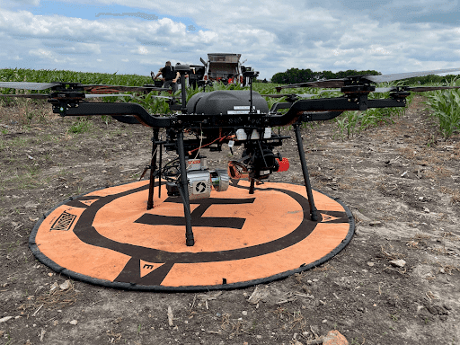
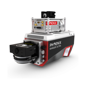
The Pape-Dawson team leverages the power of UAV-based LiDAR to safely and efficiently perform existing conditions topographic surveys. Using the Phoenix LiDAR RANGER-LITE, the team can densely collect site measurements in 1 day compared to weeks on the ground using conventional surveying methods. The enhanced resolution of the LiDAR data adds the value of unparalleled feature extraction.
Application
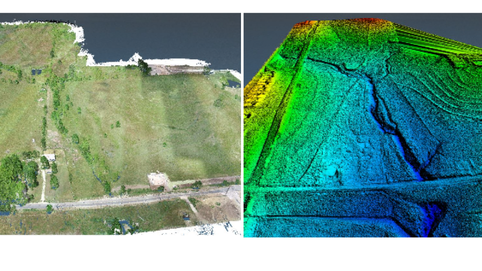
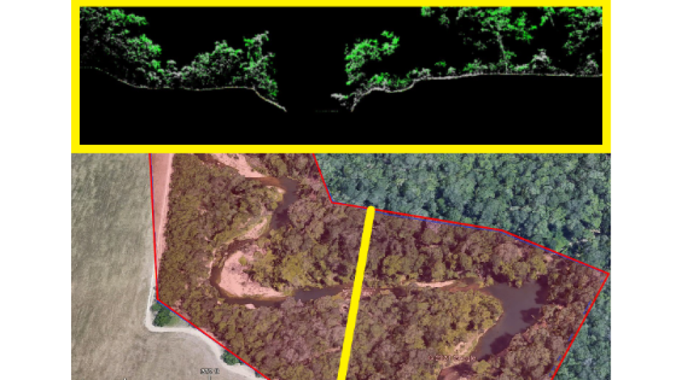
Pape Dawson mapped two miles of riverbank for a client interested primarily in the features at the top of the bank on one side. Their team mapped the site within 45 minutes leveraging the UAV-based RANGER-LITE system. They collected the river bank of interest as well as the other bank, and even captured the exposed river bed features. Their team delivered the necessary data deliverables in two days, while simultaneously working on other projects.
Parameters
✓ Scope: 2 mile river corridor
✓ Acquisition Time: 45 minutes
✓ Processing Time: 2 days
Results
Heavily vegetated sites used to take Pape-Dawson’s surveyors several days to cut lines through vegetation in preparation for data collection. Now, the team lets the RANGER-LITE do the heavy lifting, mapping large-scale and complex vegetated sites in under an hour. Accurate existing conditions surveys are critical, especially as it pertains to mass grading or dirt quantity calculation projects. They now capitalize on the enhanced resolution and accuracy provided by the RANGER’s LiDAR data for faster and more accurate quantity takeoffs, saving their team time and saving their customers money.
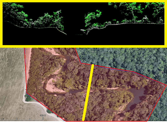
Top: LiDAR data cross-section shows the profile of ground returns under dense vegetation. Bottom: river corridor area of interest shown in red. Cross section location represented by a yellow line.
Do you have questions about this case study?
Get in touch with Phoenix LiDAR Systems, and they would be happy to answer any questions you have about pricing, suitability, availability, specs, etc.


![Do-Giant-Tortoises-Make-Good-Neighbors-1[1].jpg](https://cdn.geo-matching.com/vRMO2Edp.jpg?w=320&s=a6108b2726133ff723670b57bc54c812)


