
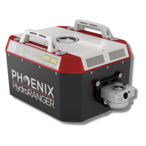
RANGER-ULTRA
The Ultimate Corridor Mapping System
Survey-Grade (cm-level) accuracy with 250m+ laser range and outstanding intensity calibration on high altitude and high-speed missions.
Phoenix LiDAR Systems
Austin, US
Description
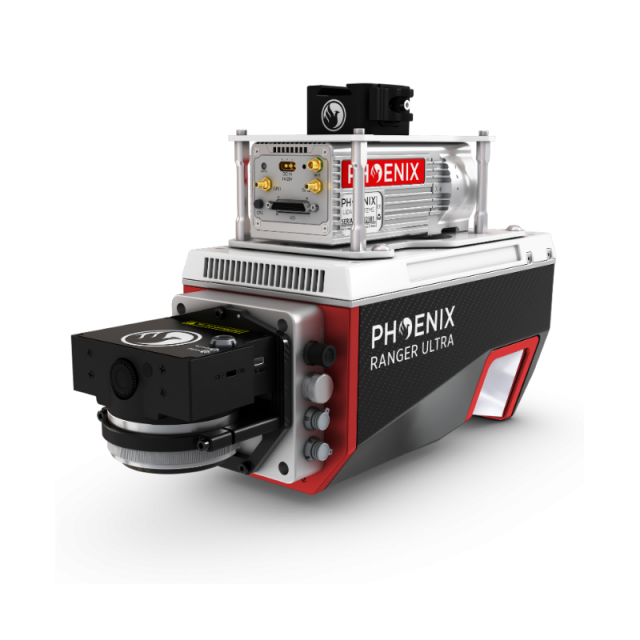
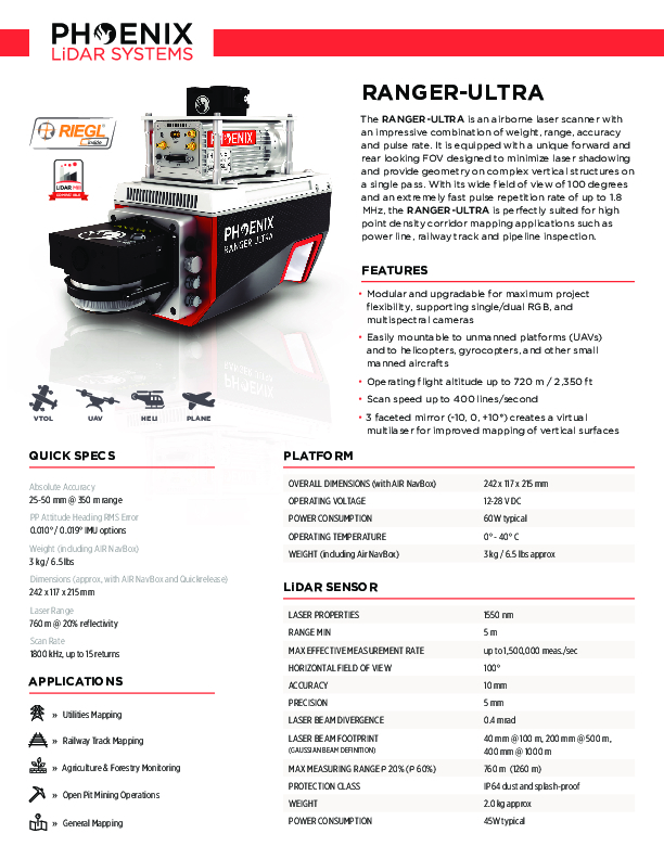
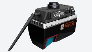
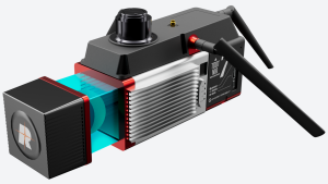
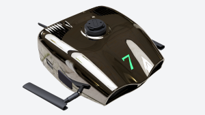
The RANGER-ULTRA is an airborne laser scanner with an impressive combination of weight, range, accuracy and pulse rate. It is equipped with a unique forward and rear looking FOV designed to minimize laser shadowing and provide geometry on complex vertical structures on a single pass. With its wide field of view of 100 degrees and an extremely fast pulse repetition rate of up to 1.8 MHz, the RANGER-ULTRA is perfectly suited for high point density corridor mapping applications such as power line, railway track and pipeline inspection.
Features:
-
Modular and upgradable for maximum project flexibility, supporting single/dual RGB, and multispectral cameras.
-
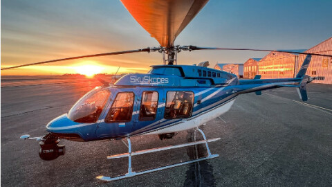
Easily mountable to unmanned platforms (UAVs) and to helicopters, gyrocopters, and other small manned aircraft.
-
Operating flight altitude up to 720 m / 2,350 ft.
-
Scan speed up to 400 lines/second.
-
3 faceted mirror (-10, 0, +10°) creates a virtual multilaser for improved mapping of vertical surfaces.
Quick Specs:
-
Absolute Accuracy = 25-50 mm @ 350 m range.
-
Weight = 3 kg / 6.5 lbs.
-
Dimensions = 242 x 117 x 215 mm.
-
Pulse Rate = 1800 kHz, up to 15 returns.
-
Laser Range = 760 m @ 20% reflectivity.
Specifications
-
Application
-
Main applications
Utility Infrastructure, Railway Track Mapping, Agriculture & Forestry Open Pit Mining, General Mapping
Distinguishable features
High altitude laser
Training, maintanence and support
1 year warranty on defective hardware or software issues. Training and support can be included with purchase.
-
Measurement Characteristics
-
Range accuracy [mm]
10
Max. pulse frequency [Hz]
1,800,000
Max. field of view [degrees]
100
Max. number of recorded echoes per pulse
15
Scanning method
rotating, multifaceted mirror
Scanning Speed [measurements p second]
1500000
multiple pulses in air
Y
Min. pulse frequency [Hz]
150,000
Recording of intensity of return signal [bits]
16
-
Physical Properties
-
Height [cm]
21.5
Length [cm]
24.2
Width [cm]
11.7
Weight [kg]
3
Water and dust proof
IP64
-
Laser Pulse Characteristics
-
Wavelength [nm]
1550
Beam divergence [mrad]
0.4
Min. range of laser pulse [m]
5
Max. range of laser pulse [m]
440
Laser Class
Class 1
-
Power Supply
-
Power consumption
60W typical
Power requirements
14-28V
Type of battery
recommended 6S LiPO
-
Positioning System
-
Type of INS or IMU
Several different IMU choices, including both FOG and MEMS IMUs.
Number of GNSS positioning sensors
1
Type of GNSS positioning sensors
GNSS unit that supports mutli-band signal tracking for all constelations, dual antenna functionality, and up to 100 Hz data rate.
Typical positioning accuracy [cm]
1
Heading, Pitch and Role internally captured
Y
Gyroscopes Bias In-Run stability [deg p hr]
Dependent on IMU choice
-
Operation Characteristics
-
Mounting
Easily mountable to unmanned platforms (UAVs) and to helicopters, gyrocopters, and other small manned aircrafts.
Requirements for compatible UAVs
Phoenix Dovetail
Camera included
Optional
Camera specifications
Depends on camera
Control and user interface
PC software interface capable of displaying real time, georeferenced returns via 5.8 GHz WiFi connection, or a more simplified push-button interface.
-
Data and Software
-
Type of storage
flash card
Max. storage space [mb]
1000000
Included software
Includes software for point cloud creation and data acquisition - trajectory processing software can also be purchased.
-
General
-
Year of last update
2021
Year of introduction
2021
Documents
Brochure
pls-ranger-ultra-spec-sheet.pdf
1.5 MB
Videos


