Case study | Drone-based Echo Sounder overcomes the obstacles to surveying physically inaccessible areas
Accurate data collection in challenging environments has always been a hurdle in bathymetric surveying and mapping. Physical access limitations and traditional methods often hinder efficient data acquisition, increasing costs and time consumption. To address these issues, SPH Engineering has introduced an innovative drone-based solution for bathymetry - an Integrated System consisting of the Echo Sounder & SkyHub System.
This case study delves into the transformative impact of this system, specifically in small-scale survey areas where physical access is restricted or traditional methodologies could be more practical.
Client
Urban Systems Ltd., an Environmental consulting firm.
Challenge
Our Client had a clear goal: mapping, measuring, and inspecting inland storm ponds and wetlands in areas with restricted physical access or where conventional methods are impractical posed formidable challenges. These sites were characterized by rugged terrains and limited accessibility, posing significant challenges to accurate data collection. Our client needed a solution that would enable them to overcome these obstacles, reduce costs, and speed up the survey process.
Solution
The Integrated System of Echologger ECT D052 Echo Sounder and SkyHub onboard computer with True Terrain Following system was the ideal solution for the client's surveying needs. The system combines a Dual-Frequency Echo Sounder with a True Terrain-Following system, all integrated into the SkyHub onboard computer.
Dual-Frequency Echologger ECT D052S echo sounder employs advanced sonar technology for precise depth measurements, even in challenging underwater conditions. This technology ensures high-resolution data collection, which is crucial for accurate mapping and measurement.
True Terrain-Following system is a game-changer for surveying in complex environments. It allows the system to maintain a consistent altitude above the terrain, even when encountering elevation changes. This ensures continuous measurements with survey-grade accuracy, reducing the risk of data gaps or errors.
SkyHub onboard computer integration with the Echo Sounder enables autonomous and efficient survey missions. The system can be programmed to follow predefined waypoints, towing the echo sounder through the water at optimal speeds (0.7-0.9 m/s). This autonomy minimizes human intervention and enhances data consistency.
Outcome
The implementation of the Echo Sounder Integrated System yielded significant advantages and outcomes for our client:
Cost Efficiency: The system's autonomous survey missions eliminated the need for manual labor in hazardous or hard-to-reach areas, resulting in substantial cost savings.
Time Savings: Due to challenging terrains, traditional surveying methods would have consumed considerably more time. The system's swift and accurate data collection capabilities led to a reduction in overall survey duration.
Data Accuracy: The combination of the dual-frequency echo sounder and terrain-following altimeter ensured the highest level of data accuracy. This precision is essential for well-informed decision-making and compliance with regulatory requirements.
Access to Challenging Areas: The system's adaptability to rugged terrains and areas with limited access allowed the client to survey previously unreachable locations.
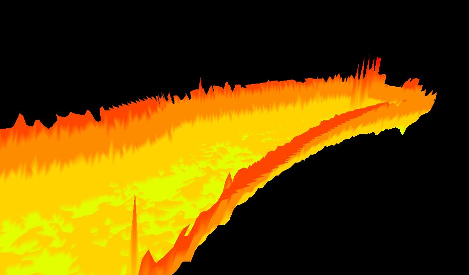
3D model of the pond’s bottom.
Integrated System with the Echo Sounder from SPH Engineering demonstrated its prowess in revolutionizing bathymetric surveying in challenging environments. By effectively addressing the limitations of traditional methods and providing a cost-efficient, time-saving, and accurate solution, the System empowered the Client to accomplish their surveying goals with unprecedented ease and precision. This case study stands as a testament to the potential of innovative technology in reshaping the landscape of bathymetric surveying and mapping.
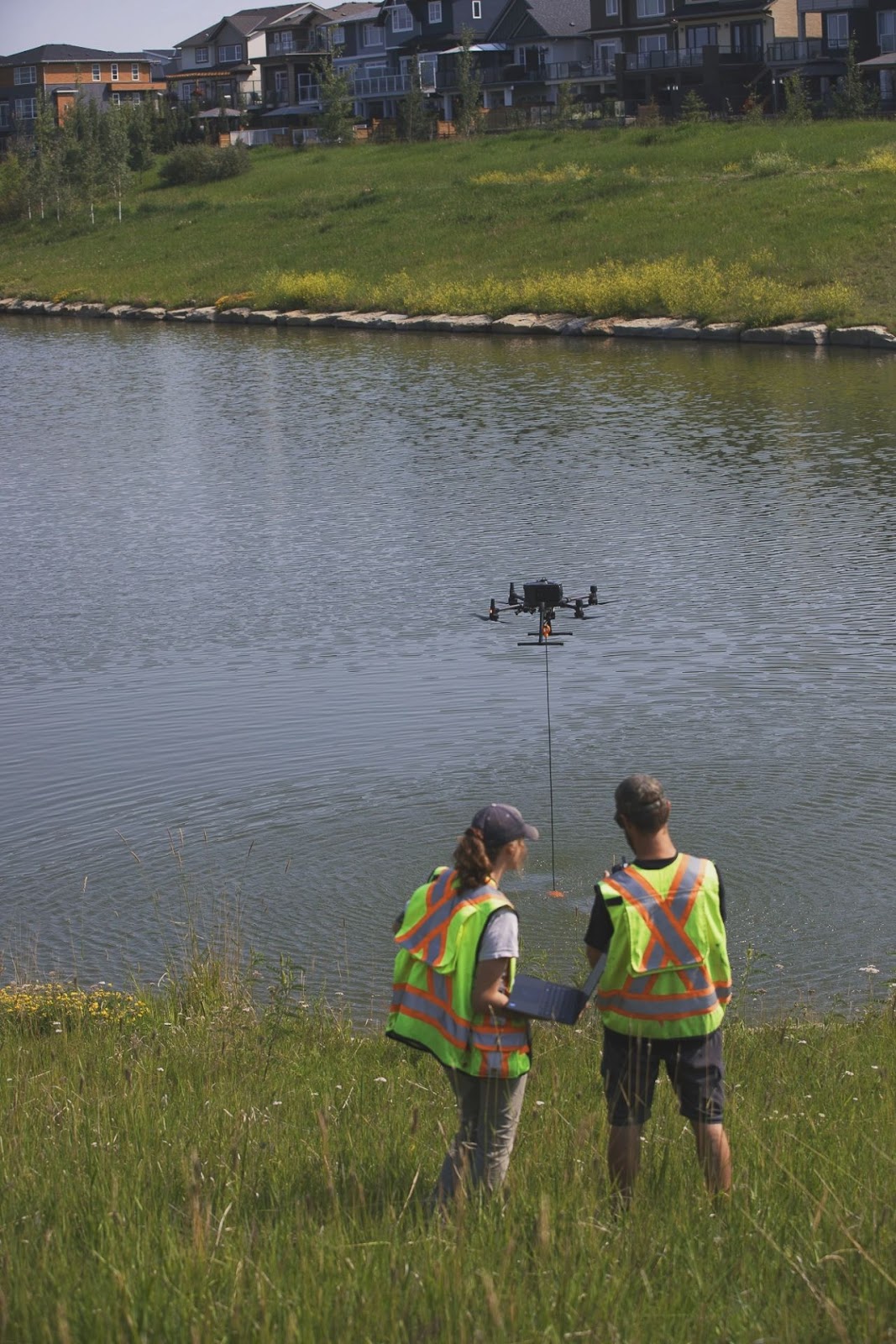
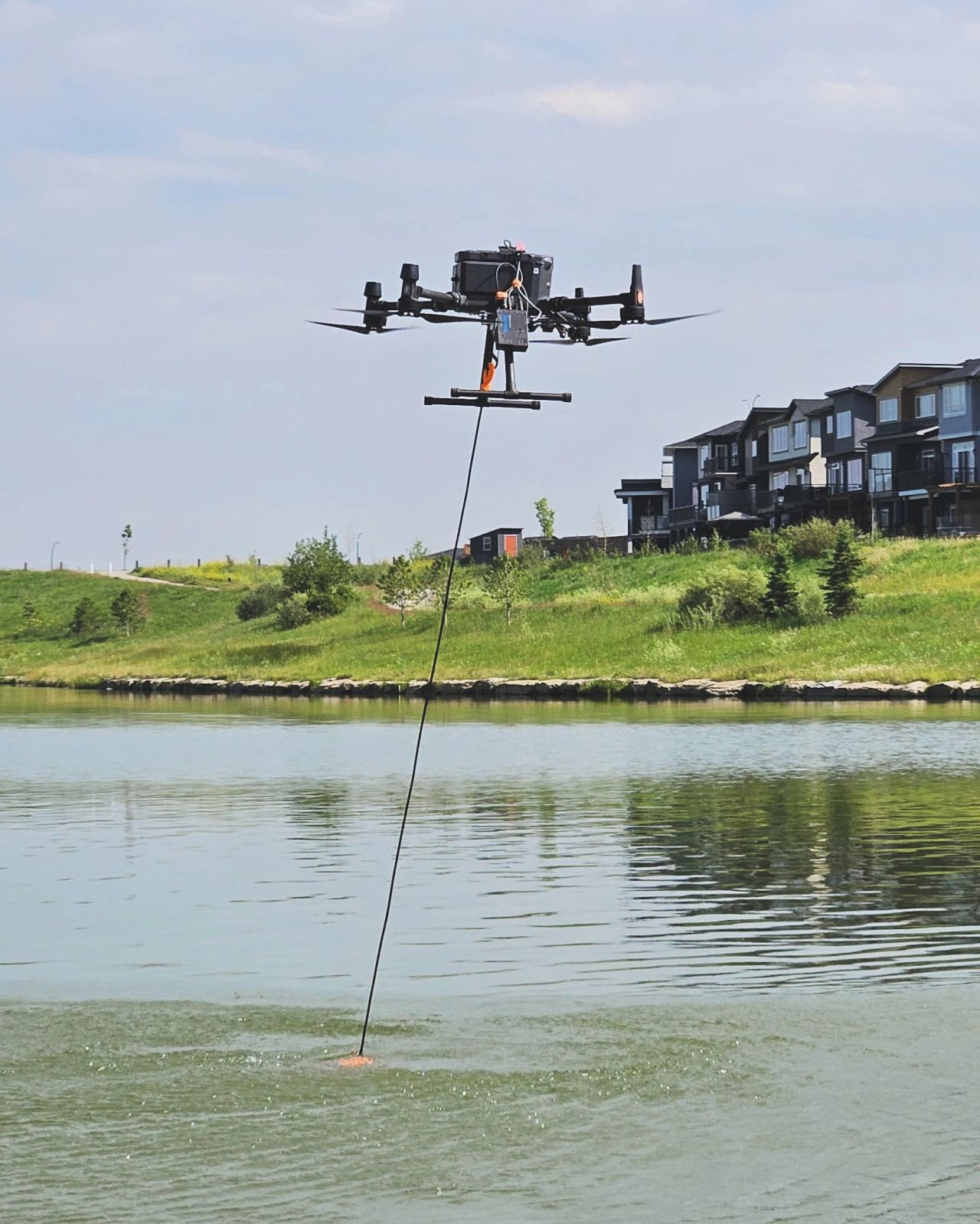
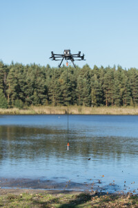
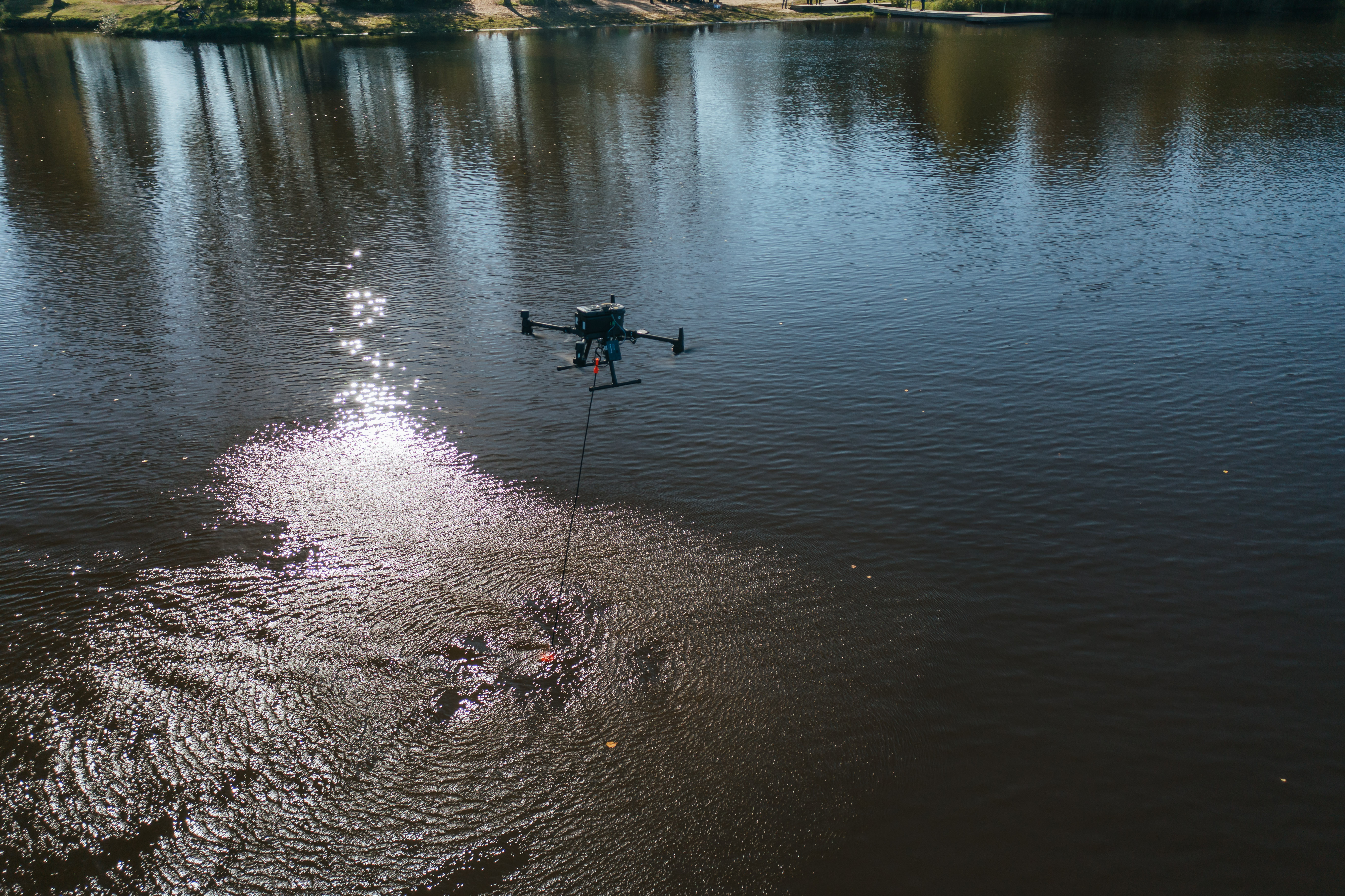
SPH Engineering Integrated System with Echo Sounder during the Pond Survey.
The pictures are available as a courtesy of Urban Systems Ltd.
Do you have questions about this case study?
Get in touch with SPH Engineering, and they would be happy to answer any questions you have about pricing, suitability, availability, specs, etc.

Related products


![Do-Giant-Tortoises-Make-Good-Neighbors-1[1].jpg](https://cdn.geo-matching.com/vRMO2Edp.jpg?w=320&s=a6108b2726133ff723670b57bc54c812)


