


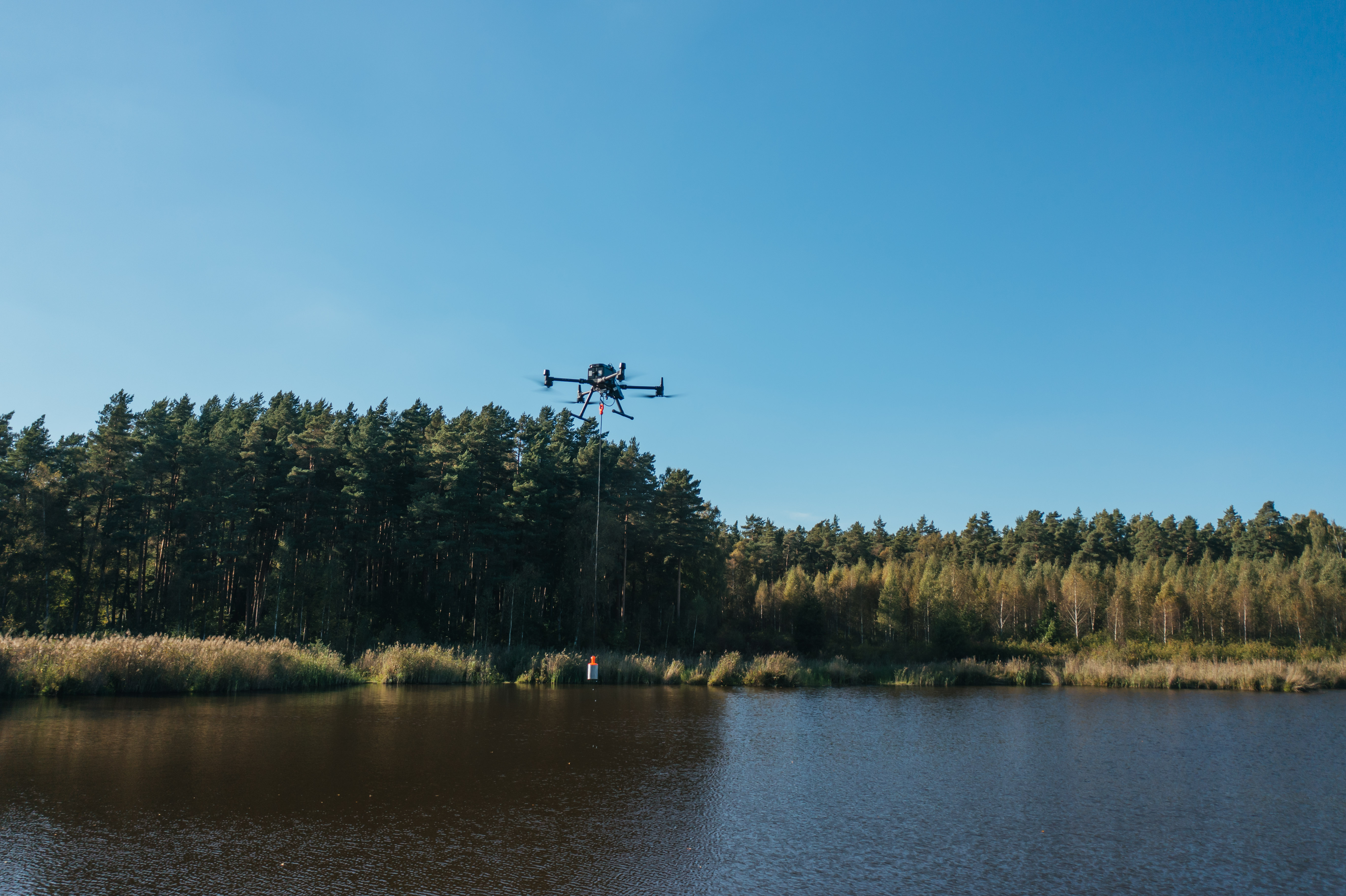
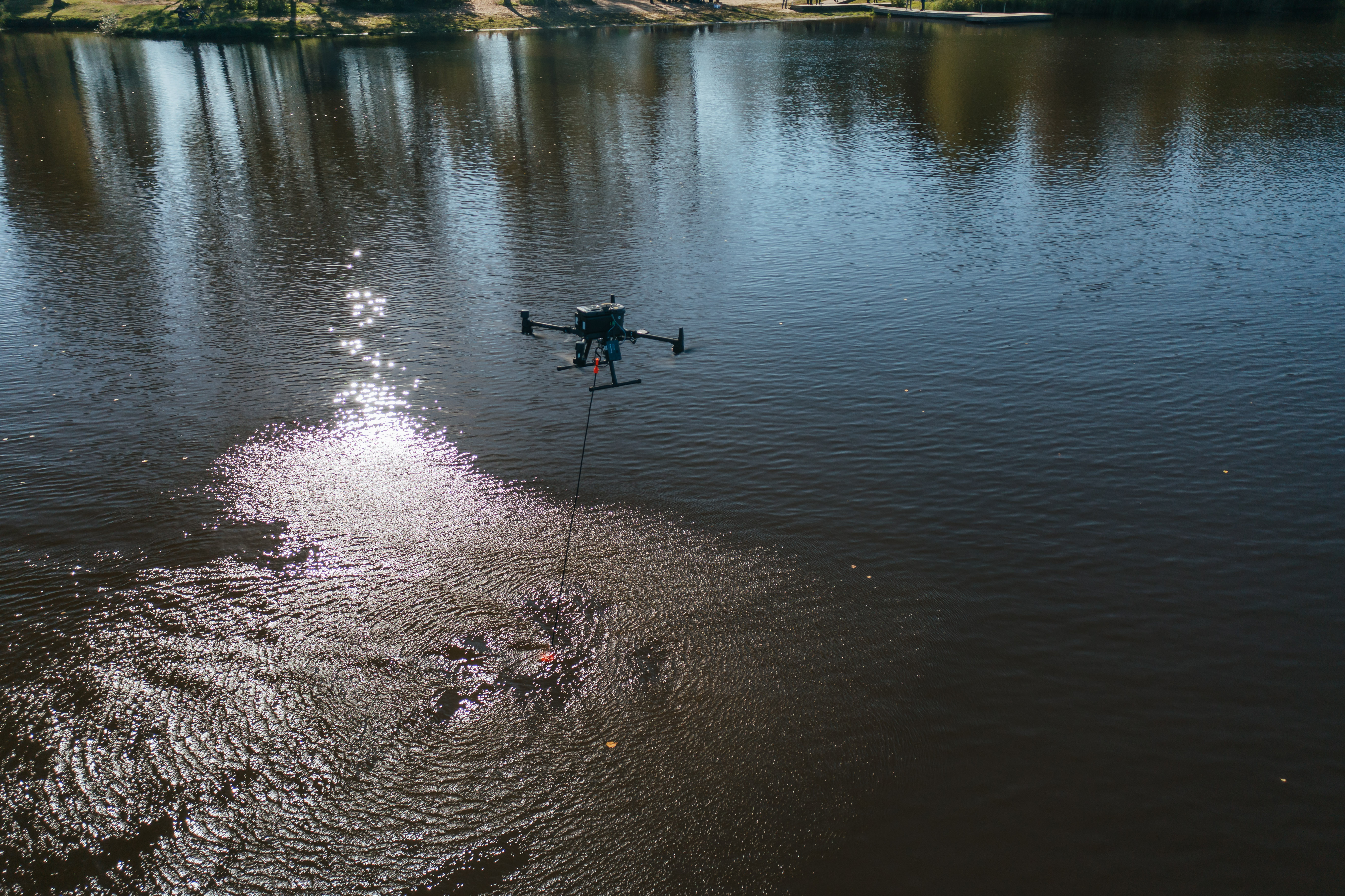

Single-frequency Echo Sounder for Drone System
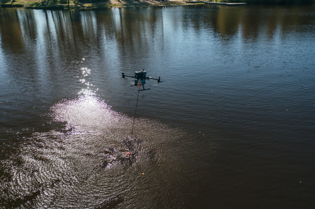
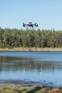
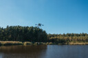
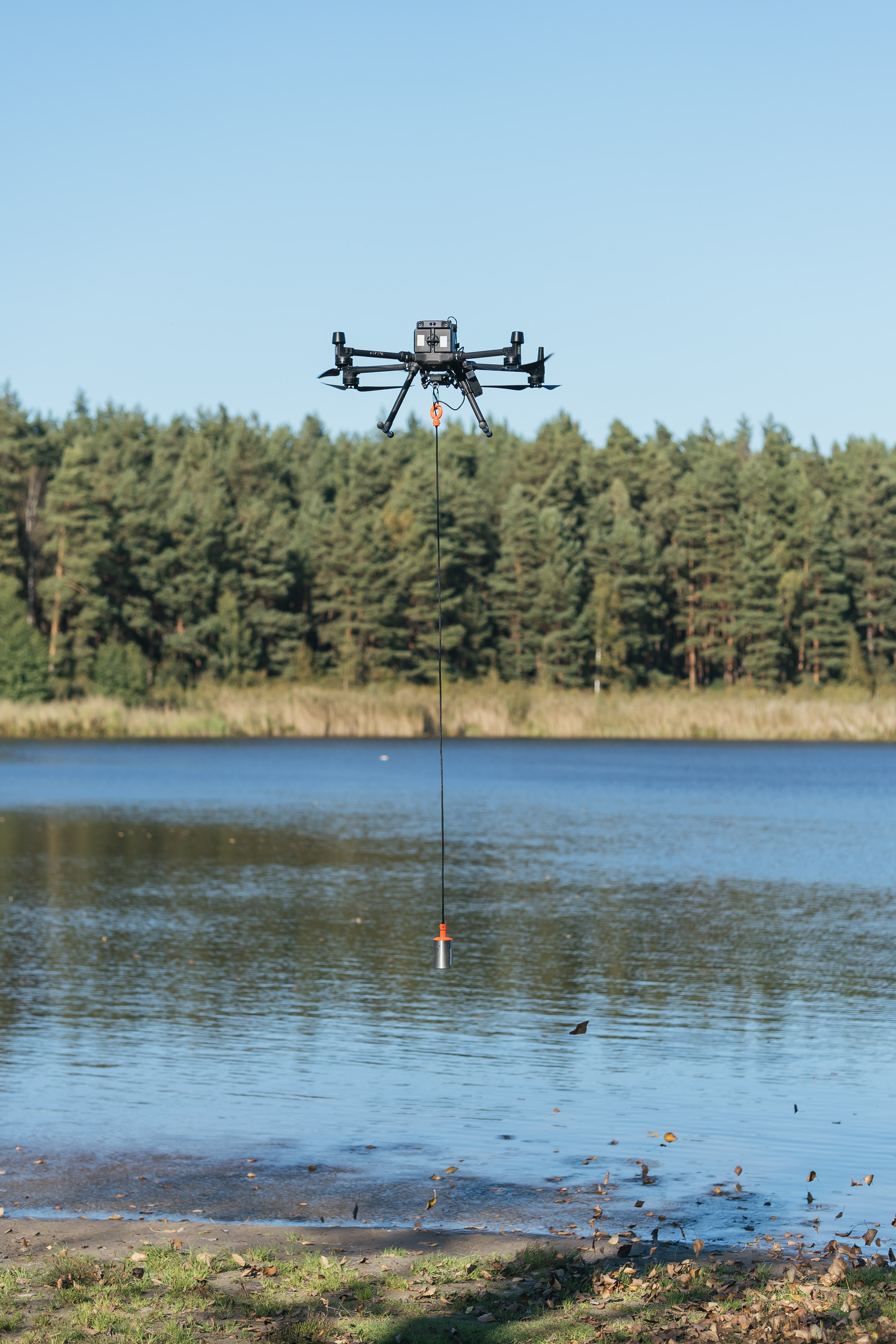
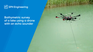
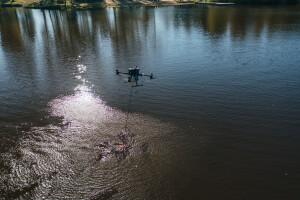
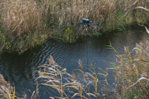
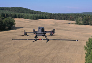
Bathymetry measures the depth of water in oceans, rivers, or lakes. The standard measurement tool for bathymetry is an echo sounder, and the survey process involves using a ship, boat, or unmanned surface vehicle (USV) as a platform for the sensor. An alternative is to fly a drone (UAV) to carry the echo sounder. A drone is compact and easy to transport and deploy. Drones also have a high precision of following planned survey lines and can be used anywhere where there is at least a small area for take-off and landing near the surveyed water surface.

SPH Engineering
Balozi, LV
Description
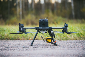
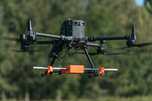
The integrated drone system for bathymetry includes the following:
A commercially available drone like DJI M350 RTK, DJI M300 RTK, M210, or M600 Pro (as well as drones based on the Pixhawk autopilot)
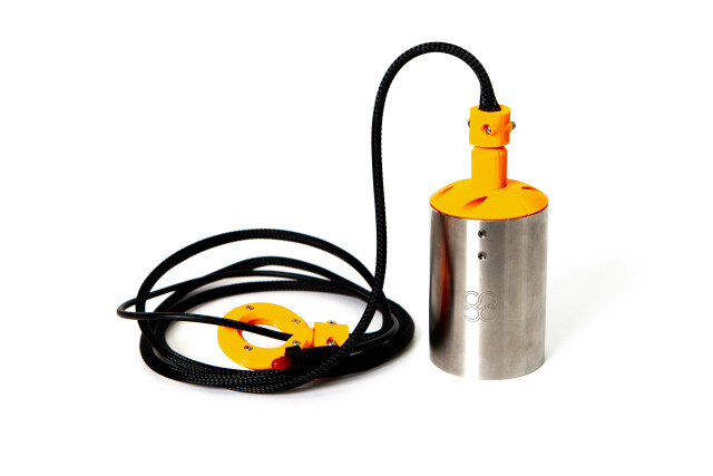
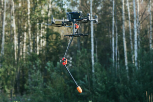
Echo sounder sensor on a rope
Radar altimeter to measure the precise altitude of the drone over the water surface
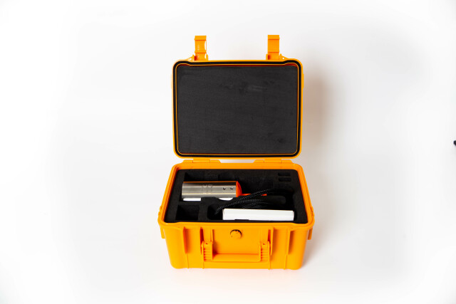
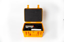
On-board SkyHub computer to control the mission and store geotagged measurements
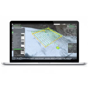
UgCS Expert ground control software
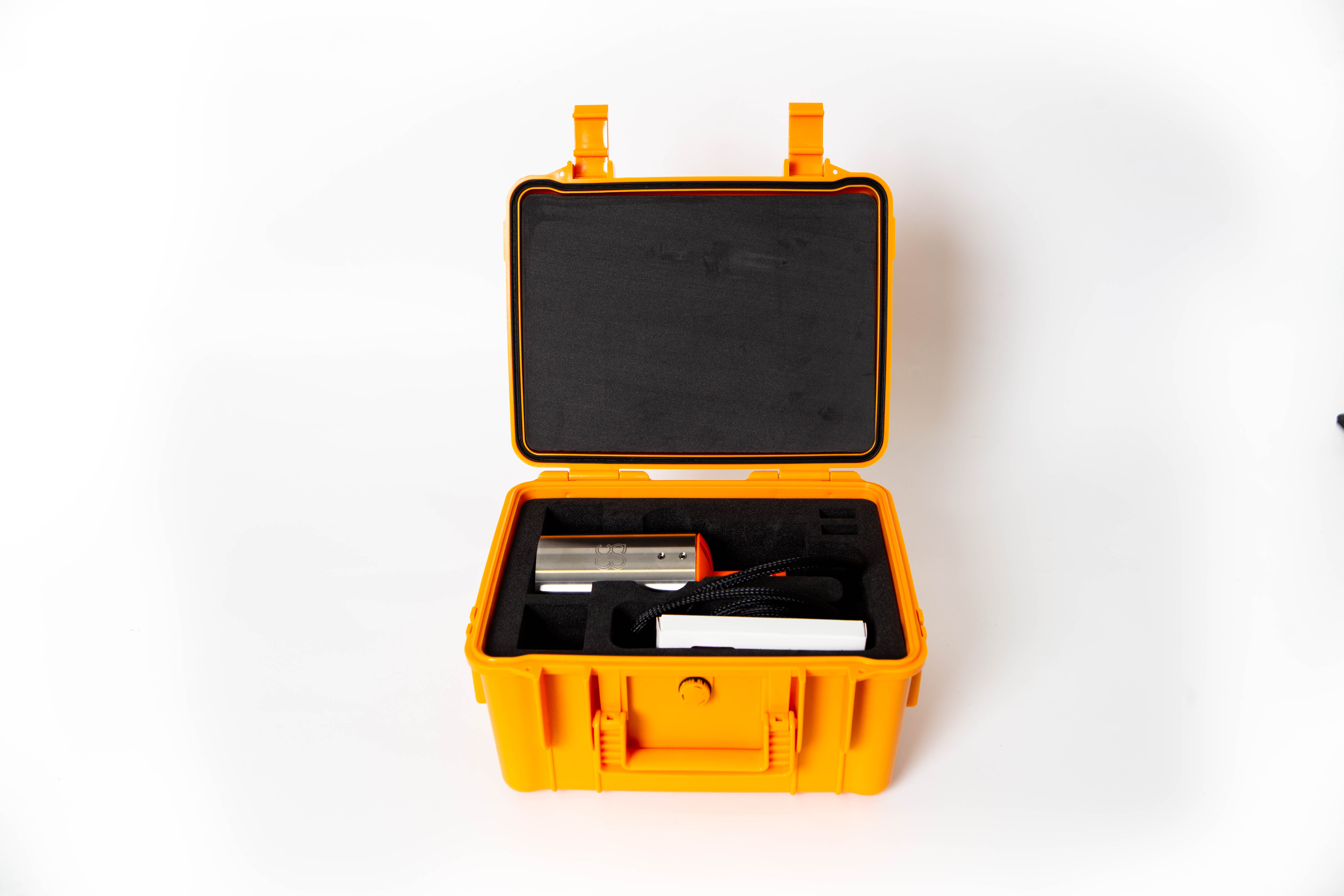
Sensor: ECT 400S
Type: Single-frequency
Acoustic frequency: 450 kHz
Measurement range*: 0.15 ... 100m
Beam width, Conical (-3dB): 5°
Weight of the echo sounder (in the air): 275g
Weight of all components in the air (echo sounder, SkyHub, altimeter, housing, cables, mountings): 1.6 kg (light housing), 2.6 kg (heavy housing)
Suitable DJI drones (or Pixhawk drones of comparable size): M210 (light housing), M300 RTK, M350 RTK, M600 Pro
(*) The measurement range is from the bottom of the transducer. The practical minimum depth is around 15cm deeper because the sensor should be submerged during measurement.
Do you have questions about this product?
- Questions about price, availability, and/or retailers
- Questions about technical specifications and usage
- Questions about suitability for your project or application
Documents
Brochure
SPHE Integrated Systems - Echo-sounder-SystemDescription.pdf
5.2 MB

