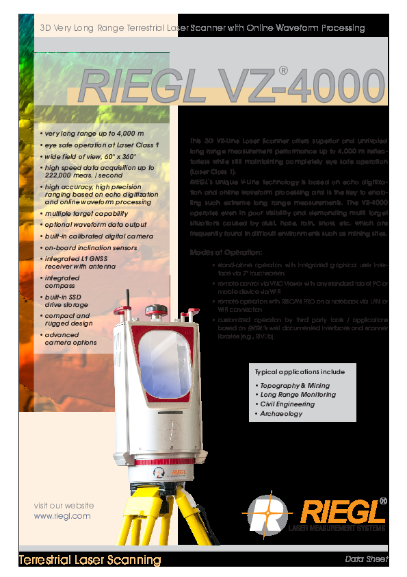
VZ-4000
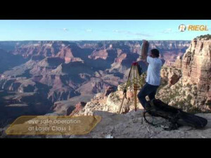
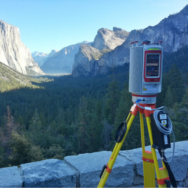
This 3D VZ-Line Laser Scanner offers superior and unrivalled long range measurement performance of up to 4000 m reflectorlessly while still maintaining completely eye safe operation (Laser Class 1).

RIEGL | Innovation in 3D
Horn, AT
Description
RIEGL's unique V-Line technology is based on echo digitization and online waveform processing and is the key to enabling such extreme long range measurements. The VZ-4000 operates even in poor visibility and demanding multi target situations caused by dust, haze, rain, snow, etc. which are frequently found in difficult environments such as mine sites.
Do you have questions about this product?
- Questions about price, availability, and/or retailers
- Questions about technical specifications and usage
- Questions about suitability for your project or application
Specifications
-
Application
-
Training facilities
Yes
Main users
surveyors; architects; civil engineers; archaelogy, mining
Main applications
Topography & Mining, Long Range Monitoring, Civil Enineering, Archaelogy
Distinguishable features
echo digitization; online waveform processing; multiple target capability; stand-alone data acquisition; HMI-interface; integrated GPS receiver; integrated compass; built-in SSD data storage media; laser plummet; inclination sensors; compact; lightweight, advanced camera options
-
Peripherals
-
External Camera
Y
Export formats of camera image
JPEG, TIFF, RAW
User interface
integrated, tablet, PC, terminal
Specifications
Windows, Android, iOS, Linux
Additional sensors
Inclination sensors, SyncTimer, GNSS receiver, Compass, Laser Plummet
Registration/orientation methods
Stand-alone Registration, Registration via Control Points, Totalstation-like-Registration
-
Operation Characteristics
-
Operating temperature: min. [°C]
-20
Operating temperature: max. [°C]
40
Humidity range [%]
80
Internal Camera
Y
Control panel built in
Y
IP Rating
64
Dual Axis Compensation
Y
-
Scanning Characteristics
-
Max. vertical field of view [deg]
60
Max. horizontal field of view [deg]
360
Min. horizontal step size [deg]
0.002
Min. vertical step size [deg]
0.002
Uncertainty of horizontal step size [deg]
0,0005
Uncertainty of vertical step size [deg]
0,0005
Beam deflection mechanism
rotating/oscillating mirror; rotating head
Max. measurement rate [kHz]
300
-
Software Functionality
-
Software name
RiSCAN PRO
Automatic detection of tie points
Y
Real time visualization during scanning
Y
Geo-referencing
Y
Fitting of primitives
Y
Specification of primitives
lines; planes
Max. size of model [million points]
1000
-
Laser Ranger
-
Range measurement principle
pulse
Laser safety classification
1
Min. Range [m]
5
Max. Range [m]
4000
Range uncertainty (constant part) [mm]
15
Beam diameter at exit [mm]
18
Beam divergence [mrad]
0.15
Spot at 50 m distance [mm]
20
Intensity recording [bits]
16
-
Power
-
Battery type
external
Scan time per battery [h]
3
-
General
-
Year of introduction
2011
Height [m]
0.45
Depth [m]
0.226
Width [m]
0.248
Total Weight [kg]
14.5
Documents
Brochure
RIEGL VZ-4000 Datasheet.pdf
3.98 MB
Other documents
-
RiSCAN PRO Datasheet.pdf5.87 MB
Videos


