VQ-1560II-S
Dual Channel Waveform Processing Airborne LiDAR Scanning System for High Point Density Mapping and Ultra-Wide Area Mapping
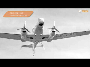
The VQ-1560 II-S follows the successful concept of RIEGL’s proven dual channel laser scanner series. With increased laser power the operational altitudes are extended up to 1700m AGL at a pulse repetition rate of 4MHz, or up to 3900m AGL at a pulse repetition rate of 540kHz (all values given for 20% target reflectance). These improved maximum ranges allow an increase of the system’s productivity by about 25% for a very attractive point density range.

RIEGL | Innovation in 3D
Horn, AT
Description
Its unique "cross-fire" scan pattern and its wide operational range make the instrument the most versatile airborne laser scanner on the market today. It is perfectly suited for any kind of application – from ultra-dense corridor mapping from low altitudes, over high-resolution city mapping with minimum shadowing effects in narrow street canyons, to large-scale wide-area mapping at utmost efficiency of up to 1130km² per hour at a density of 4 points per square meter.
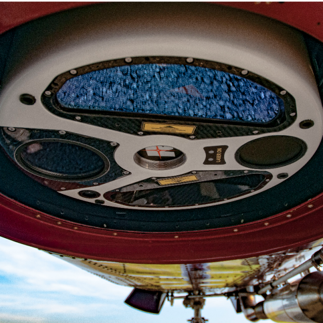
The system is equipped with a seamlessly integrated high-performance IMU/GNSS unit and e.g. an optional 150-megapixel RGB camera integrated into the primary camera bay.
Optionally, a second camera, e.g. a thermal camera or a 150 megapixels near-infrared camera, can be integrated on request. The design of the compact housing features a mounting flange for interfacing with typical hatches or gyro-stabilized levelling mounts.
Do you have questions about this product?
- Questions about price, availability, and/or retailers
- Questions about technical specifications and usage
- Questions about suitability for your project or application
Specifications
-
General
-
Year of introduction
2020
Total Weight [kg]
60
Power requirements
20 - 32VDC typ. 370W
Camera
opt. RGB and thermal camera
Data storage facilities
DR1560ii
Postprocessing software
RiAQUIRE, RiPROCESS, RiUNITE
-
Application
-
Main applications
Ultra Wide Area / High Altitude Mapping • Ultra-High Point Density Mapping • Mapping of Complex Urban Environments • Glacier & Snowfield Mapping • Mapping of Lakesides & River Banks • Agriculture & Forestry • Corridor Mapping
-
Measurement Characteristics
-
Scanning method
rotating polygon mirror
Min. pulse frequency [Hz]
540000
Max. pulse frequency [Hz]
4000000
Max. field of view [deg]
58
Max. number of recorded echoes per pulse
45
Full-wave form digitization
Y
multiple pulses in air
Y
-
Operation Characteristics
-
Platform
Helicopter, Fixed-wing
Max. flying height [m]
5800
-
Laser Pulse Characteristics
-
Beam divergence [mrad]
0.17
Type/class laser
3B
-
More information
-
Distinguishable features
high laser pulse repetition rate up to 4 MHz • up to 2.66 million measurements per second on the ground • offers highly efficient data acquisition at a wide range of point densities • two waveform processing LiDAR channels offering excellent multiple target detection capability • enables Multiple-Time-Around (MTA) processing of up to 45 pulses simultaneously in the air • excellent suppression of atmospheric clutter • online waveform processing as well as smart and full waveform recording • integrated inertial measurement unit and GNSS receiver • integrated, easily accessible medium format camera • prepared for integration of a secondary camera • high-speed fiber data interface to RIEGL data recorder • housing shape and mounting flange optimized for interfacing with typical hatches and stabilized platforms • detachable handgrips for facilitated handling
-
Application areas
-
Select an application area:
Documents
Brochure
datasheet_VQ-1560II-S
Other documents
-
Applicationsheet Forestry & Agriculture.pdf3.41 MB
-
Infosheet ALS Overview.pdf4.34 MB
-
RiPROCESS Datasheet.pdf3.99 MB
Videos


