NavVis IVION Core
Add more value to buildings and assets
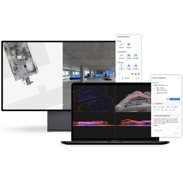
A reality capture platform for laser scanning and AEC professionals. Manage your 3D scans with intuitive tools for creation, collaboration, and publication. NavVis IVION Core makes mobile mapping workflows more efficient, speeds up model creation and delivery, and adds value to your data.
NavVis
Munich, DE
Description
NavVis IVION Core is a reality capture platform for laser scanning and AEC professionals. Manage your 3D scans with intuitive tools for creation, collaboration, and publication. NavVis IVION Core makes mobile mapping workflows more efficient, speeds up model creation and delivery, and adds value to your data.
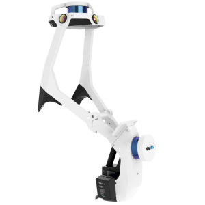
Taken together, NavVis VLX and NavVis IVION Core offer a complete mobile mapping solution for the built environment. The NavVis VLX wearable mapping system can scan with unprecedented speed and accuracy, while NavVis IVION Core makes your digital buildings accessible from everywhere.
Specifications
-
Files and Registering
-
Geo-referencing
Y
Stitching multiple scans
Y
Input formats
e57, .ply, .xyz, .pts, .ptx
Output formats
e57, .ply, .xyz, .pts, .ptx
-
Pre-processing and Automatic Filtering
-
Image matching facilities
Y
Removal of individual outliers
N
Removal of vegetation
N
Removal of buildings
N
Bare ground DEM generation
N
-
Manual Measurements
-
3D Coordinates extraction
N
Length and Height
Y
Angle
N
Distance
Y
Area
Y
Volume
N
-
Interoperability
-
CAD software
Autodesk - Revit Add-On
Assigning colour from imagery to points
Y
-
General
-
Source of Point Clouds
Indoor TLS, Outdoor TLS
Year of last update
2021
Supported Systems
Browser-based and available through NavVis Cloud Environments as Software as a Service
Year of initial introduction
2016
-
Visualisation and Editing
-
Zoom, pan and rotate
Y
Fly-throughs
Y
Adding Points
N
Removing Points
N


