Orbit 3DM Publisher
Software to Capture, Model, Share
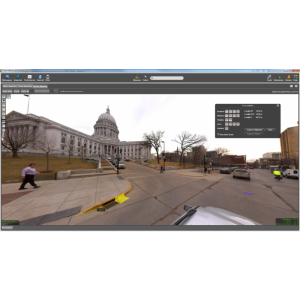
On-site Publisher service to share 3D Mapping content, fusion of Mobile Mapping, Aerial Mapping, Indoor and Outdoor scanning, Drone Mapping etc. All Capture techniques supported.
Orbit GT
Lokeren, BE
Description
On-site Publisher service to share 3D Mapping content, fusion of Mobile Mapping, Aerial Mapping, Indoor and Outdoor scanning, Drone Mapping etc. All Capture techniques supported.
Publishes to browser and plugins, Plugins SDK available for free integrations in any host software, from GIS to asset management and more.
Specifications
-
Hardware/software requirements
-
RAM [GB]
8
HD [GB]
8
Use of GPU
Y
Processor
["64-bit"]
Stereo Display
N
List software environment, e.g. Microstation
any browser
-
Other
-
Typical applications
Mobile Mapping (Indoor & Outdoor)
Distinguishing features
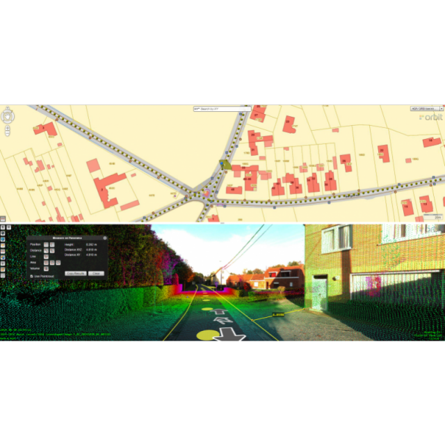
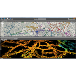
More Data. More Content. More Users. publish all mobile mapping content onlinesupports 360 degree imagery and unlimited size point cloudsdefine user credentials, multiple publications, server poolshare on the web, mobile devices, and integrate using SDK
-
Files and Registering
-
Geo-referencing
N
Automatic Target Detection
N
Stitching multiple scans
N
-
Pre-processing and Automatic Filtering
-
Image matching facilities
N
Frequency domain decoding for data reduction
Y
Removal of individual outliers
N
Removal of vegetation
N
Removal of buildings
N
Bare ground DEM generation
N
-
Manual Measurements
-
3D Coordinates extraction
Y
Length and Height
Y
Angle
Y
Distance
Y
Area
Y
Volume
Y
-
Interoperability
-
CAD software
Yes, see integrations
Hydrological software
N
Assigning colour from imagery to points
N
Image overlay on TIN
Y
Integration with other data types
Yes, see integrations
-
General
-
Year of last update
2019
Year of initial introduction
2010
Modules
More Data. More Content. More Users. Publish all mobile mapping content online, supports 360 degree imagery and unlimited size point clouds, define user credentials, multiple publications, server pool, share on the web, mobile devices, and integrate using SDK
Source of Point Clouds
Airborne Lidar, Indoor TLS, Outdoor TLS
Supported Systems
all system support, all reality capture techiques
-
Analysis
-
Line of sight
N
Aspect and slope
Y
Individual tree heights
Y
Simulation facilities
N
Time series analysis
Y
-
Automatically Generated Products
-
Regular Grid DEMs
N
Cross sections
N
TIN
N
Contour Lines
N
Break lines
N
Boundary detection of solids
N
Building footprints
N
Building roofs
N
3D City modelling
no
-
Solid Modelling
-
Lines
N
Planes
N
Cubes
N
Spheres
N
Cylinders
N
NURBS
N
Industrial features
N
Earth surface features
N
-
Visualisation and Editing
-
Zoom, pan and rotate
Y
Fly-throughs
N
Adding Points
N
Removing Points
N
Point Reduction
N


