


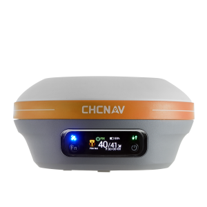
i73+ IMU-RTK GNSS
Compact GNSS Base Station and Rover For Maximum Flexibility
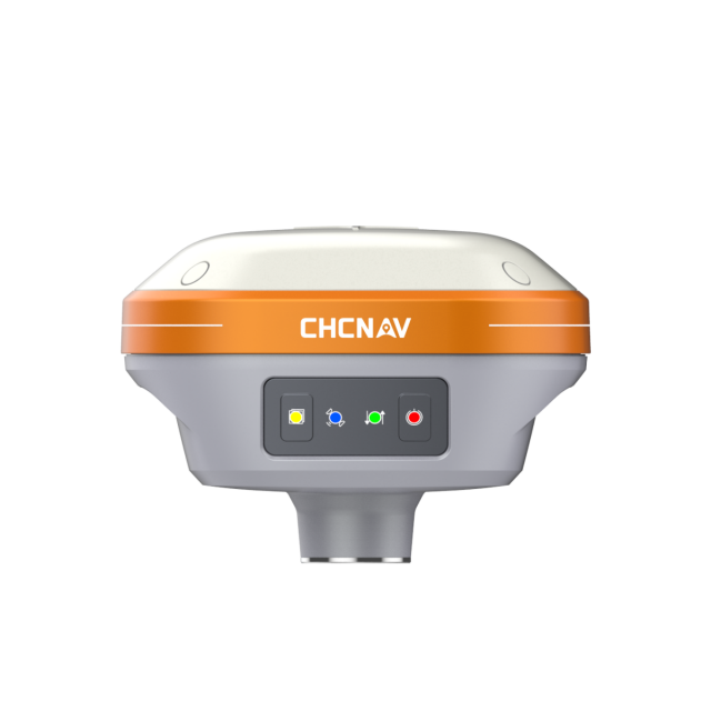
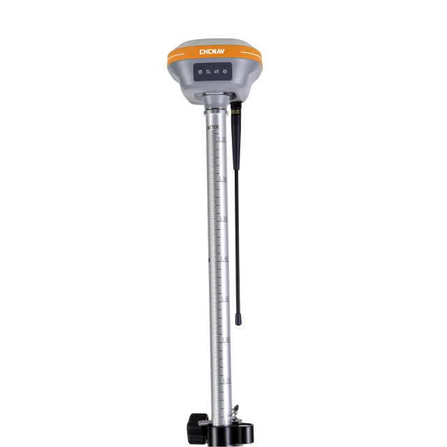
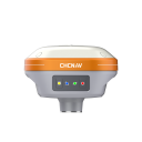
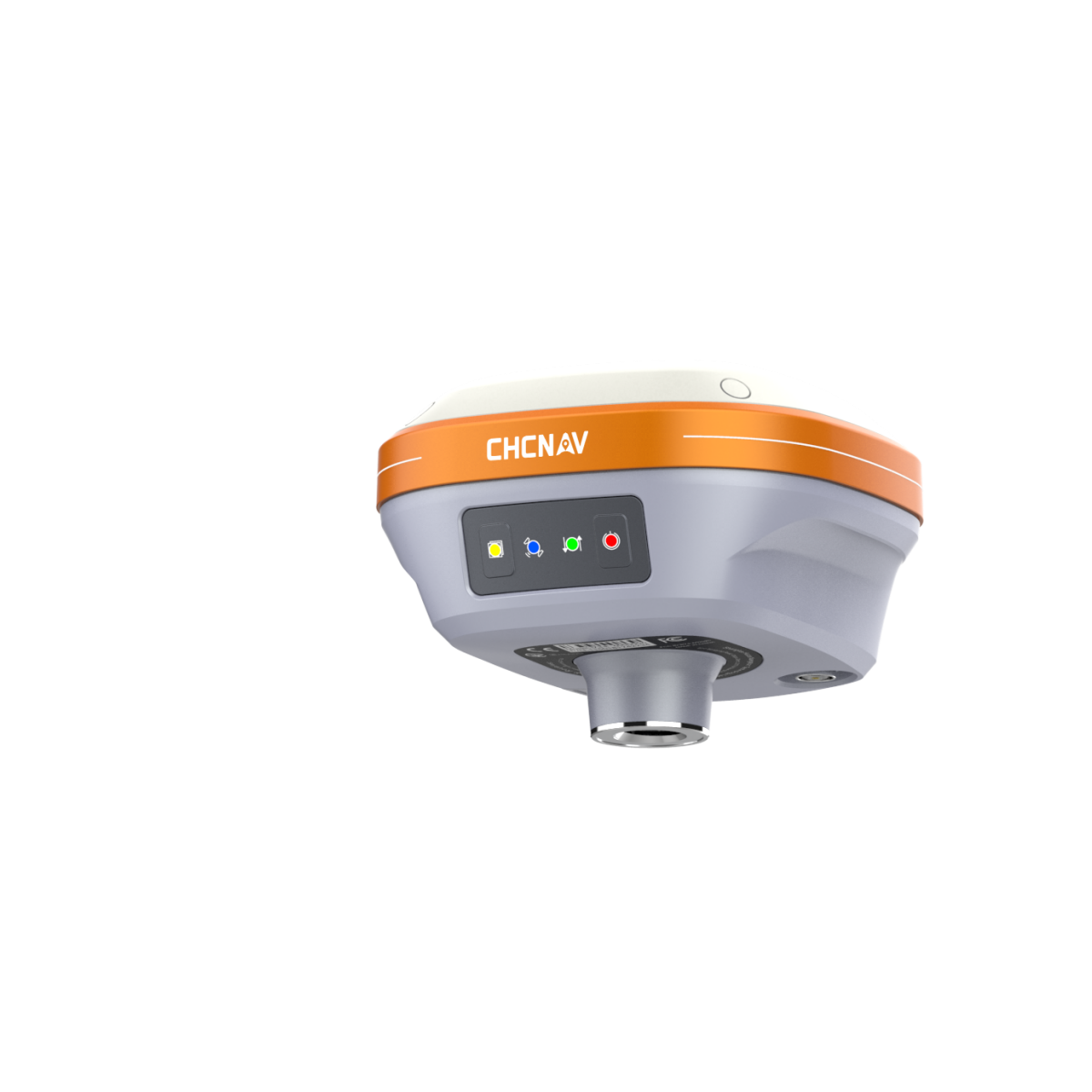
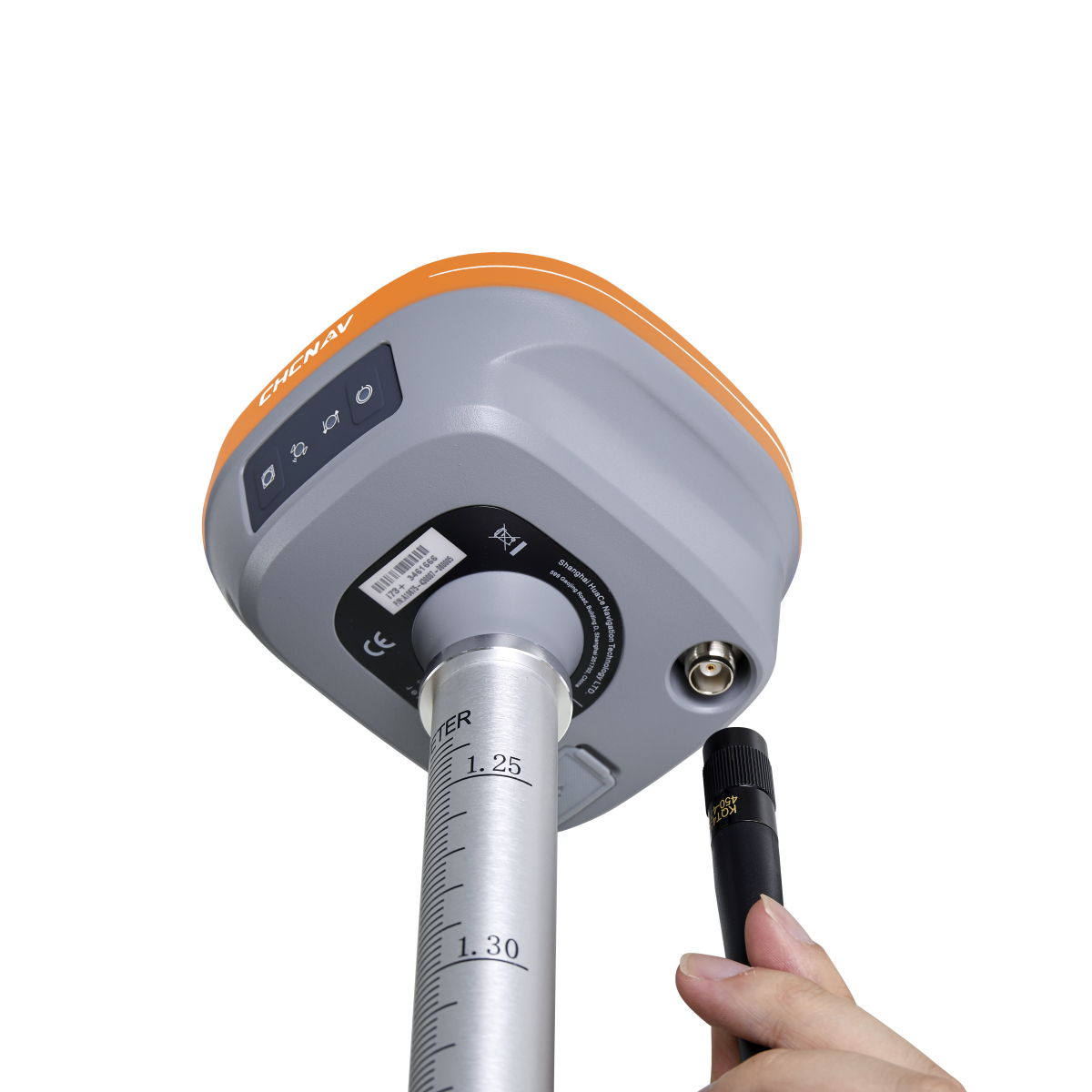
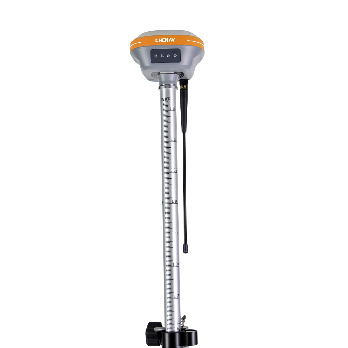
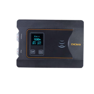
The i73+ GNSS is an extremely compact, powerful and versatile GNSS receiver with an integrated UHF Tx/ Rx modem which can be used either as a base station or as a rover. Powered by CHCNAV iStar technology that optimally tracks satellite signals from all constellations, the i73+ GNSS achieves survey-grade, fixed RTK centimeter positioning within 30 seconds after power-up. In addition, its automatic pole tilt compensation increases the efficiency of point measurements and stakeout surveys.

CHC Navigation | CHCNAV
Shanghai, CN
Description
-
BEST-IN-CLASS SIGNAL TRACKING
Full GNSS with 1408 channels and advanced tracking. The integrated advanced 1408-channel GNSS technology takes advantage of GPS, Glonass, Galileo and BeiDou, particularly the latest BeiDou III signal, and provides robust data quality at all times. The i73+ extends GNSS surveying capabilities while maintaining centimetre-level survey-grade accuracy. GNSS surveying has never been more efficient.
-
PORTABLE INTERNAL UHF BASE+ROVER
Integrated Tx/Rx UHF modem in a compact design. The i73+ features a built-in transceiver radio module compatible with major radio protocols, making it the perfect choice for a portable built-in UHF base and rover kit with fewer accessories. i73+ is a highly productive NTRIP rover when used with a handheld controller or tablet and connected to a GNSS RTK network via CHCNAV LandStar field software. The i73+ is a highly rugged and reliable receiver without downtime used for surveying of any terrain, mapping, or construction site.
-
THE POWER OF GNSS+IMU RTK TECHNOLOGY
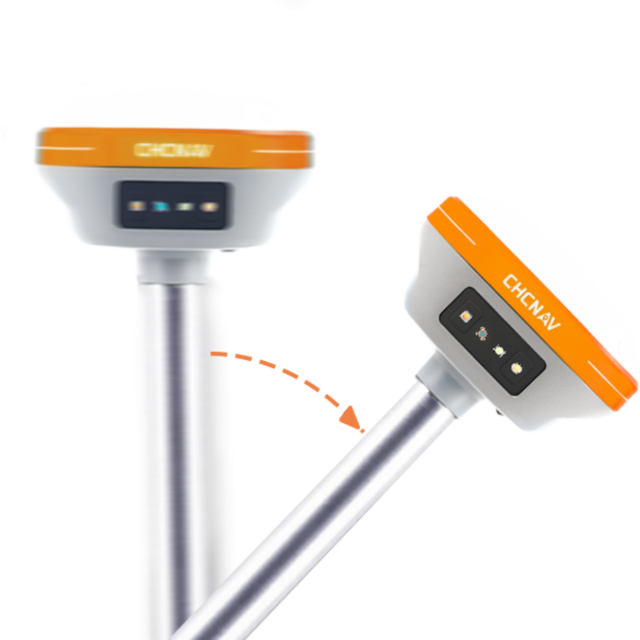
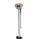
Survey anywhere with its built-in interference-free IMU. Even in a complex electromagnetic environment, the i73+ initializes its IMU in 3 seconds, with no need for repeated re-initialization. It delivers 3 cm accuracy up to a 30-degree pole tilt, increasing the efficiency of point measurement by 20% and stakeout by 30%. The i73+ GNSS eliminates the challenge of measuring hidden or dangerous points while making the work of survey crews safer and more efficient. GNSS surveys are made easier by removing the need for the operator to focus on the perfect levelling of its surveying pole.
-
THE ULTIMATE POCKET GNSS IMU RECEIVER
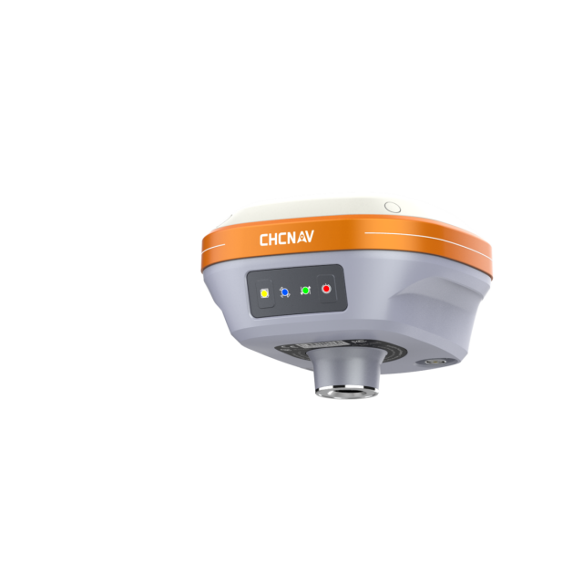
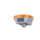
Extremely rugged to cope with challenging environments. The i73+ benefits from the ultra-compact magnesium alloy design of the i73 series, making it one of the lightest receivers in its class, weighing only 0.73 kg, including the battery. The i73+ is more than 40% lighter than a traditional GNSS receiver, making it more convenient to carry, use and operate without fatigue. The i73+ GNSS is packed with technology, fits in your hands, and offers maximum productivity for GNSS surveys.
The i73+ GNSS is an extremely compact, powerful and versatile GNSS receiver with an integrated UHF Tx/ Rx modem which can be used either as a base station or as a rover. Powered by CHCNAV iStar technology that optimally tracks satellite signals from all constellations, the i73+ GNSS achieves survey-grade, fixed RTK centimetre positioning 30 seconds after power-up. In addition, its automatic pole tilt compensation increases the efficiency of point measurements by up to 20% and stakeout surveys by up to 30%. Easy to carry in one hand, the i73+ GNSS is an effective, lightweight GNSS solution that adapts to various job site configurations, making intensive field surveys more convenient and less tiring for the operator.
Do you have questions about this product?
- Questions about price, availability, and/or retailers
- Questions about technical specifications and usage
- Questions about suitability for your project or application
Specifications
-
More information
-
Distinguishable features
Compact GNSS receiver with built-in UHF modem
-
Power
-
Operating power: min. [V]
7.4
Operating power: max. [V]
7.4
Typical consumption [W]
4
Internal power supply
Built-in non-removable battery 6,800 mAh
Operating time with internal power supply [hr]
18
Certifications
CE Mark; FCC Part 15 Subpart B Class B; NGS Antenna Calibration
-
Performance
-
No. channels
624
Tracked satellite signals
GPS, GLONASS, Galileo, BeiDou, QZSS
RTK Network Compatibility
RTK tilt - compensated
-
General
-
Type
Land
Year of initial introduction
2022
Height [m]
0.085
Depth [m]
0.119
Width [m]
0.119
Total Weight [kg]
0.73
-
Recording
-
Data capacity [MB]
8000
Data input
RTCM 2.x, RTCM 3.x, CMR input / output HCN, HRC, RINEX 2.11, 3.02 NMEA 0183 output NTRIP Client, NTRIP Caster
-
Communication: general
-
Bluetooth
Y
-
Environment
-
Operating temperature: min. [°C]
-40
Operating temperature: max. [°C]
65
Humidity resistance
100% condensation
Water sand and dust proof
IP67 waterproof and dustproof, protected from temporary immersion to depth of 1 m
Shock and vibration proof
Survive a 2-meter pole drop
-
Communication: links
-
Radio modems
UHF Radio
Documents
Brochure
i73+_DS_EN (3).pdf
1.1 MB


