


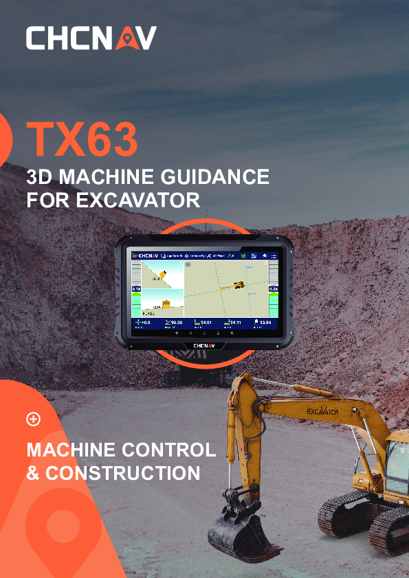
TX63
3D Machine Guidance For Excavator
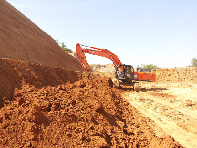
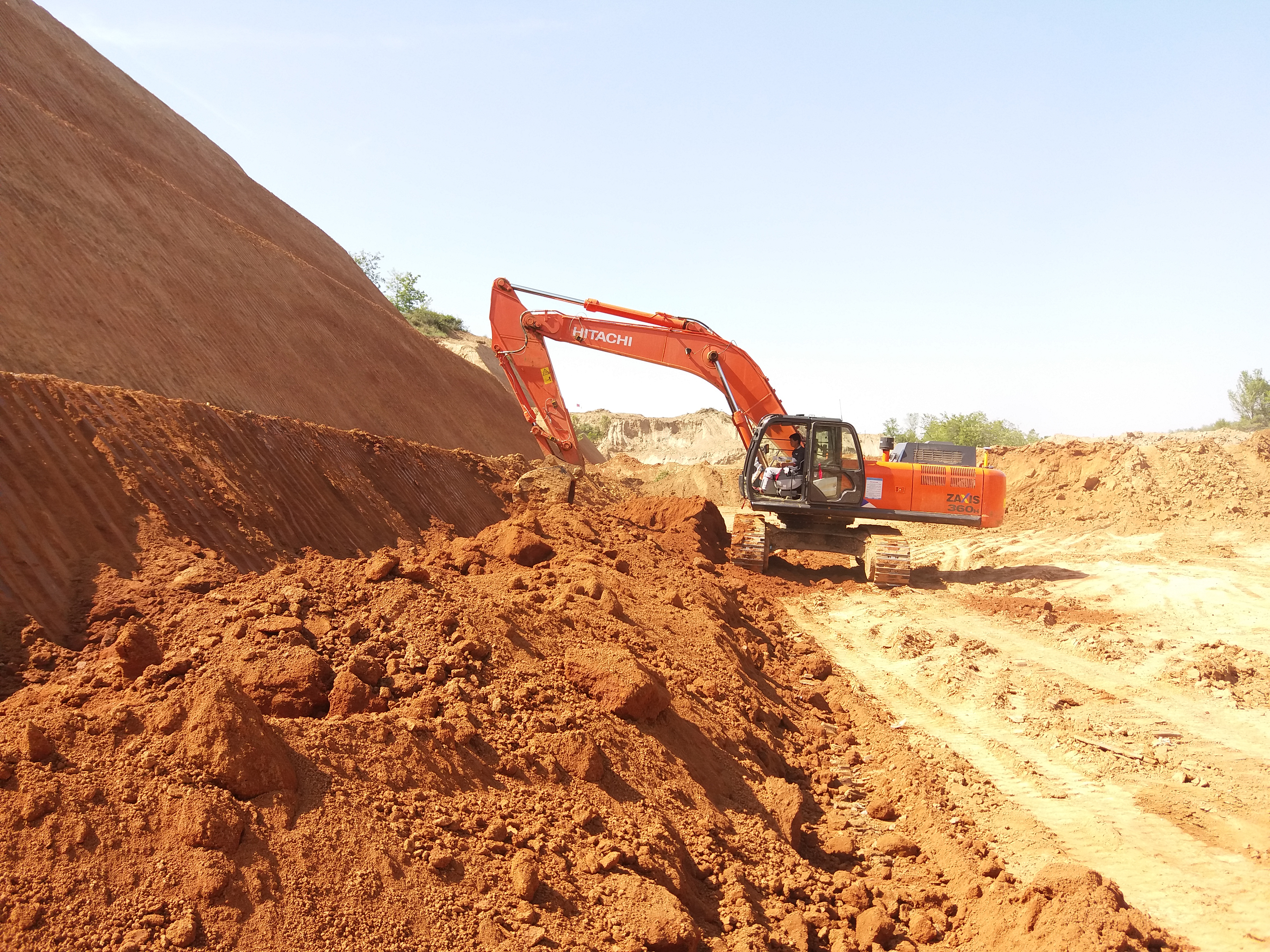
The CHCNAV TX63 excavator guidance system enhances excavation precision and efficiency by integrating high-accuracy dual-GNSS, high-frequency IMU sensors, and EX-Tech's mechanical model algorithm. This enables reliable 3D positioning and heading information for precise bucket placement. With real-time guidance, operators can steer the bucket to the design surface quickly and accurately, reducing time and increasing accuracy. The system eliminates manual staking, boosting operational efficiency and productivity. The industrial touchscreen places controls within easy reach, and the MCNAV software offers comprehensive, user-friendly guidance with detailed job information, including project setup, cut-fill data, and machine posture, all accessible at a glance.

CHC Navigation | CHCNAV
Shanghai, CN
Description
HIGH ACCURACY
Dual GNSS + IMU and EX-Tech model algorithm
The TX63 excavator guidance system, featuring high-accuracy dual GNSS and high-frequency IMUs, along with the EX-Tech model algorithm, offers precision better than ±3 cm, ensuring consistent accuracy on both sides of the bucket tip. Additionally, EX-Tech's dynamic model algorithm guarantees optimal bucket accuracy in all positions, and the high-performance receiver delivers high-precision positioning in all terrain conditions.
EASY TO USE
Fast Installation and Calibration
The TX63 excavator guidance system is designed with a built-in GNSS module in the display for easy setup. The system can be completely installed in less than two hours, and calibration takes two more hours, minimizing downtime. Additionally, it features an optional dual 2D/3D mode for added versatility, making it flexible for various excavation needs.
EXCELLENT COMPATIBILITY
Effortless Integration without Additional Labor
The TX63 excavator guidance system is a versatile solution suitable for all excavator models, offering support for tilt bucket functionality and compatibility with various radio protocols. It features built-in and editable global coordinate systems and supports multiple coordinate calibration files. The system provides professional-grade options for base stations and offers full constellation support, as well as design file support for quick surface design in the field, streamlining operational workflow.
OPTIMIZED GUIDANCE INTERFACE
More Realistic Guidance Screen
The TX63 excavator guidance system offers the most realistic guidance screen, providing fully synchronized mechanical attitude, model attitude, and cut-and-fill data. With four different views tailored to various job sites and work practices, the system ensures that operators have the information they need at their fingertips. The 10.1" widescreen display allows for at-a-glance access to crucial information, enhancing efficiency and productivity on the job site.
SAFE AND RUGGED DESIGN
Ensure durability in harsh environments
The TX63 excavator guidance system features robust components such as an IP68 and 50 G shock-resistant IMU sensor, an industrial-grade antenna with an IP68 rating, and rugged cables designed for wear resistance, ensuring reliable performance in demanding conditions.
Do you have questions about this product?
- Questions about price, availability, and/or retailers
- Questions about technical specifications and usage
- Questions about suitability for your project or application
Specifications
-
General
-
Field of Use
Highway, Rail, Airport, Test Site, Water, Municipal
Main design elements
hardware and software
Year of current version
2024
Year of introduction
2024
-
Dimensions
-
Height [cm]
4.2
Length [cm]
18.1
Width [cm]
28.1
Total weight [kg]
1.5
-
Operation Characteristics
-
Operating temperature: max. [°C]
70
Operating temperature: min. [°C]
-30°C
Storage temperature min [°c]
-40°C
Storage temperature max [°c]
85
Type of screen
10.1", 1024*600 pixel, 750 cd/m2
Integrated sensors
IMU
Water and dust proof [IP]
IP65
-
Connectivity
-
Supply Voltage [V]
3 ~ 6 V DC
-
Functionalities
-
3D interference and collision detection
Yes
Remote control of vehicles
Y
View different mapping layers
Y
View position, planned route and speed
Y
-
More information
-
Distinguishable features
Dual GNSS + IMU and EX-Tech model algorithm, Fast Installation and Calibration, Effortless Integration without Additional Labor, More Realistic Guidance Screen
Main applications
Highway, Rail, Airport, Test Site, Water, Municipal
-
Software
-
Compatible software
McNav
Display of external data and photos
Y
Editing of points
Y
Editing of lines
Y
Measurements: area
Y
Documents
Brochure
TX63_DS_EN.pdf
11.6 MB
Videos


