


RS10
Handheld Slam 3D Laser Scanner + GNSS RTK System
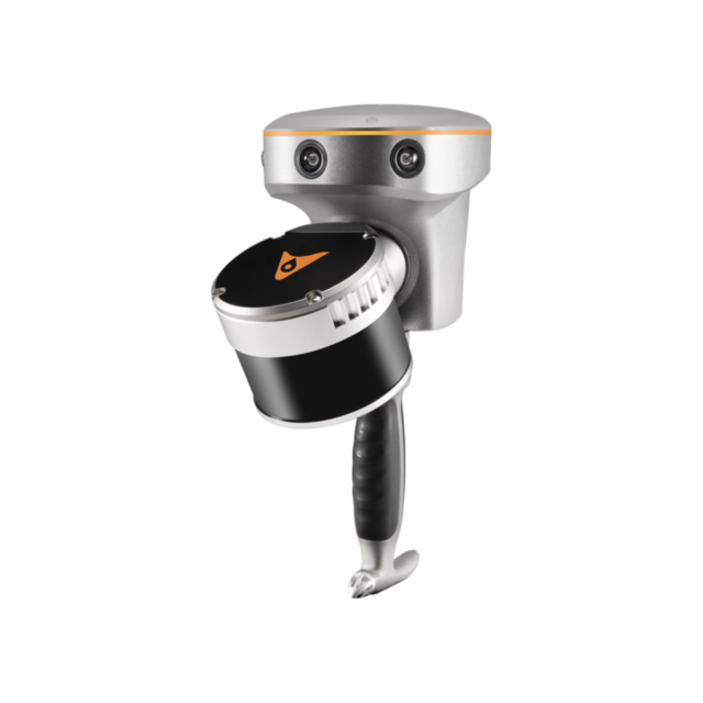
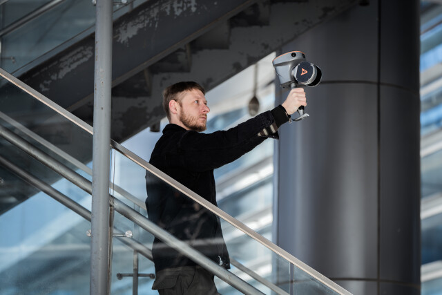
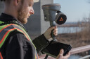
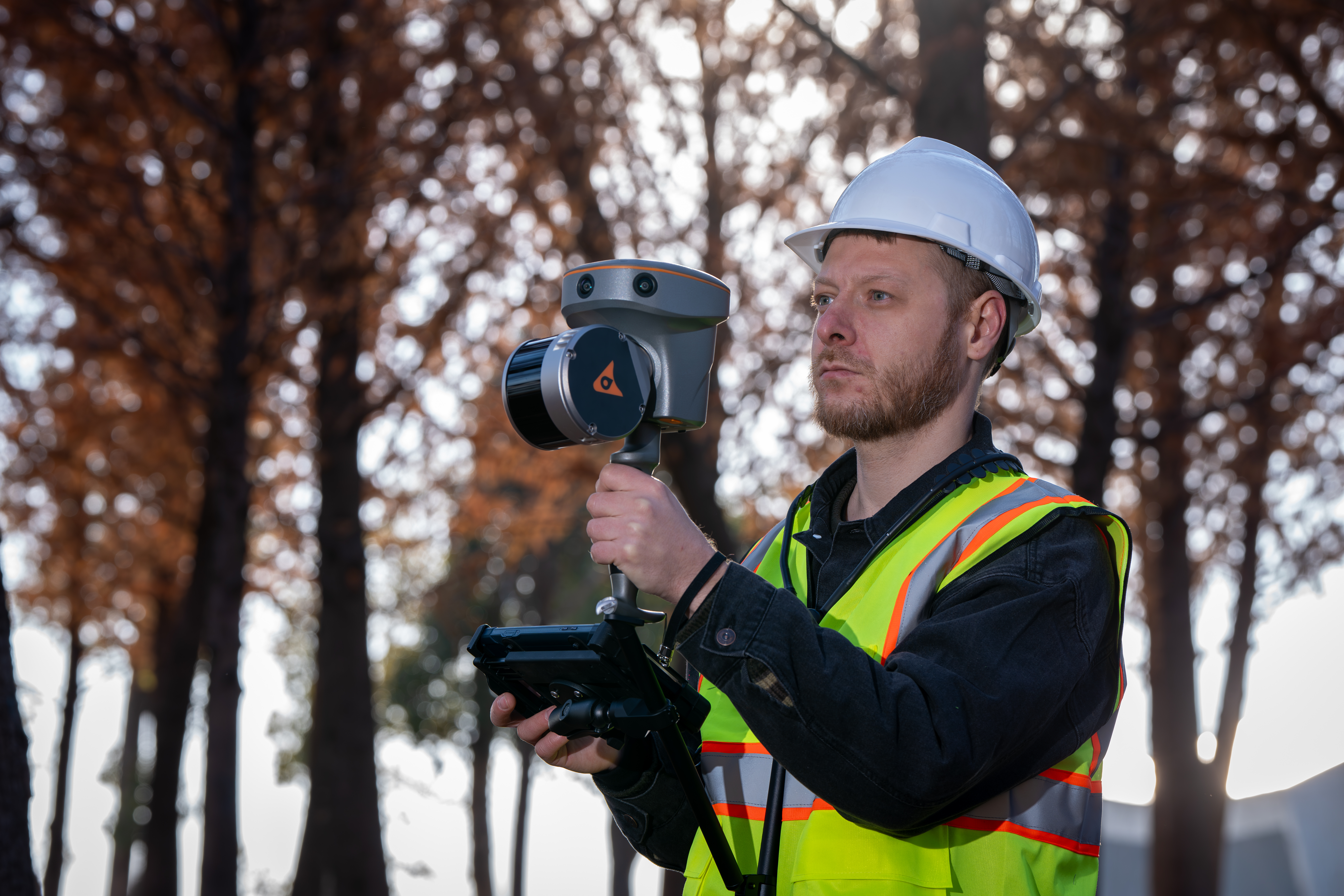
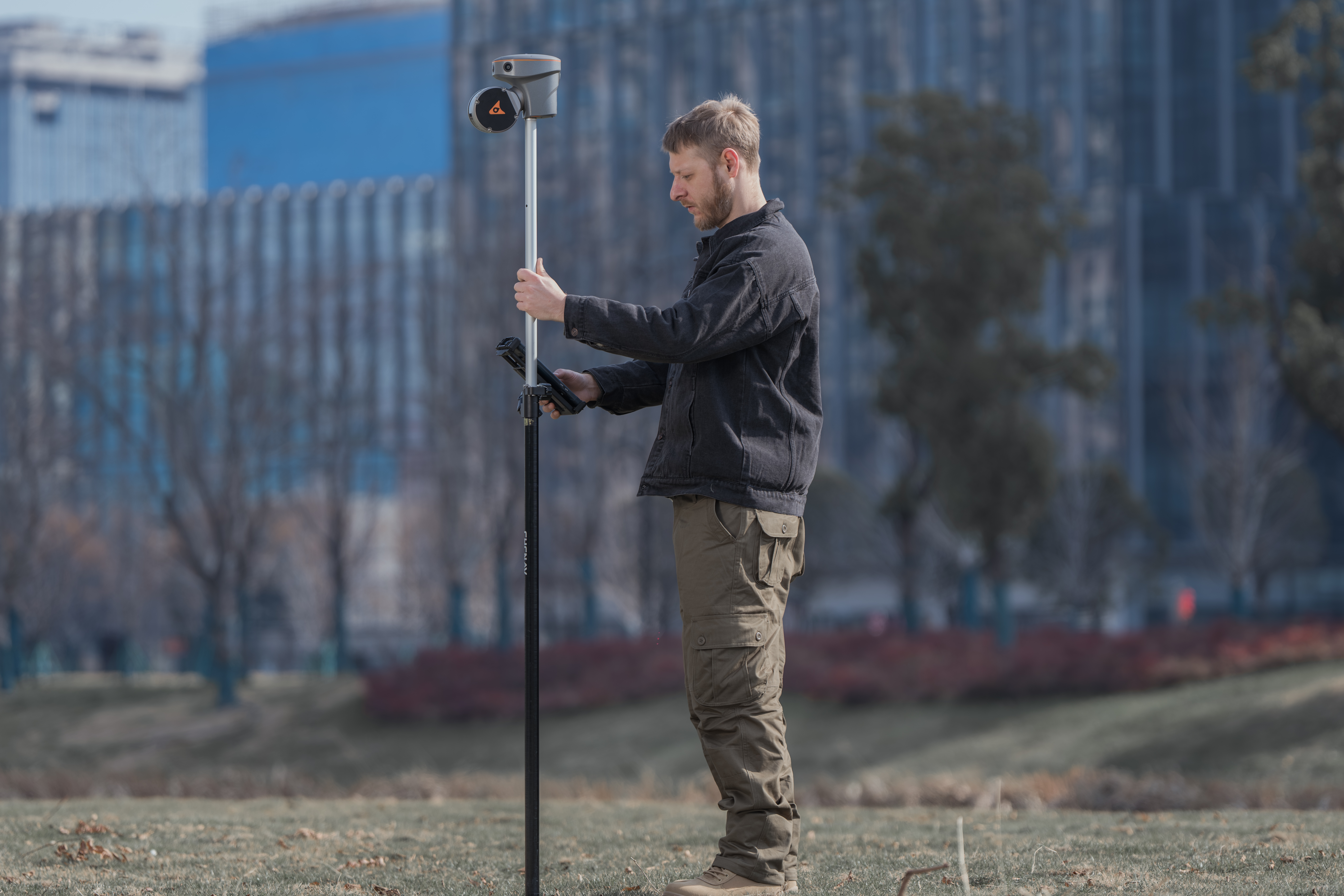
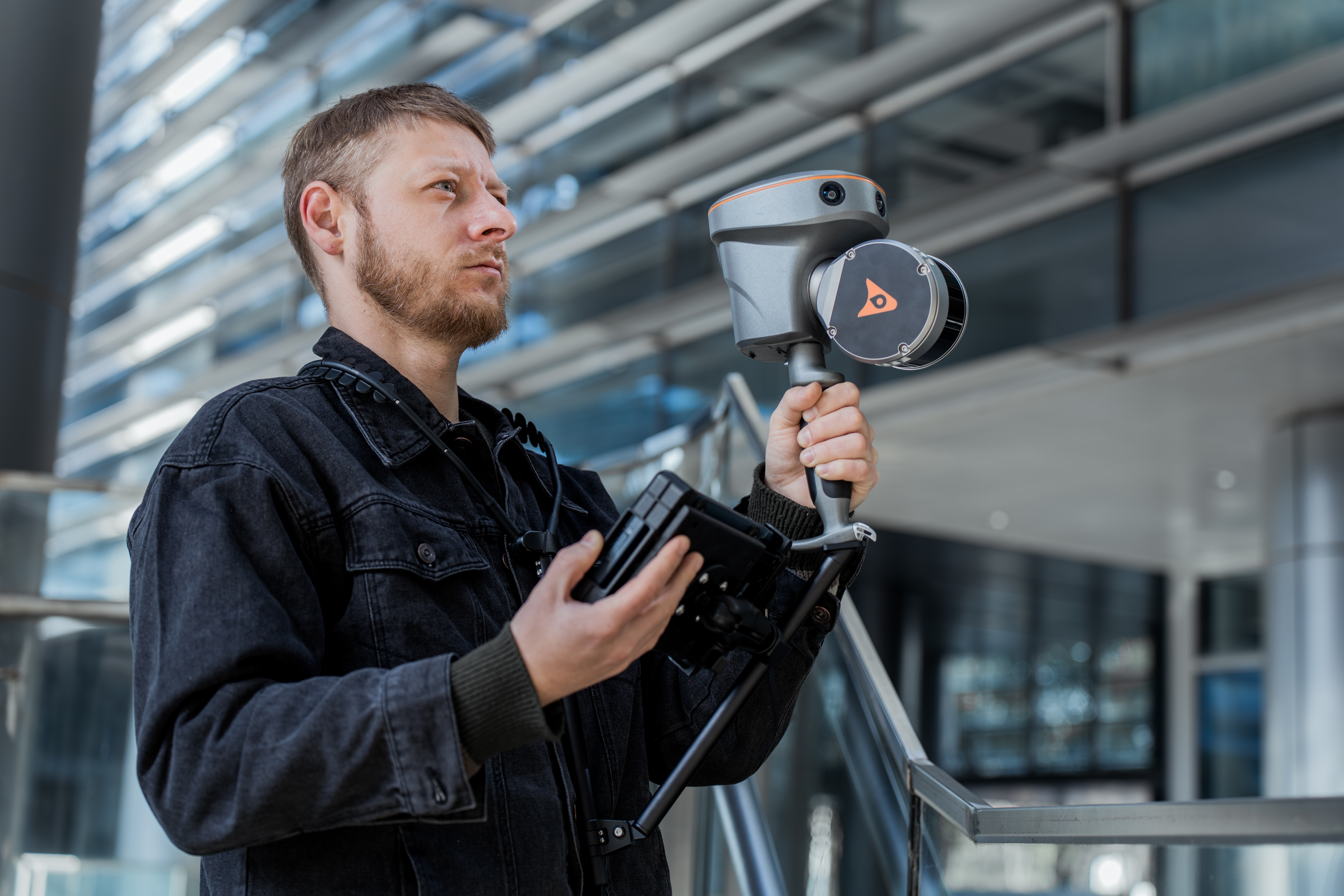
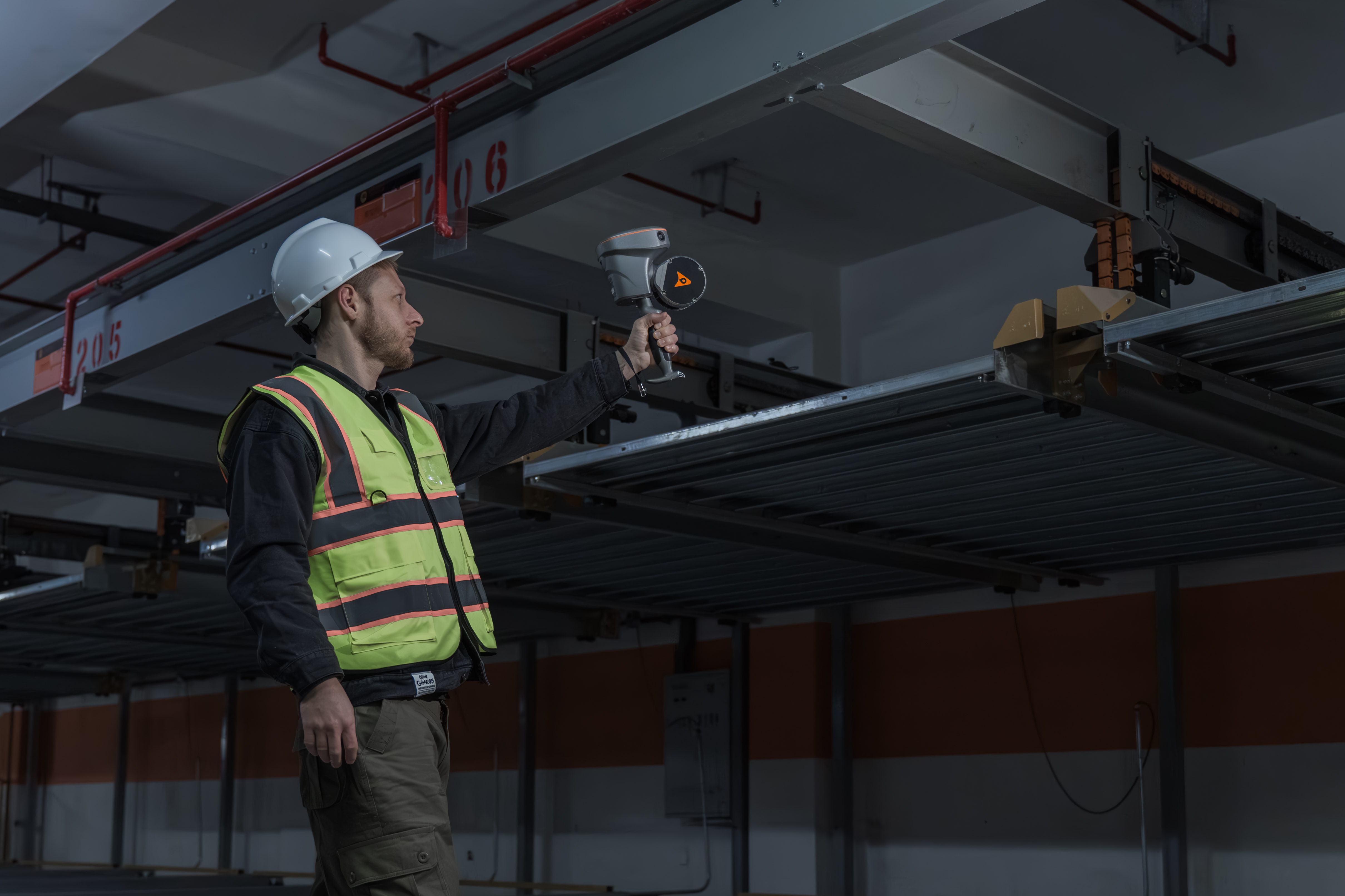
The RS10 brings a new approach to geospatial surveying by integrating GNSS RTK, laser scanning, and visual SLAM technologies into a single platform designed to improve the efficiency and accuracy of indoor and outdoor 3D scanning and surveying tasks. The RS10 is a versatile solution for surveying, civil engineering, and BIM professionals, as well as for applications such as agricultural and forestry surveying, power line inspection, material pile volume calculation, and data collection in underground spaces. With the RS10, surveyors are able to overcome the challenges of surveying in areas with poor or no GNSS signals, bringing a new level of flexibility and accuracy to their work. By supporting both traditional GNSS RTK surveying and innovative 3D reality capture, the RS10 simplifies fieldwork and improves data reliability.

CHC Navigation | CHCNAV
Shanghai, CN
Description
RTK AND SLAM FUSION FOR BETTER MAPPING ACCURACY
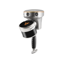
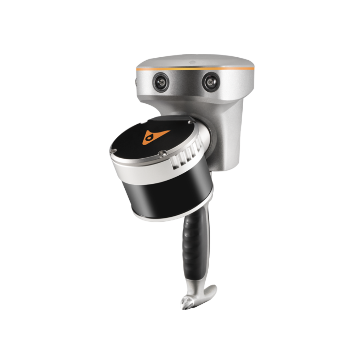
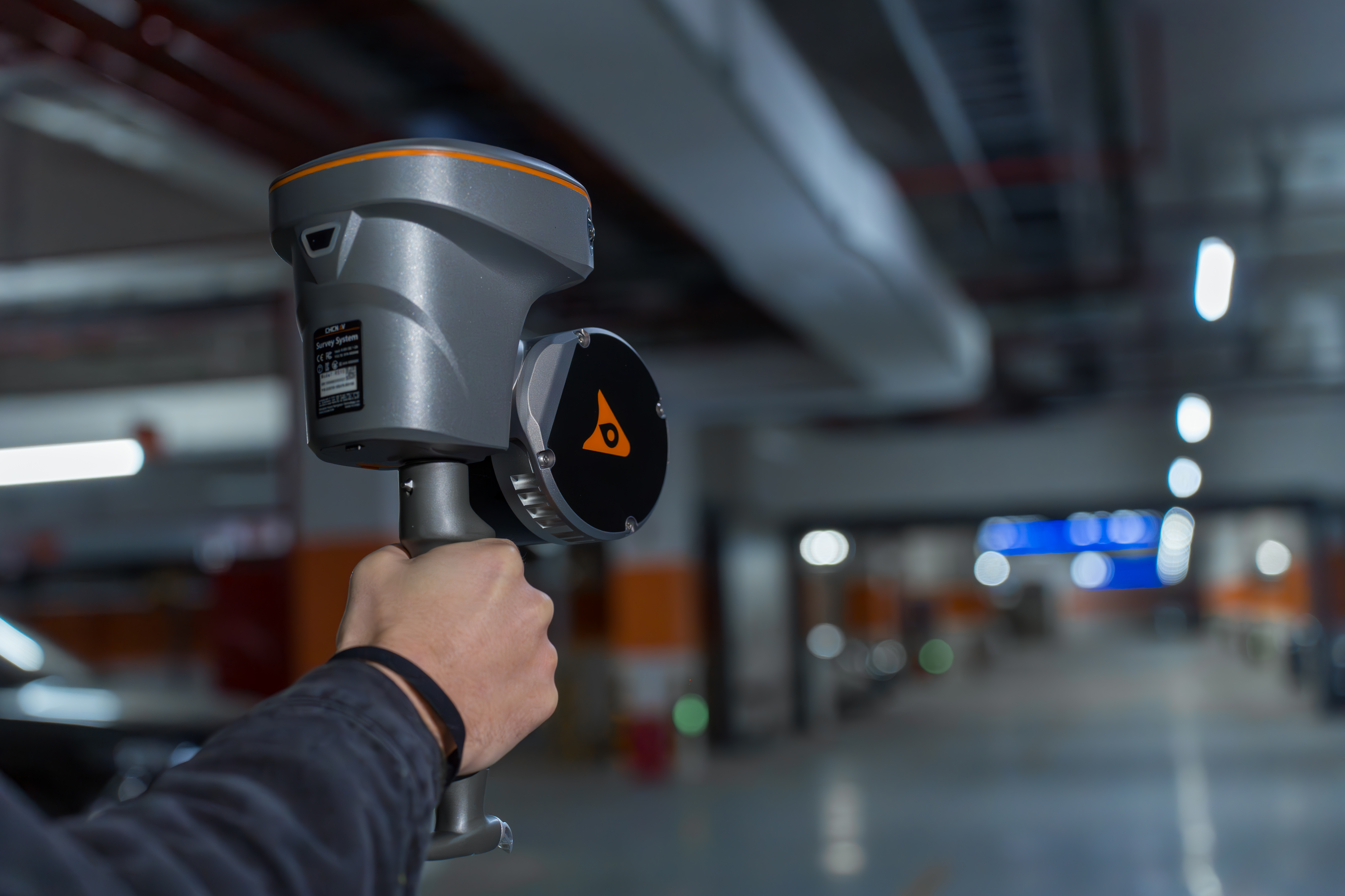
The RS10 is the result of CHCNAV's expertise in GNSS technology development. Featuring a 4th generation air dielectric GNSS antenna, it provides RTK positioning accuracy of better than 3 cm in a variety of challenging environments. Combined with the system's high-precision LiDAR and three HD cameras, it fuses RTK, laser, and visual SLAM to deliver 5 cm absolute measurement accuracy. From detailed architectural surveys to complex infrastructure projects, the RS10 gives professionals the tools they need to collect rich and accurate data efficiently.
REAL-TIME SLAM CAPABILITIES
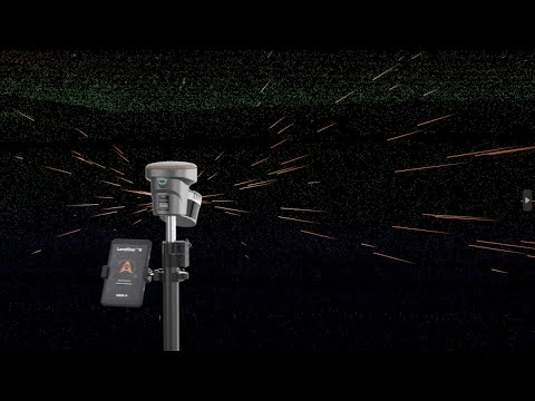
Equipped with a powerful on-board processor, the RS10 provides real-time SLAM (Simultaneous Localization and Mapping) capabilities to create georeferenced point clouds directly in the field without the need for post-processing. With immediate feedback on the collected data, users can make adjustments on the fly to ensure complete and detailed scan coverage. The RS10 can map large areas up to 13,000 square meters in real-time, making it ideal for rapid or complex surveying projects where time and accuracy are critical.
EFFICIENT LOOP-FREE WORKFLOW
The integration of high-precision GNSS and SLAM technologies eliminates the need for traditional loop closure, which often complicates the data collection process for handheld scanners. By enabling loop-free path planning, the RS10 streamlines field data collection and significantly reduces the time and effort required to complete projects.
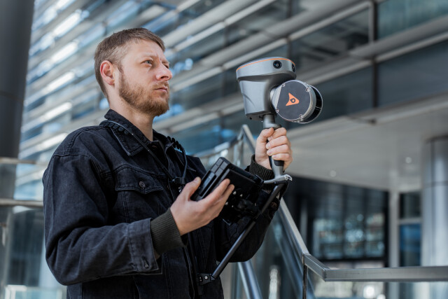
SEAMLESS OUTDOOR AND INDOOR MAPPING
The transition between outdoor and indoor environments is seamless with the RS10's ability to use the same coordinate system without the need for additional georeferencing. Users can select the desired CS (coordinate system) directly in the field using either the SmartGo or LandStar™ SWs, ensuring consistent, simplified and accurate data collection in both outdoor and indoor environments.
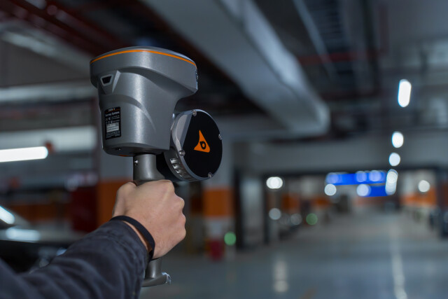
SFIX TECHNOLOGY - PRECISION WITHOUT SATELLITES
With innovative SFix technology working in RTK rover mode, when RS10 enters an area with weak or even no GNSS signal, where conventional RTK surveying doesn’t work, RS10 will calculate accurate RTK point coordinates from its LiDAR and Visual SLAM data. This technology ensures a precision of 5 cm within 1 minute without satellite signals, opening new possibilities for surveying indoor spaces and urban canyons.
VI-LIDAR RECHNOLOGY FOR CONTACTLESS MEASUREMENTS
The RS10's Vi-LiDAR technology offers a new mode of RTK surveying that combines GNSS rover capabilities with laser scanning for contactless offset measurements. By simply selecting the point to be measured in the LandStar™ software, its three-dimensional coordinates are calculated in real time from the intersection of the RTK origin segment and the LiDAR point cloud to an accuracy of 5 cm within 15 m (50 ft).
Do you have questions about this product?
- Questions about price, availability, and/or retailers
- Questions about technical specifications and usage
- Questions about suitability for your project or application
Specifications
-
Application
-
Distinguishable features
RTK and slam fusion; Real-time slam; SFIX technology; Vi-lidar technology; Efficient loop-free workflow; Seamless outdoor and indoor mapping
Main applications
surveying, civil engineering, BIM professionals, agricultural and forestry surveying, power line inspection, material pile volume calculation and data collection in underground spaces
Main users
surveyor
-
Peripherals
-
Additional sensors
Yes
External Camera
Y
-
Operation Characteristics
-
Humidity range [%]
80%, non-condensing
Operating temperature: max. [°C]
50
Operating temperature: min. [°C]
-20
Control panel built in
Y
IP Rating
IP64 (according to IEC 60529)
-
Scanning Characteristics
-
Max. horizontal field of view [deg]
360
Max. vertical field of view [deg]
30
-
Software Functionality
-
Automatic detection of tie points
Y
Real time visualization during scanning
Y
Software name
SmartGo software, CoPre intelligent processing software, CoProcess efficient feature extraction software, LandStar Field Survey APP
-
Laser Ranger
-
Laser safety classification
Class 1 Eye Safe
Max. Range [m]
120
Min. Range [m]
0.05
Wavelength [nm]
905
Rotating Speed
10 Hz
-
Power
-
Battery type
Lithium battery, supports hot-swapping and portable charger
Scan time per battery [h]
1
-
General
-
Total Weight [kg]
1.9 kg (including RTK and battery)
Year of introduction
2024
Documents
Brochure
RS10_DS_EN.pdf
1.51 MB

Videos


