
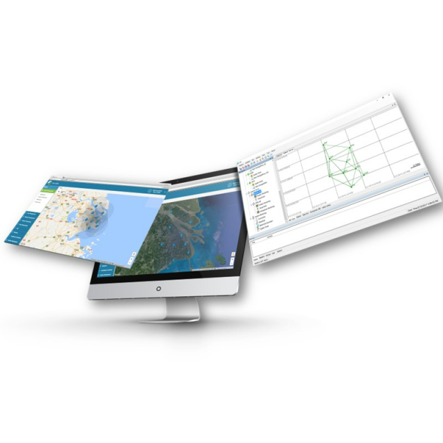


CPS GNSS Network
GNSS RTK Network Management Software
GPS, GLONASS, BEIDOU, and GALILEO software solutions for local, regional and nationwide GNSS CORS and RTK Networks.

CHC Navigation | CHCNAV
Shanghai, CN
Description
-
RTK CORRECTIONS SERVICES AT REACH
Integrate data stream, core computation, and user management modules
The modular CPS software framework provides extreme stability and scalability to your RTK correction services. The CHCStream module streams the GNSS raw data from the GNSS reference stations to the CPS Software Core, which computes RTK corrections, ensures real-time quality control, and manages users' subscriptions. The CPSCaster module provides unified users access to the available RTK Networks. CPS WEB ensures comprehensive user management platform, including LBS, data plan, online subscription, and front-end management of the GNSS networks.
-
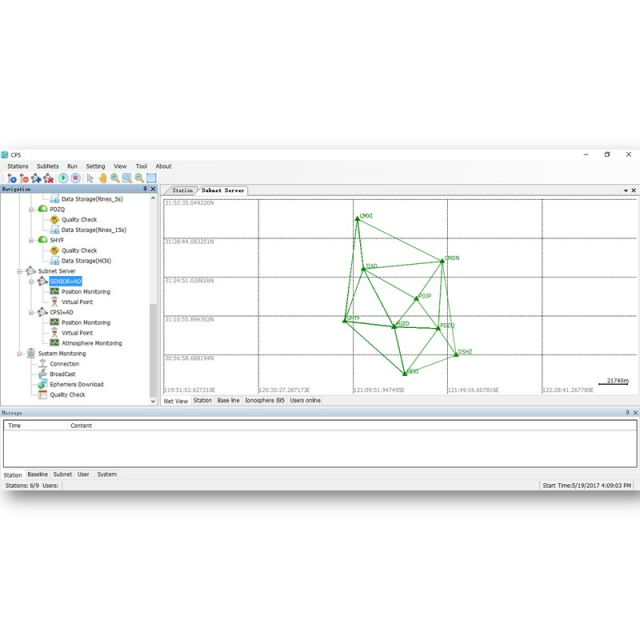
ADVANCED NETWORK RTK ALGORITHMS
Combining a series of real-time modules
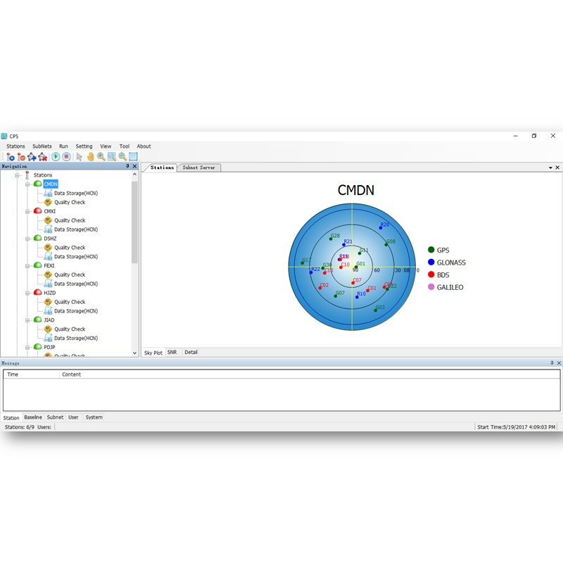
CPS quality control module monitors the GNSS data quality in real time for each reference station. The data storage module converts the GNSS raw data from each reference station to RINEX or Binary data. The advanced GNSS corrections modules compute optimized RTCM RTK corrections.
-
HIGH-ACCURACY FULL-GNSS POSITIONING SERVICES
Industry-standard RTCM corrections ensure multi-brand compatibility.
CPS integrates all GNSS constellations -GPS, GLONASS, Galileo, and BeiDou- to provide ultimate full-GNSS RTK positioning services to users. CPS is compatible with industry-standard GNSS receiver models to integrate existing reference stations and CHCNAV's GNSS reference stations.
-
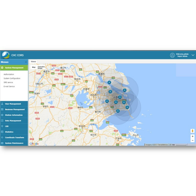
TURNKEY WEB MANAGEMENT FOR RTK CORRECTION SERVICES
Comprehensive and ready-to-use RTK Network and subscription management
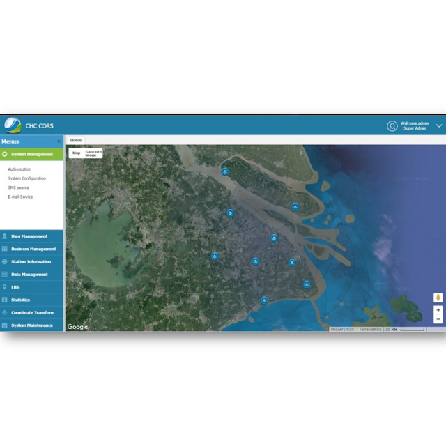
Setting up your Network RTK is simplified with our CPS web-based management console. CPS Web is built around seven modules: RTK network configuration, SMS or email alerts, user management, subscription management including service packages, real-time reference station monitoring, GNSS data management, and a location base system (LBS) module to monitor users in real-time.
CHCNAV Precision Positioning Service Software (CPS) is an advanced server-based software package to control and manage regional and nationwide GNSS CORS and RTK networks.
CPS is the result of years of scientific development and technical qualification. With optimized analysis of GNSS positioning errors such as ionospheric, tropospheric, orbit, and multipath errors, CPS computes and outputs high-quality RTK corrections from single-base to virtual network base solution. Supporting direct TCP/IP and NTRIP protocols as well as embedded user management, CPS is the solution to deliver local to large-scale reliable CORS and RTK network services.
Do you have questions about this product?
- Questions about price, availability, and/or retailers
- Questions about technical specifications and usage
- Questions about suitability for your project or application
Specifications
-
General
-
Compatible Receivers
GNSS Antennas, GNSS Sensors
Year of introduction
2019
Area of application
Marine, Airborne, Land
Processing type
Real Time Correction Service
-
Requirements
-
Operating System
-
Corrections base
-
RTK Corrections Via NTRIP Network
Y
Signal
Satellite
-
Technical specifications
-
Coverage
local to large-scale
-
Miscellaneous
-
Subscription
Global, Regional, Local
Distinguishable features
CPS is the result of years of scientific development and technical qualification. With optimised analysis of GNSS positioning errors such as ionospheric, tropospheric, orbit and multipath errors, CPS computes and outputs high quality RTK corrections from single-base up to virtual network base solution.
Typical applications
To control and manage regional and nationwide GNSS CORS and RTK networks.
Support
Direct TCP/IP and NTRIP protocols as well as embedded users management
Documents
Brochure
cps-ds-en.pdf
543.91 KB
Videos


