
UAV LiDAR Solution in Large-scale Aerial Mapping
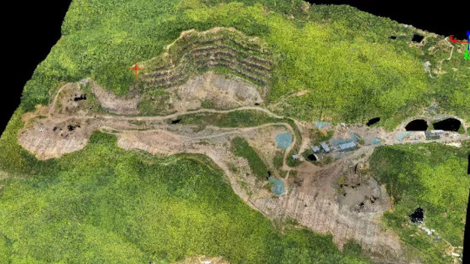
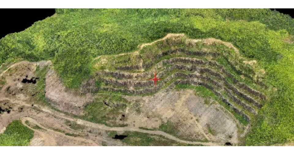
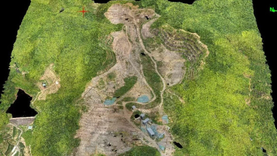
When it comes to large-scale aerial mapping for a challenge area with heavy vegetation and huge terra drops, what would be your best equipment to conduct the mission.
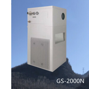
Geosun offers you an cost-effective solution with GS-2000N #LiDAR system and GS-L300 hexacopter in high performance.
Key feature to take away:
10cm accuracy at 500m AGL
Up to 7 returns
100K to 2,000K laser pulse rate per second
Max 300 lines scan rate
Geosun high-level gSpin 410 POS system
0.003° pitch/roll accuracy
0.01° heading accuracy
45MP Full-frame RGB camera
300m to 800m AGL recommended
Born for aerial surveying
Let the data speak for itself:
https://drive.google.com/drive/folders/1rQFNod-RJKGnx8UJFM2Rt1Nh5Rjo3h_Y?usp=drive_link
Do you have questions about this case study?
Get in touch with Geosun Navigation, and they would be happy to answer any questions you have about pricing, suitability, availability, specs, etc.

Related products


![Do-Giant-Tortoises-Make-Good-Neighbors-1[1].jpg](https://cdn.geo-matching.com/vRMO2Edp.jpg?w=320&s=a6108b2726133ff723670b57bc54c812)


