
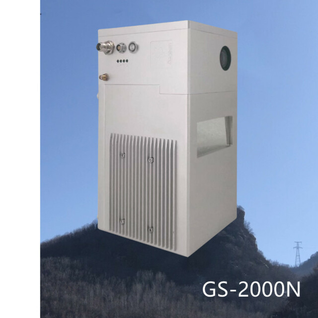


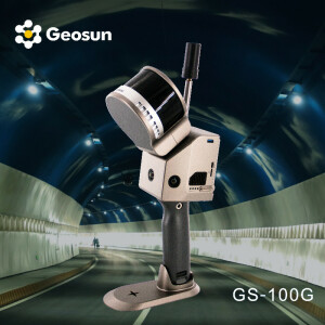
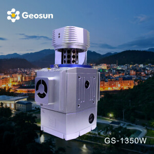
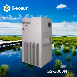
Geosun LiDAR GS-2000N
200HZ Airborne UAV LiDAR System Long Range LiDAR Scanning System
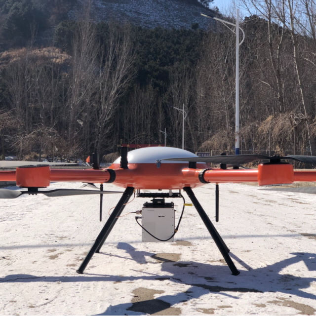
UAV/ Helicpoter based Lidar scanning system independently developed by Geosun Company. GS-2000N integrates a laser scanner, GNSS/INS system, and full frame camera, enabling it to quickly obtain high-precision laser point cloud data in large scale area. The system can be widely used in digital city construction, land surveying, forestry, especially mountain areas.

Geosun Navigation
Wuhan, CN
Description
GS-2000N is a long-range and high-precision LiDAR scanning system specially designed by Geosun Navigation for large-scale aerial survey projects. It integrates long-range laser sensor, independently developed GNSS/INS positioning and attitude measurement system (POS), cameras and storage control units. It can be loaded on multiple platforms such as multi-rotor, fixed-wing, and helicopter, supports non-base station operation mode, and can provide customers in the fields of terrain surveying, road measurement, power inspection, etc. with a complete integrated solution.
Specification of LiDAR Scanning System gAirHawk GS-2000N
| LiDAR scanning system gAirHawk GS-2000N | ||
| Item Name | System Parameters | |
|
GS-2000N Parameters |
Weight | 3.2kg |
| Working temperature | -20℃~+60℃ | |
| Power range | 12 V- 24 V | |
| Consumption | 65 W | |
| Carrying Platform | 6 Aixs Multi Rotor Drone | |
| Storage | 64 GB storage, maximum support 128GB TF card | |
|
Lidar Unit |
Measuring Range | 2000m@80% |
| Laser class | 1550 nm Class1 (IEC 60825-1:2014) | |
| Laser line number | FT-1500H Single-Beam | |
| Measuring accuracy | 3mm@100m | |
| Max. range | 2000m | |
| Return | Seven echos | |
| Scanning frequency | 10HZ-200HZ | |
| Beam Divergence | 0.3mrad | |
| FOV | 75°-90°, adjustable | |
| POS Unit | Update frequency | 200HZ |
| Heading accuracy | 0.010° | |
| Pitch accuracy | 0.003° | |
| Rolling accuracy | 0.003° | |
| Position accuracy | Horizontal: 0.02m, Vertical: 0.03m | |
| GNSS signal type | GPSL1/L2/L5 GLONASSL1/L2 BDS B1/B2/B3 GAL E1/E5a/5b | |
| IMU | gSpin 410 | |
| Pre-processing software | POS software | Output information: position, speed, attitude |
| Point cloud software | Output point cloud data format: LAS format, custom TXT format | |
| Camera (built-in) | FOV | 48 * 33 Degree |
| Effective Pixel | 45 MP (Full-frame Camera) | |
| focal Length(mm) | 16 | |
Do you have questions about this product?
- Questions about price, availability, and/or retailers
- Questions about technical specifications and usage
- Questions about suitability for your project or application
Specifications
-
General
-
Year of introduction
2022
Year of last update
2022
Total Weight [kg]
3.2
Type of GNSS/INS positioning system
GPS L1/L2/L5,GLONASS L1/L2 BDS B1/B2/B3,GAL E1/E5a/E5b
Camera
yes
Data storage facilities
64 GB storage, maximum support 128GB TF card
Mission planning software
Customized Route Planning Software-WayPoint Master
-
Application
-
Main applications
forestry, agriculture, mining industry ,autonomous vehicles, mapping, environmental monitoring, robotics navigation, measurement and inspection
-
Measurement Characteristics
-
Scanning method
Single line mechanical scanning
Scan frequency [Hz]
200Hz
Max. field of view [deg]
75-90
Max. number of recorded echoes per pulse
Seven Echo
-
Operation Characteristics
-
Platform
Fixed-wing
Min. flying height [m]
10
Max. flying height [m]
2000
-
Laser Pulse Characteristics
-
Type/class laser
1550nm
-
More information
-
Distinguishable features
Long Range
-
Uncertainty and resolution
-
Pitch and roll pointing precision [deg]
0.003
Heading pointing precision [deg]
0.01
-
Application areas
-
Select an application area:
Construction and Infrastructure, Land Surveying and Cadastre, Mining, Other
Documents
Brochure
gairhawk-gs-1350n.pdf
1.01 MB
Videos

