Submeter Precision in Geo-positioning: Exploring the Limits of Single Mode in GNSS Receivers
Introduction
Geo-positioning by Satellite Global Navigation Satellite System (GNSS) has become an essential tool in various applications that require high-precision geospatial data. However, the constant search for higher levels of accuracy has led to exploring the limits of the precision that can be achieved using single-mode GNSS receivers. This article will examine the maximum accuracy achievable in this mode and provide recommendations for optimizing geospatial data capture.

Maximum Accuracy in Single Mode
Single mode refers to receiving signals from a single GNSS system (such as GPS, GLONASS or Galileo) to determine position. Although technological advances have significantly improved the accuracy of GNSS receivers, submeter accuracy remains the practical limit in single mode. This is due to several factors, including atmospheric errors, multipath, and limitations inherent to the geometry of satellites in the sky.
Atmospheric errors, such as the ionosphere and troposphere, affect GNSS signals as they pass through the atmosphere, introducing inaccuracies in the distance measurement between the receiver and the satellite. Additionally, multipath occurs when GNSS signals reflect off nearby surfaces before reaching the receiver, generating incorrect distance measurements.
Recommendations for Maximum Accuracy
Despite the limitations, strategies can be implemented to improve single-mode accuracy. To achieve the highest possible accuracy, it is important to follow the following recommendations when capturing geospatial data:
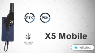
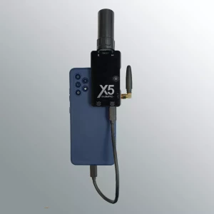
Use a high-quality GNSS receiver with a high-gain antenna like the X5 Mobile GNSS mini receiver.
Make sure the GNSS receiver is updated with the latest firmware.
Select a data capture location that has a clear view of the sky.
Avoid capturing data in adverse weather conditions.
Take measurements at different times of the day to minimize errors caused by GNSS signal variation.

Applications of Submeter Precision GNSS Technology
Submeter precision has key applications in various areas, such as cadastre, surveying, topography, precision agriculture, and real-time location services. Below is a table highlighting the accuracy ranges required for different applications:
The applications of GNSS technology are diverse and are used in a variety of activities that require submeter precision geospatial data capture. Some of the most common applications include:
Application: Required Accuracy Ranges
Cadastre: Submetric to Metric
Surveying: Submetric
Mapping: Submeter to centimeter
Topography: Submeter to centimeter
Geology: Metrics
Archeology: Submetric to Metric
Agriculture: Submetric to Metric

The Precision obtained with the Mettatec X5 Mobile Mini receiver
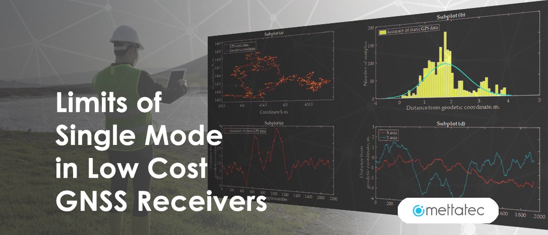
The X5 Mobile from Mettatec is a multi-band, multi-constellation mini GNSS receiver based on U-Blox’s ZED F9P chipset. It has 184 channels and a multi-band helical GNSS antenna model Helix5 from Mettatec. The results obtained in the field tests demonstrate the useful potential of low-cost X5 Mobile receivers equipped, for example, with a HeliX5 helical multi-band GNSS antenna. The results show great reliability and repeatability during continuous use sessions for long periods of time. The use of multi-constellations and multi-frequency GNSS is essential to achieve precision in the submetric range. Sometimes differential corrections may also be required from a GNSS Base to improve quality and achieve centimeter precision.
In a field experiment carried out to establish a local geodetic control network with a combination of a geodetic grade receiver as a base station and the X5 Mobile as rovers, it shows that the precision of the coordinates can be less than 17 mm and 40 mm for the horizontal and vertical component, respectively. Better precision can be obtained, with a longer duration of the sessions.
The potential of the low-cost X5 Mobile GNSS receivers invites us to reflect on the possible applications in topographic and geodetic work when establishing control and reference networks. Its usefulness can be even greater in the context of practical applications that require less precise results at the centimeter level, such as urban and rural cadastre, precision agriculture, steering of construction machines or transport machines in container reloading areas.
Conclusion
Although single mode in GNSS receivers has its limitations, its ability to achieve submeter accuracy remains invaluable in various applications. The combination of additional technologies and optimized geospatial data capture practices can maximize accuracy, enabling better performance in activities that require highly precise information. Continued research and development in the field of GNSS promises to continue pushing these boundaries in the future.
We invite you to learn about the X5 Mobile Mini GNSS Receiver, our submetric solution for geopositioning applications.
Do you have questions about this case study?
Get in touch with METTATEC, and they would be happy to answer any questions you have about pricing, suitability, availability, specs, etc.
Related articles


![Do-Giant-Tortoises-Make-Good-Neighbors-1[1].jpg](https://cdn.geo-matching.com/vRMO2Edp.jpg?w=320&s=a6108b2726133ff723670b57bc54c812)


