Next-Generation Aerial UAS Lidar Mapping With Integrated INS
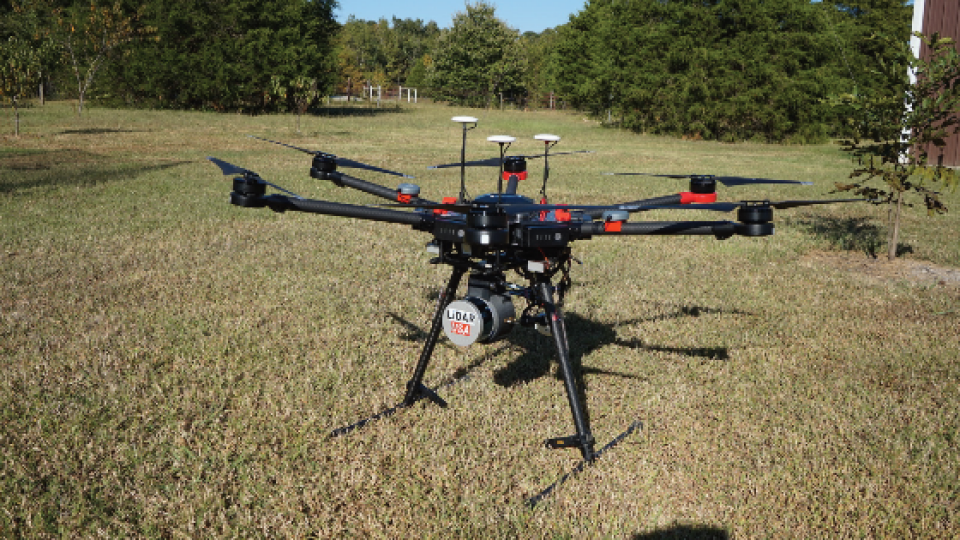
UAV (Unmanned Aerial Vehicle) mapping is a booming industry. One company taking advantage of the technological advances is LiDAR USA with the ScanLook Revolution integrating the VN-300 Dual-Antenna Inertial Navigation System. The combined system provides LiDAR (Light Detection and Ranging) mapping capabilities targeted at applications that require a fast, efficient, cost effective and easy-to-use solution.
The size, weight and power requirements of legacy LiDAR mapping systems primarily limited their use to manned aircraft. Overall hardware and operations cost also resulted in the need to map large areas to maintain financial feasibility. Recent advances in both LiDAR and inertial navigation technology have enabled a new generation of mapping
systems that weigh just a few hundred grams and fit in the palm of your hand. LiDAR units are now also affordable enough for small businesses to develop services around this technology with a meaningful return on investment.
Lidar Mapping Challenges
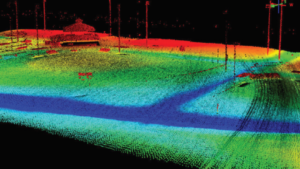
Mobile LiDAR mapping requires several components to work synergistically in order to provide a suitable output: a LiDAR scanner, attitude/orientation sensor, positioning system, timing reference system and a vehicle or mobile platform. Traditionally users had to either piece all the components together or buy expensive pre-configured systems designed for survey applications using items such as L1/L2 GPS receivers incorporating RTK (Real-Time Kinematic) positioning techniques in order to get centimetre-level positioning. These types of systems require the additional overhead of communicating with a reference base station or reference network system in order to maintain such accuracy.
LiDAR USA identified an opportunity for a low cost, easy to use system that enables a wider range of users to achieve their mapping requirements without the need for advanced training, complex setup and expensive post-processing. Leveraging 18 years of experience in the LiDAR mapping and survey market they developed the new ScanLook Revolution system.
Jeff Fagerman, CEO of LiDAR USA says: “The Revolution system was designed for mapping applications where relative position measurement, rather than absolute centimetre-level position measurement, is important. For example, if you want to know the vegetation encroachment on power lines then you are more interested in the relative distance between the powerline and the branches of the tree than knowing the absolute position of the tree with 2cm accuracy.”
The Revolution is easy to use and includes a LiDAR Scanner, Inertial Navigation System (INS), onboard data logging and WiFi interface for remote control. All the user has to do is mount the unit and attached GPS antennas and supply power.
How VectorNav Inertial Navigation Systems Helped With Lidar Mapping
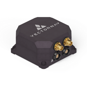
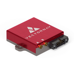
To keep the Revolution small, accurate and fully featured, LiDAR USA turned to VectorNav for assistance with the INS and selected the VN-300 Dual-Antenna INS. According to Jeff “We evaluated many other inertial navigation systems for this job, but the VN-300 stood out among the rest for its exceptional performance in a wide range of operating conditions and especially for its small size and low weight. The VN-300 is a powerful sensor, it’s tiny, only weighs 30 g and has performance comparable to much higher-priced systems.”
LiDAR USA selected the VN-300 in part due to the fact that it does not rely on magnetometers for heading estimation. According to Jakub Maslikowski, Director of Sales and Marketing at VectorNav, “relying on magnetometers for accurate heading estimation is typically highly problematic.” The VN-300 uses two GNSS receivers and a technique known as Carrier Phase Interferometry that enables the VN-300 to estimate the heading solely from GPS signal measurements when the vehicle is stationary.
Future Plans for Integrating Inertial Navigation Systems with UAS Lidar
VectorNav Technologies is a leading developer and manufacturer of high-performance inertial navigation systems using the latest in MEMS sensor and GPS/GNSS technology. Since its founding in 2008, VectorNav has provided systems integrators in the Military, Aerospace, Marine, and Robotics industries with inertial navigation solutions with a best-in-class price to performance ratios.
Do you have questions about this case study?
Get in touch with VectorNav Technologies, and they would be happy to answer any questions you have about pricing, suitability, availability, specs, etc.


![Do-Giant-Tortoises-Make-Good-Neighbors-1[1].jpg](https://cdn.geo-matching.com/vRMO2Edp.jpg?w=320&s=a6108b2726133ff723670b57bc54c812)


