
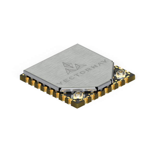
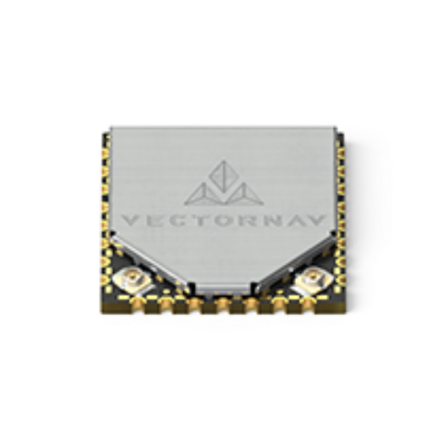
VN-300 Surface Mount Dual Antenna GNSS/INS
The VN-300 is a miniature high-performance dual GNSS-Aided Inertial Navigation System that combines MEMS inertial sensors, two high-sensitivity GNSS receivers, and advanced Kalman filtering algorithms to provide optimal estimates of position, velocity, and orientation for industrial applications.

VectorNav Technologies
Dallas, US
Description
The VN-300 is a miniature high-performance dual GNSS-Aided Inertial Navigation System that combines MEMS inertial sensors, two high-sensitivity GNSS receivers, and advanced Kalman filtering algorithms to provide optimal estimates of position, velocity, and orientation for industrial applications. By utilizing two separate GNSS receivers and antennas the VN-300 enables accurate heading measurements without reliance on vehicle dynamics or magnetic sensors, providing unmatched performance under both static and dynamic conditions.
OVERVIEW
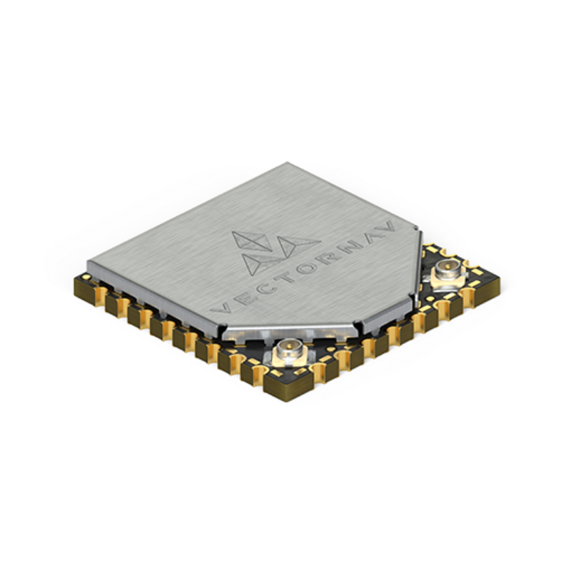
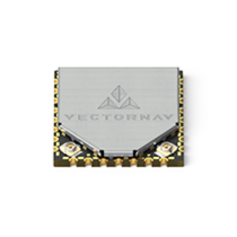
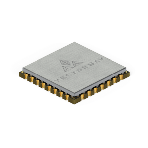
The VN-300 is designed for applications that require highly accurate inertial navigation solution under both static and dynamic operating conditions, especially in environments with unreliable magnetic heading and good GNSS visibility. The VN-300 is the first and only Dual GNSS Antenna Inertial Navigation System in a single surface mount package. At the size of a postage stamp, the VN-300 SMD requires only a single 3.2-5.5V power supply and can be directly embedded into a user’s electronics for unprecedented SWAP advantages.
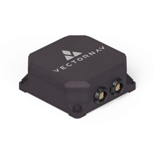
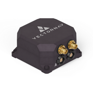
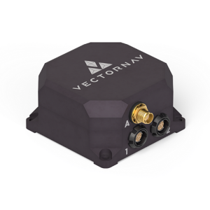
The VN-300 Rugged is the “plug and play” version of the VN-300 SMD. Enclosed in a clamshell precision anodized aluminium enclosure, the VN-300 Rugged offers additional protection of the internal MEMs sensors, GNSS receivers and electronics. Interfacing with the module is made through a locking 10-pin connector, as well as two MMCX connectors for external active GPS antennas.
SENSOR SUMMARY
-
GNSS Compass for static and low dynamic heading accuracy
-
VectorNav Processing Engine (VPE) 2.0 for disturbance rejection, adaptive filtering, dynamic filter tuning
-
Hard/Soft Iron Compensation
-
Coupled position, velocity and attitude estimates
-
Solid-State MEMS inertial sensors
-
All sensors are individually calibrated for bias, scale factor, misalignment, and temperature over full operating range (-40°C to 85 °C)
-
Two x 72 Channel GNSS Receivers:
-
GPS L1 C/A
-
Galileo E1
-
SBAS: L1 C/A
-
-
Raw Psuedorange, Doppler and carrier phase outputs
-
800 Hz IMU Data
-
400 Hz navigation and attitude data
-
Yaw/Pitch/Roll
-
Position and Velocity
-
Coning and sculling integrals (ΔV’s, Δθ’s)
-
Data output format: ASCII (VectorNav), NMEA-0183, Binary (VectorNav)
-
VectorNav Control Center freely available for easy setup, configuration and logging
-
ITAR-Free
Do you have questions about this product?
- Questions about price, availability, and/or retailers
- Questions about technical specifications and usage
- Questions about suitability for your project or application
Specifications
-
Other specifications
-
Graphical user interface
Y
Typical application
Camera/Antenna Stabilization, UAVs, UAS, Ground Vehicles, Mapping
Distinguishable features
Onboard GNSS-Compass, SWaP-C optimized, surface mount design, calibrated over temperature, onboard Extended Kalman Filter, automatic filter initialization & dynamic alignment, external GPS, accurate heading under static and dynamic conditions
Export restrictions
ITAR free
-
Environmental
-
Max. rotation speed [deg/s]
2000
Min. operating temperature [°C]
-40
Max. operating temperature [°C]
85
-
Software
-
Filtering
Y
-
GNSS aided uncertainty
-
Heading [deg]
0.3
Pitch [deg]
0.03
Roll [deg]
0.03
-
General
-
Year of initial development
2015
Height [m]
0.003
Width [m]
0.022
Length [m]
0.024
Weight [kg]
0.005
Min. Voltage (DC)
3.2
Max. Voltage (DC)
5.5
Power consumption [W]
1.25
Splashproof casting
N
Water resistant casting
N
Type of accelerometer
3-axis MEMS
Type of gyro
3-axis MEMS
Removable from base plate
N
Type of application
Air, Land, Marine
Moving parts
N
Height [mm]
3
Width [mm]
22
Length [mm]
24
-
GNSS Positioning Sensor
-
Number of integrated GNSS receivers and antenna ports
2
No. channels p receiver
72
Tracked satellite signals
GPS L1, GLONASS L1, Galileo E1
SBAS differential signals
Y
RTK Network Compatibility
N
Update rate [ Hz ]
5
Cold start [ seconds ]
29
Hot start [ seconds ]
1
-
Unaided uncertainty
-
Heading [deg]
2
Pitch [deg]
0.5
Roll [deg]
0.5
-
Data formats
-
NMEA formats
RMC, GGA, GLL, GSA, GSV, HDG, HDT, THS, VTG, ZDA
-
Inertial Measurement Unit
-
Accelerometer bias [µ-g]
40
gyro bias [deg/hr]
5
Calibration procedure
Calibrated at room temperature or over full thermal operating range (-40 C to +85 C) for bias, scale factor, misalignment and gyro g-sensitivity.
-
GNSS positional accuracy
-
Horizontal Position Accuracy [ RMS in cm ]
250
Horizontal Position Accuracy (SBAS) [ RMS in cm ]
200
Documents
Brochure
migrationaaaqki.pdf
4.84 MB

Other documents
-
Product Manual (80)4.33 MB
-
Next-Generation Aerial LiDAR Mapping2.25 MB
More from VectorNav Technologies

