Equipping Small-Scale ROV With Advanced Navigation’s Subsonus USBL/INS
DOF Subsea is an international subsea services organisation. The company provides integrated project-managed and engineered subsea solutions to the global offshore energy industry. DOF Subsea offers services to energy-producing regions around the world. DOF Subsea employs more than 1200 subsea professionals, and owns and operates a fleet of 25 vessels and over 71 ROVs and two AUVs. The DOF Group is a trusted and leading partner delivering services globally for the sustainable utilisation of offshore energy and other subsea resources.
Challenge
Much of the world’s current energy resources are buried beneath the seabed and must be acquired and transferred safely to the mainland for collection and processing. For gas and liquid resources, pipelines are often used to transfer materials. The highly corrosive and volatile nature of marine environments creates a need for very regular and thorough inspections to ensure the structural integrity of pipelines. Inspection and maintenance is critical to preventing possible environmental impacts from material leakage. Three main inspection points are; firstly, looking for “spanning” where the seabed beneath the pipe is eroded and the pipe is no longer adequately supported. Secondly, checking the condition of sacrificial anodes that prevent corrosion of the pipe material. Thirdly, check the condition of the protective coating on the pipes.
DOF Subsea provides regular pipeline GVI (general visual inspection) and maintenance services to clients all over the world. Depending on the actual environmental conditions and pipeline depth below water, be it 20 m or 2000 m, different vessels and inspection vehicles are used, as necessary. As the water becomes shallower or the environment more sensitive to larger vessels, complications arise in getting appropriately sized and manoeuvrable equipment into place. This can also be coupled with increasing changes in client requirements in wanting to significantly reduce carbon emissions, expenditure, and vessel and crew sizes.
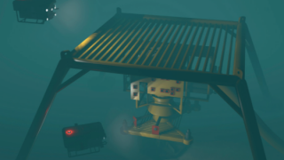
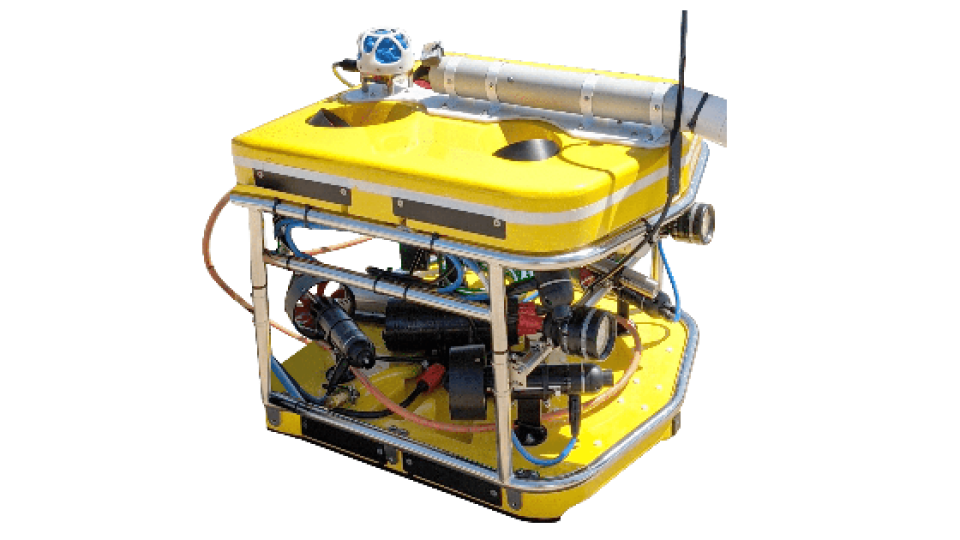
In this case, the client requires liquid petroleum gas pipeline inspections off the coast of Western Australia. The coastal area where the pipelines run is approximately <10 to 15 m deep. Shallow water means that the objects and reef structures around the pipeline tract are again closer to the surface. This presents several initial problems in that the surface vessel must have an appropriately shallow draft to avoid collisions. For this, the project team chartered a suitable catamaran. Similarly, the ROV being used for inspection must also be small enough to navigate the environment safely. In many cases where the survey is conducted in more open water, ROVs may be 2 to 3 m long. Here, however, the ROV is approximately 1 m in length. A definitive factor for USBL positioning in such conditions is handling signal reflectivity due to proximity to the seabed, submerged objects and surface reflections.
Another all-important requirement is that the position and heading of the ROV must be known for the purposes of mapping the absolute position of locations along the pipeline where maintenance is required. Although the ROV is piloted via a visual display for GVI, the position data is required as a reference for each anomaly. This data is used post-survey, when sending divers or other equipment to the location to perform maintenance tasks. With many kilometres of pipeline in question, position accuracy is extremely important to the efficiency of operations. Gavin Wallace, Project Surveyor at DOF Subsea sums up a major challenge.
To satisfy the environmental factors and reduce overall expenditure for clients, DOF Subsea needed a USBL that required minimum fuss to install to their ROV whilst providing better than sub-metre position accuracy.
Solution
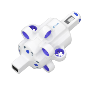
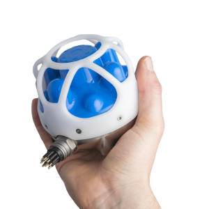
The requirements of using a small-scale ROV in shallow water made the option to use Subsonus highly viable. Some of this can be attributed to previously using far bulkier USBL navigation equipment that often led to extensive and expensive modifications to ROVs to fit. Depending on ROV size, this could impact on the operation of the ROV, its buoyancy and manoeuvrability, adding further complexity to solve. For a small-scale ROV, the size of the USBL is critical.
The unique dual USBL transducer architecture of the Subsonus provides several benefits, including:
- System accuracy and error correction are enhanced by performing USBL calculations at both the vehicle and the surface vessel. Advanced Navigation’s AI-enhanced data fusion algorithm is able to look at the system as a whole and to utilise data from each transducer to account for uncertainty when calculating the position of the tracked object.
- Full INS capability is provided to the ROV for position plus roll, pitch and yaw. Absolute position is gained by integrating a GNSS Compass.
- In addition to position data, the INS functionality of Subsonus provides acoustically transferred heading to the surface vessel. Heading information delivers benefits to ROV pilots through having accurate vehicle orientation information.
Additionally, the 8-transducer array of the Subsonus USBL provides higher levels of position accuracy over traditional USBL arrays that contain fewer transducer elements. This offers a range of 150° either side of the boresight axis, so even above parallel USBL is possible in the right conditions. The high sensitivity and fine granularity of angular measurement from the Subsonus transducer architecture and integrated depth sensor helped overcome difficulties in precise position when dealing with acute slant range due to water shallowness and when attached to a more dynamic (smaller and more prone to water-induced movement) vessels.
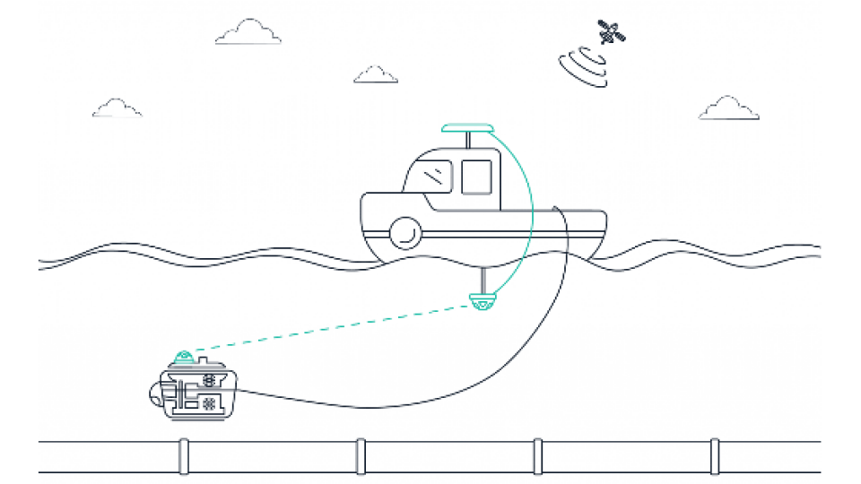
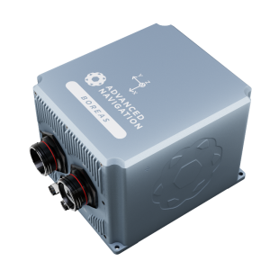
To gain higher accuracy and provide heading data for the pipeline survey, a Subsonus and GNSS Compass is attached to the surface vessel. This arrangement provides accurate GNSS-based dual-antenna heading and acoustic position and heading data via dual USBL positioning between surface vessel and ROV (communications are handled using the ROV tether). The heading solution means a traditional subsea heading source such as a FOG is not required. This alone can potentially save thousands of dollars per survey. The system converges the time-stamped relative position/heading of the ROV to the absolute position/heading of the surface vessel to record the ROV georeference. Knowing the position of the ROV at all times is critical to not only the navigational data but to safety. If the position of the ROV is lost, the possibility of crashing it or colliding with the surface vessel or pipelines increases hugely.
The direct connection between components and simple configuration made deployment of the GNSS antenna to USBL not only fast but also simple and neat. The integrated INS in the Subsonus also meant freeing up the ROV of what used to be a separate piece of equipment.
The DOF Subsea team fitted a third-party DVL to the ROV to provide velocity and altitude above seafloor data into the Subsonus system. Velocity data from the DVL improves system accuracy particularly at longer distances where, due to decreasing slant angle, the accuracy of the USBL degrades. DVL provides relative positioning, which augments and enhances the absolute positioning data provided acoustically from the Subsonus. This improves precision, at distance, from potentially within several metres to under 0.5 m. Using a DVL is also critical in maintaining the vertical position of the ROV above the pipeline, for safety reasons. This integration not only provides a full survey navigation system but negates requiring additional magnetic heading that will be affected by the steel pipeline. This solution also vastly reduces costs and complications if FOG heading were to be considered.
The team uses previous survey information in their software to create a map of the pipeline that is referenced to KPs, which are markers on the pipe at 1 km intervals. Using the KP and the X-Y coordinate data, the maintenance crews are able to view video taken by the ROV of the associated pipeline anomaly. This coupling between the ROV video and the estimated location is essential for rapidly locating and assessing anomalies and when sending crews and equipment to anomaly sites.
Result
The pipeline survey team found that the Subsonus USBL configuration they used provided much of what they needed for USBL positioning on several levels. To meet the demands of using smaller-scale vessels, crew and ROVs meant that Subsonus was the only device on the market capable of being used without extensive modification to the ROV. The full INS capability of the system and easy DVL input produced significant benefits to accuracy, precision and value of the survey to DOF Subsea’s customer. These factors make big differences to clients that, in general, are increasingly looking to reduce their costs and impacts on the environment. Notwithstanding, Subsonus helped DOF Subsea improve their survey results;
“Subsonus achieved the required positioning remarkably well and provided us much greater USBL positioning stability. Both myself and our client were highly impressed with the INS positioning over previous campaigns.” commented Gavin Wallace - Project Surveyor, DOF Subsea, Australia.
The simple configuration and easy deployment of the system not only reduced the complexity of the integration but provided an opportunity to speed up preparations for the surveying task. The Subsonus acoustic navigation performance, simple installation and minimal size provide several paths for DOF Subsea to help satisfy client needs, improve overall operating efficiency and generally scale down the size and cost of the operation.
Do you have questions about this case study?
Get in touch with Advanced Navigation, and they would be happy to answer any questions you have about pricing, suitability, availability, specs, etc.
Related articles


![Do-Giant-Tortoises-Make-Good-Neighbors-1[1].jpg](https://cdn.geo-matching.com/vRMO2Edp.jpg?w=320&s=a6108b2726133ff723670b57bc54c812)


