Bathymetry and Backscatter Data Survey in Paris Using Multibeam Echosounder and Lidar System
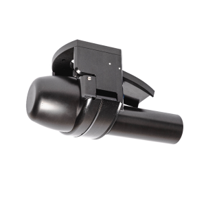
NORBIT has launched the iWBMS Ekinox product in partnership with SBG Systems, featuring a WBMS sonar with an integrated SBG Navsight Ekinox inertial navigation system. Performance trials were conducted in Paris, France. The iWBMS Ekinox and iLiDAR were mounted on a vessel of opportunity and configured for operation in less than 1 hour.
NORBIT has launched the iWBMS Ekinox product in partnership with SBG Systems, featuring a WBMS sonar with an integrated SBG Navsight Ekinox inertial navigation system:
- Frequency agile 200-700kHz.
- 0.5 x 0.5°beam width resolution at 700kHz.
- Up to 210°swath width (single head) as standard.
- HD beamformer provides 512 beams per ping with 1024 HDS option.
- High performance integrated Navsight Ekinox GNSS/INS system.
- Integrated sound velocity probe.
- Small form factor and low power consumption.
- Designed for rapid mobilization on any platform.
- Bathymetry and various backscatter and water column data as standard deliverables.
- Optional integrated Lidar.
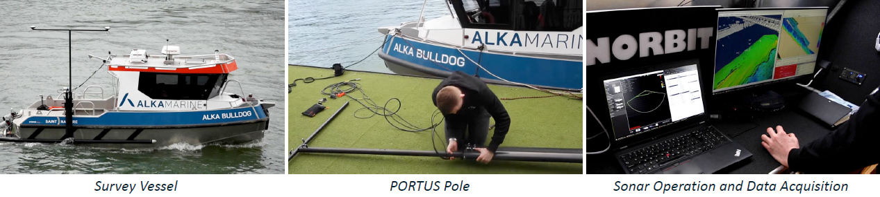
Performance trials were conducted in Paris, France. The iWBMS Ekinox and iLiDAR were mounted on a vessel of opportunity and configured for operation in less than 1 hour.
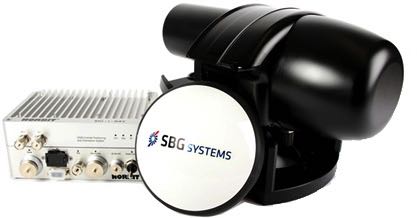
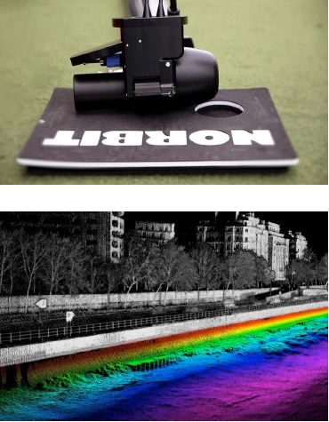
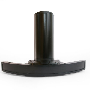
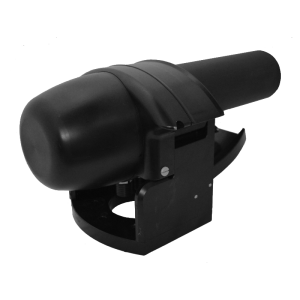
- The sonar and integrated INS interface to the compact topside unit via a single deck cable.
- All sensors were mounted on a small boat using the NORBIT PORTUS pole, a lightweight, portable carbon fibre solution that was specifically designed for NORBIT systems.
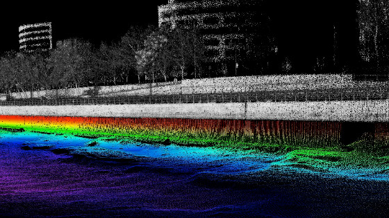
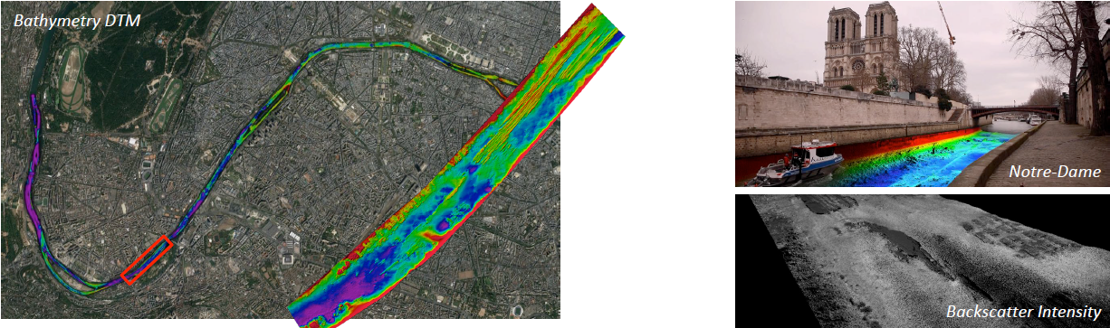
14km of the Seine River was mapped in less than 2 days, and the resulting 0.25m DTM was overlaid on aerial imagery.
- The high-resolution bathymetry data shows small geological features on the riverbed.
- In the narrow sections of the river, it was possible to achieve full data coverage on both sides up to the waterline in a single pass using NORBIT’s 210°wide swath capability.
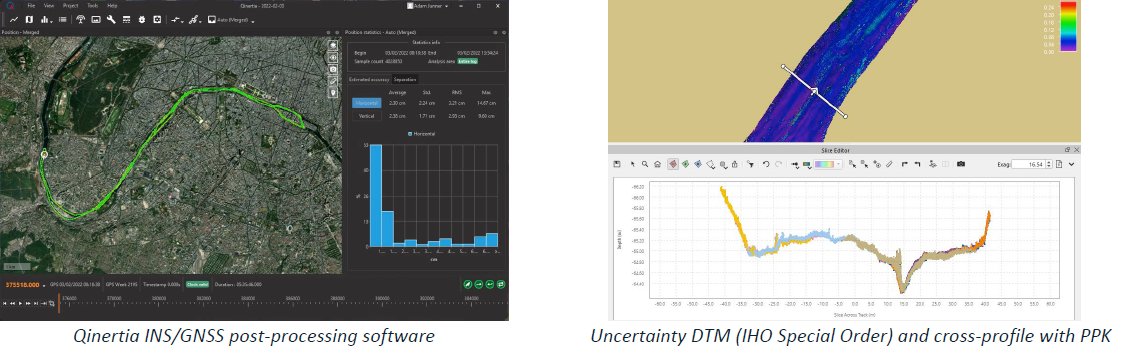
RTK GNSS corrections were interfaced with the system in real-time, providing centimetre positioning accuracy.
- The raw navigation data was logged and post-processed in Qinertia to improve the navigation solution under bridges where satellite coverage was not optimal.
- The PPK solution output from Qinertia was applied to bathymetry data in the post-processing software.
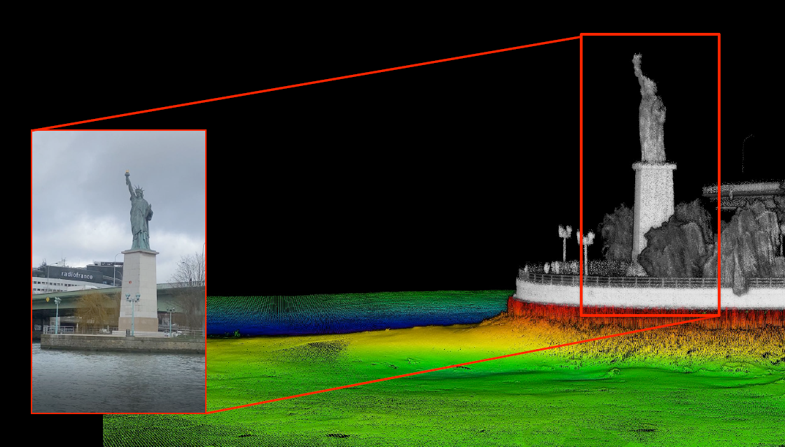
- The Statue of Liberty replica, given to the city in 1889, was surveyed with the Multibeam and Lidar simultaneously.
- The system generates a full georeferenced point cloud, above and below the waterline, in real-time.
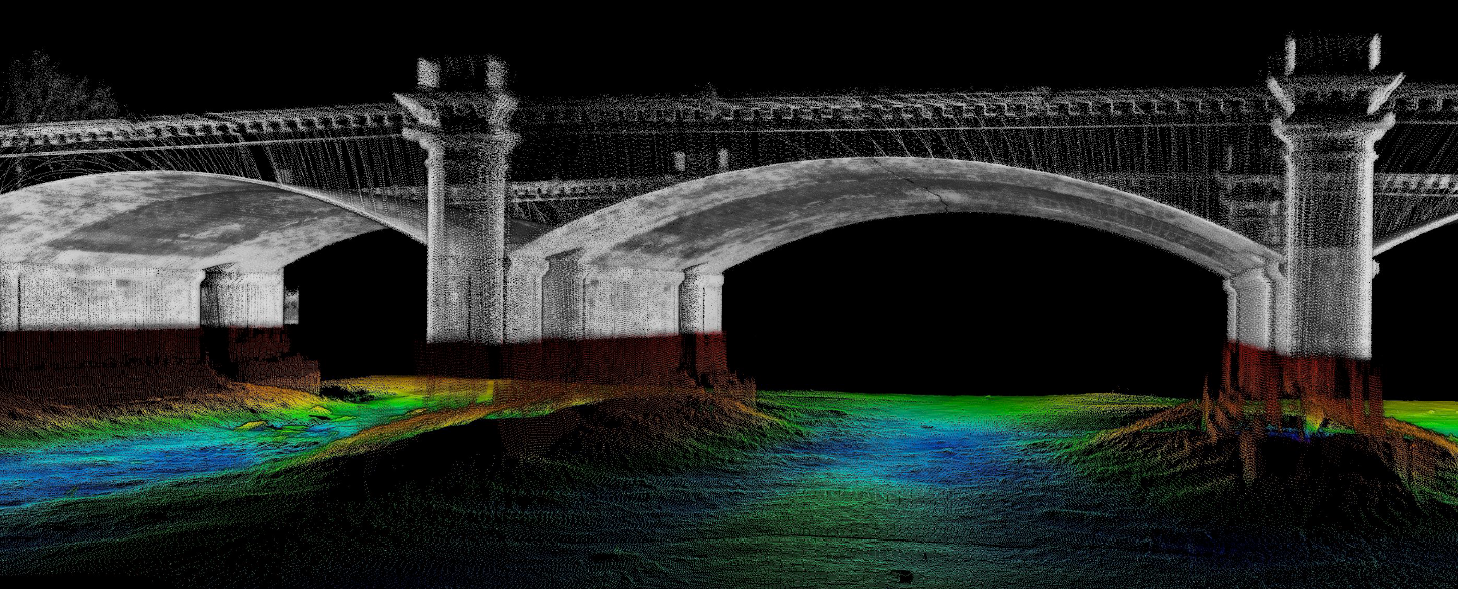
Many bridges were also surveyed, such as the Pont de la Concorde arch bridge shown here.
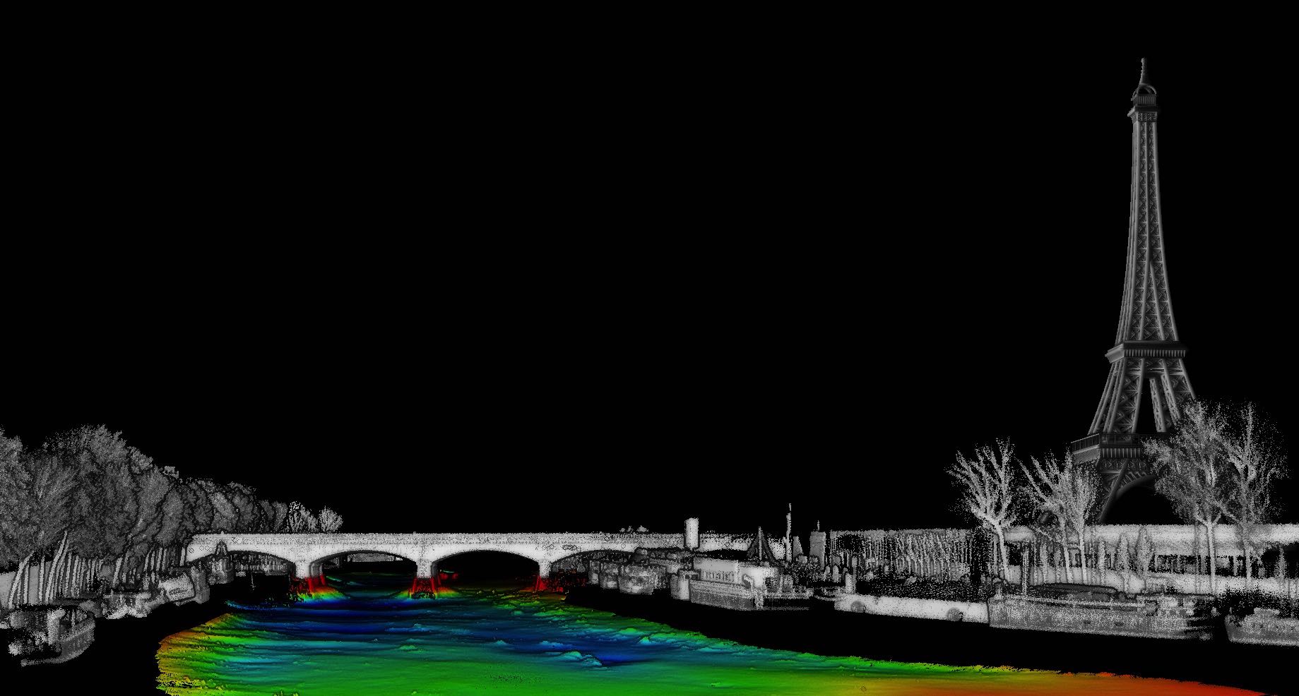
This image shows the point cloud data from the Multibeam and Lidar around the Eiffel Tower in central Paris. The Eiffel Tower 3D model was added later for context.
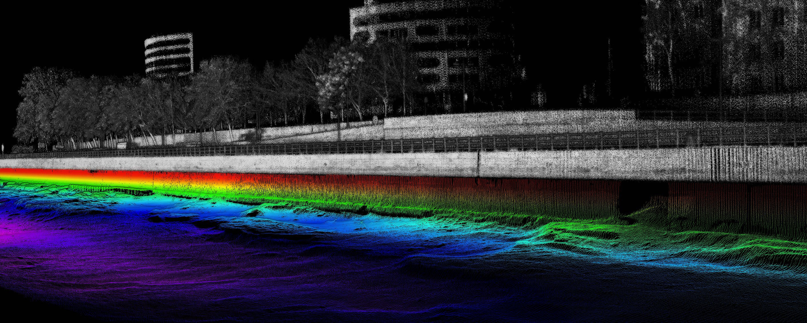
With NORBIT’s 210°wide swath capability, quay Walls were surveyed with a seamless transition between the Multibeam and Lidar data.
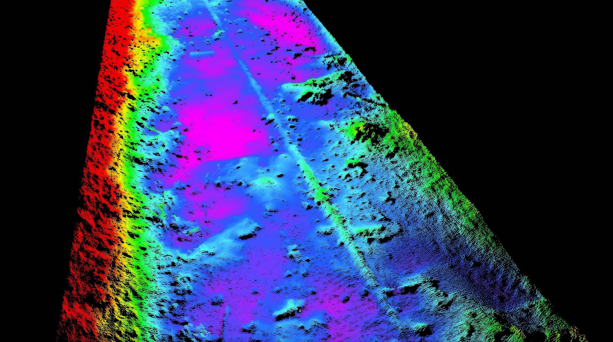
The sonar is able to detect small features (both natural and man-made) on the riverbed, including this Ø20in (0.5m) gas pipeline.
The NORBIT iWBMS Ekinox offers a high accuracy GNSS/INS solution coupled with NORBIT high-resolution WBMS to existing SBG users and as an alternative system for NORBIT iWBMS users.
- The sonar with SBG Ekinox GNSS/INS embedded into the unit ensures fast and reliable mobilization and the highest quality sounding data in all conditions.
- The tight integration of the GNSS/INS subsystem minimizes cables and error sources compared to traditional setups with standalone sensors.
- NORBIT’s curved array technology allows the beams to be steered electronically up to the waterline without having to physically rotate the sonar, which is ideal for combined Multibeam and Lidar surveys, allowing a seamless transition between the two data types.
Do you have questions about this case study?
Get in touch with NORBIT Subsea, and they would be happy to answer any questions you have about pricing, suitability, availability, specs, etc.


![Do-Giant-Tortoises-Make-Good-Neighbors-1[1].jpg](https://cdn.geo-matching.com/vRMO2Edp.jpg?w=320&s=a6108b2726133ff723670b57bc54c812)


