


AI Unlocks Bathymetric Data in Near Real-Time
Base station-free satellite corrections and cutting-edge AI-powered data processing combine to unlock new efficiencies at sea, and in the office.
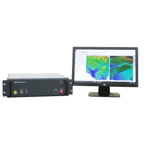
In December 2022, a trial survey of a sandbank near Lowestoft, England successfully tested the combined ability of a new artificial intelligence data processing solution for the GeoSwath 4 bathymetric sonar combined with the Trimble Applanix POS MV OceanMaster and real time Trimble CenterPoint RTX corrections. The survey was carried out by GeoAcoustics Ltd, the manufacturer of the well-established GeoSwath 4 bathymetric sonar.
The team has focused its R&D activity on creating a hands-free AI-powered data processing system for the GeoSwath 4 since 2020 and along with its academic partner the University of East Anglia, has succeeded in delivering powerful and unique new capabilities that can save time and money during a survey and at the post-processing stage by essentially allowing a high quality live-stream of te seafloor via the GeoSwath 4 sonar.
Artificial Intelligence
GeoSwath 4’s new AI data-processing capabilities have been field tested in diverse environments and applications globally over the last 18 months, with results confirming new levels of performance and onboard data quality that would be challenging to achieve in real-time using standard bathymetric echosounder technology.
The immediate benefit of receiving real-time data in much greater detail than previously available is that the surveyor can follow exactly what is happening below the surface and subsequently, take a more proactive approach to the survey as it happens. With AI enabled, targets of interest are revealed in detail and in real-time, giving the survey team much more agility to cross-check and confirm data on the spot, and base decision-making on the information at hand.
The quality difference witnessed by the team during their survey of the sandbank off Lowestoft was quite astounding. Whereas most bathymetry displays present a maximum of 1024 soundings at any time, the GeoSwath 4 system is able to process thousands more for real-time display. AI offers a game-changing jump in speed from ping to quality-controlled, actionable data that will help optimise established marine survey workflows significantly.
Precision data
Likewise, with the Applanix POS MV OceanMaster and CenterPoint RTX corrections (Fig 1) in the mix, end-users can unlock new ways of working with even more accuracy in their stream from the seafloor. The recent trials saw the integrated systems producing a Feed of much higher quality, due to the added accuracy and robustness of the navigation solution.
While centimetre accuracy is not new when using RTK systems, the CenterPoint RTX solution provides near RTK accuracy but through a satellite-based correction service, so doesn’t require a base station. Trimble RTX represents a family of GNSS correction services that provide customers with high-accuracy positioning via Satellite or the Internet.
CenterPoint RTX Marine is a real-time correction service, using an absolute positioning technique to model and correct GNSS biases, including clock errors, satellite orbit errors, and atmospheric delays, for construction and geospatial applications in the Marine sector.
The GeoSwath 4 AI technology sets itself apart from traditional processing algorithms by offering a real-time feature that more accurately identifies and flags data before it is logged or shared with third-party acquisition software like NavAQ.
Extended processing
Real time corrections are susceptible to telemetry dropouts due loss of connection and or interference from surrounding obstacles or structures. Further data quality improvements are possible through post processing. As well as the AI data logging, the raw POS MV data was also logged for post processing in POSPac MMS 8.9. POSPac Mobile Mapping Suite is industry-leading software for Direct Georeferencing of mobile mapping sensors using GNSS and inertial technology.
This, combined with the Trimble CenterPoint RTX aided POS MV OCeanMaster allows for fully processed data to be available for quality control during a survey.
With bathymetric data flagged in real-time, the processing time is significantly reduced, as demonstrated by a recent survey where calibration in AutoPatch took under 5 minutes and bathymetry was re-processed in just a few minutes, enabling rapid completion of the backscatter analysis.
Post-processing provides opportunity to QC data and apply external correction data, improving accuracy and reliability without the need to re-flag the data. For the trial survey that produced the pictures seen in Fig 2, GeoAcoustics utilized PP-RTX, which is the post-processed version of the real-time solution, further enhancing the accuracy, reliability and robustness of the corrections. With PP-RTX being available immediately after a survey, it’s possible for survey results to be obtained and analysed on the same day, which has the potential to revolutionise the experience for GeoSwath 4 users.
Centimetre accuracy
The Trimble CenterPoint RTX subscription service can be used for all Applanix POS MV systems and applications. With no requirement to deploy and configure a physical base station it is a cost-effective method for achieving cm level position accuracy for offshore projects and remote coastal line surveys.
AI power
The AI-powered upgrade augments existing automated filtering in the GeoSwath 4 bathymetric sonar software to remove surplus and undesired data autonomously; during acquisition, the system is designed to log virtually clean data, without any user intervention in the cleaning process.
GeoAcoustics
Represented in more than seventy countries GeoAcoustics Ltd delivers innovative, field-proven Bathymetric Sonars, Sub-Bottom Profilers, and Side Scan Sonars for the efficient acquisition of high-quality subsea data for customers working in the inland waterway and marine hydrographic surveying, dredging, and marine research fields.
Trimble Applanix
Trimble Applanix Position and Orientation Systems (POS™) are industry-standard for diverse survey operations. With global reach, unequalled engineering excellence, and global 24/7 customer support, Trimble Applanix leads the world in high-productivity in-motion surveying, direct data geo-referencing, and robust mobile mapping.
Do you have questions about this case study?
Get in touch with GeoAcoustics Ltd, and they would be happy to answer any questions you have about pricing, suitability, availability, specs, etc.


![Do-Giant-Tortoises-Make-Good-Neighbors-1[1].jpg](https://cdn.geo-matching.com/vRMO2Edp.jpg?w=320&s=a6108b2726133ff723670b57bc54c812)


